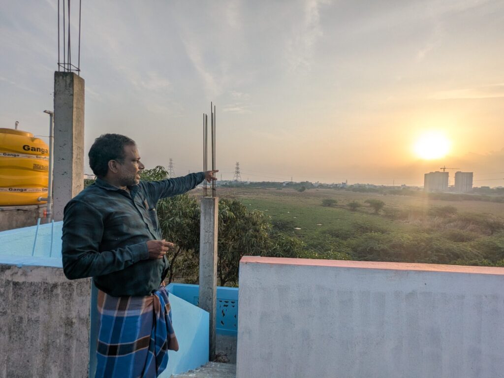
For Dhanasekaran, a resident of Ezhilmuga Nagar, an area adjacent to the proposed Global Sports City project site, the vast stretch of land in Semmencheri is more than an empty plot waiting to be developed. Every monsoon, he watches it transform into a sheet of water, carrying runoff from surrounding neighbourhoods towards the Pallikaranai Marshland.
“We are the poorvakudi (original inhabitants) of this place. Even though we were relocated here years ago, this has become our home,” says Dhanasekaran, standing beside the 112-acre site where the project is set to come up. “Officials may not know how much water will flow or stagnate here during the monsoon. But we do. We can tell how this entire landscape changes in every season and whether our homes will be affected. That knowledge comes from living here for years.”
On February 18, 2026, Chief Minister M. K. Stalin laid the foundation stone for the ₹261-crore Global Sports City in Semmencheri. Spread across 112.12 acres, the project aims to create international-standard sporting infrastructure capable of training athletes for global competitions. The project is being executed by the Chennai Metropolitan Development Authority (CMDA).
Tamil Nadu has aspired to build world-class sports facilities for years. A long-awaited milestone, the proposed Sports City promises to strengthen the state’s sporting ecosystem while attracting national and international events. However, even before construction has begun in earnest, the project has raised critical questions among residents, urban planners, and hydrologists: Is this the right place for such a large public investment?
Their concern is not with the Sports City itself, but with the fragile landscape beneath it.
OMR: A changing floodplain
- Over the years, private IT parks and commercial complexes have come up in this region, blocking the flood path.
- The OMR carriageway has been repeatedly elevated during road widening, resurfacing and Metro Rail works.
- Large residential townships by developers such as Casagrand and DAC Developers have transformed the OMR landscape.
A landscape shaped by floods
“We’ve been facing floods here since 2012, but 2015 was the worst. Our entire neighbourhood went under water and our homes were inundated,” says Chellakannu, a resident of Ezhilmuga Nagar, who runs a tiffin shop in the Semmencheri Housing Board.
Beyond 2015, the memory of Cyclone Michaung still lingers across Chennai’s southern suburbs. When the cyclone inundated the city in December 2023, neighbourhoods along Old Mahabalipuram Road (OMR)—including Perumbakkam, Semmencheri, Pallikaranai, and adjoining areas—remained submerged for days. Homes were flooded, roads became impassable, and rescue operations turned into a grim reality for thousands.
For those living around the proposed Sports City, Michaung was not an isolated disaster, but another reminder of how water naturally moves through this terrain.
“The area where we live, Thazhambur, gets waterlogged every monsoon,” says Raj, a representative of the Federation of OMR Residents Associations (FOMRRA). “The natural flow of water has always been from west to east. Earlier, there were multiple drainage outlets towards the east. But as the OMR corridor developed and more low-lying areas were built over, water began stagnating instead of flowing naturally.”
He points to the Sathyabama University stretch, a location that routinely makes headlines during heavy rains. “The government has now proposed several cut-and-cover drains to improve the flow of water there,” he says. Residents have long demanded drains to channel overflow from Navalur Eri. However, with Metro construction now underway, its feasibility remains uncertain, especially given that the “existing canal” cited in the project’s official DPR does not actually exist.
Increasing flood risk
Following Cyclone Michaung, the Tamil Nadu government sanctioned ₹738 crore for stormwater drain projects across flood-prone neighbourhoods to reduce the impact of future monsoons. However, Raj notes that residents are yet to see how these interventions perform during heavy rainfall.
“Before we’ve even had a chance to assess whether those stormwater drains work, another large infrastructure project is coming up right next to us,” he adds.
Whether building a new sports facility could come at the cost of increasing flood risks for surrounding neighbourhoods is a worry now echoed not just by residents, but also by hydrologists and urban planners studying the region.
An ’empty’ land that isn’t empty
At first glance, the project site appears to be a vast expanse of vacant land—devoid of dense residential settlements, with only open stretches interrupted by patches of water that linger long after the rains end.
“Hydrologically, this landscape is already playing an important role for the region,” says Udhayarajan of the Uvakai Foundation, an independent research and public policy organisation working on water, ecology, spatial planning, and governance.
The foundation recently published a report examining the site’s suitability, arguing that publicly available scientific data supports what residents have observed for years. “ISRO’s Bhuvan Water Bodies Information System classifies this region as a water body, and satellite imagery has consistently shown water stagnation here for nearly a decade,” notes Udhayarajan, a lead researcher on the report.
An examination of the Bhuvan platform confirms a mapped water body within the project boundary, with satellite records dating back to 2015 showing that the area repeatedly functions as a seasonal water-holding landscape rather than dry, unused land. Moreover, the proposed Sports City lies within the broader Pallikaranai catchment, one of Chennai’s most critical urban drainage systems, where rainwater from surrounding lakes and low-lying areas gradually converges before draining into the marsh.
“This is not an isolated parcel of land,” Udhayarajan explains. “Water from lakes across this part of the basin moves through here before reaching the marsh. If that pathway is interrupted, the impact won’t stay contained within the project boundary.”
Read more: Pallikaranai at a crossroads: Expert warns of irreversible damage to Chennai’s last great marshland
Beyond the project boundary
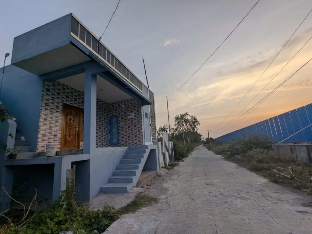
This reality may pan out in the Ezhilmuga Nagar and Jawahar Nagar resettlement neighbourhoods. Around 500 families displaced from Perungudi, Tharamani and other parts of the city have lived in this area for over two decades. Many of them work as daily wage labourers and commute across Chennai for work.
When they first arrived in 2002, residents say flooding was not a recurring problem.
“Initially, there was no flooding here. Water would naturally flow across these open grounds. There weren’t many large constructions around us then, not the Semmencheri Housing Board, St. Joseph’s College or Sathyabama University,” recalls Dhanasekaran. “But as more infrastructure came up, the water lost its natural path. Instead of flowing through the landscape, it began stagnating around our neighbourhood.”
His experience mirrors what hydrologists have documented and what the Uvakai report has found. “The concern is that protecting one site through engineering should not end up increasing flood risks for surrounding areas,” says Udhayarajan.
What the DPR reveals
Raj also points to what he believes are inconsistencies between the Detailed Project Report (DPR) and the present-day landscape.
“The DPR explains how water will be managed inside the Sports City,” says Raj of the Federation of OMR Residents Associations (FOMRRA). “But what happens outside its compound wall? There doesn’t appear to be basin-level hydrological modelling that shows how neighbouring areas will be affected.”
According to the DPR, the site,
- Is low-lying, marshy, and situated in a water-rich zone with interconnected water bodies.
- Suffers from site-wide waterlogging due to runoff from adjacent, higher-elevation lands.
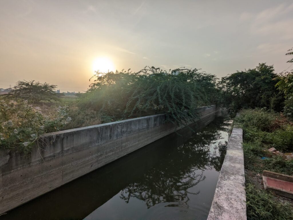
- Channels runoff from nearby ponds into the lake and routes excess water into an adjacent large nallah.
It also proposes integrating a new pond and a dedicated rowing channel into the site’s stormwater system management system
“The report refers to a canal from Navalur Lake that carries water across OMR,” adds Raj. “But that canal is non-existent. If drainage assumptions are based on infrastructure that is not functional, then naturally questions arise about the overall flood assessment.”
Building on a floodplain
Hydrologists argue that the central issue is whether a major infrastructure project should be built on a landscape that functions as a natural flood corridor.
Professor Janakarajan of the Madras Institute of Development Studies (MIDS) explains that the proposed site lies within the Kovalam basin, a low-lying watershed that receives runoff from 40 to 50 upstream water bodies in the Siruseri region. “This area is part of a wetland system,” Janakarajan says. “If the land is raised to protect the Sports City from flooding, the water won’t disappear; it will simply move elsewhere. Surrounding neighbourhoods are likely to bear that impact.”
He adds that Chennai’s geography makes the situation particularly delicate. “The city has a very gentle slope, so even a small change in elevation can alter the natural flow of water. Protecting one site should not come at the cost of increasing flood risks elsewhere.”
The regulatory situation around the Pallikaranai marsh has also grown complex. While the wetland’s Ramsar designation initially implied a proposed one-kilometre zone of influence, the Tamil Nadu State Wetland Authority (TNSWA) recently told the Madras High Court that it should not be treated as a fixed development buffer. The proposed Sports City now sits squarely within this contested area.
For Janakarajan, these issues should have been addressed upfront. “Planning authorities such as the CMDA must first assess the site’s elevation, classify the land, and understand its hydrological function before approving development. Those assessments should dictate where infrastructure can and cannot be built.”
Finding a way forward
The proposed Semmencheri site offers strong connectivity, with easy access to the airport, railway stations, and major transport corridors, an essential requirement for a world-class sports facility. However, experts and residents say accessibility alone should not dictate the location of a project of this magnitude, especially in a flood-prone watershed.
“We’ve suggested an alternative site in Guindy, near the Race Course, where the government has already proposed a biodiversity park,” says Udhayarajan. “From a hydrological perspective, that area is on higher ground and far less vulnerable to flooding. If a site exists that meets both accessibility and environmental considerations, it deserves serious evaluation.”
For residents like Dhanasekaran, the priority is long-term safety.
“We’re not just speaking for ourselves, but for everyone who will use this facility,” says Dhanasekaran. “If there’s an emergency during the monsoon, how will people evacuate safely? We all want the Sports City. The question is whether this is the right place to build it.”