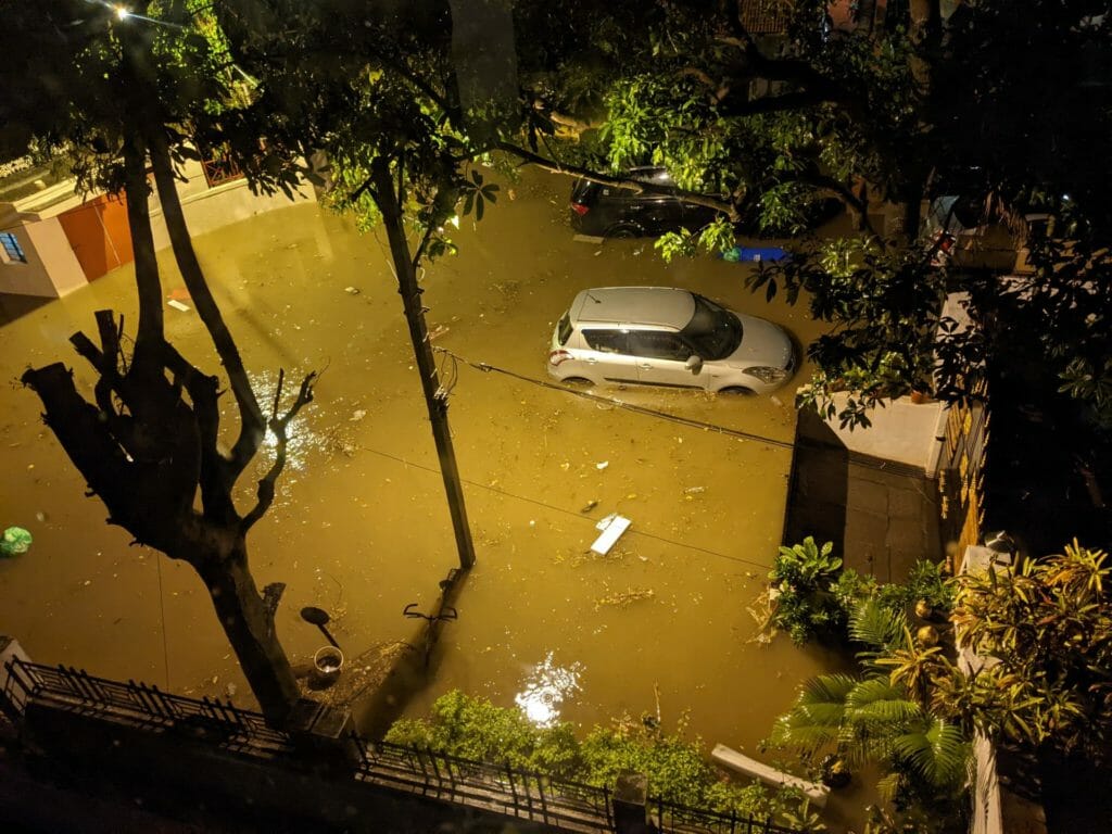
In a previous article, Citizen Matters summarised and republished the first in the YouTube series of Arun Pai’s video explainers on why Bengaluru floods to provide insights on the reasons for the city experiencing its worst floods in September this year.
In episode one of the series, Arun Pai explains how elevation determines why certain parts of Bengaluru flood. The second and third episodes in the “Floodsplaining” “series respectively explain how our ancestors captured and utilised rain water and how some locations in the city are more vulnerable to floods.
Arun Pai, founder of Bangalore Walks, uses interactive maps, history trivia, and quizzes in the video series on the Bangalore Walks’ YouTube channel, to explain in detail, the causes for floods and possible solutions. He focuses on reasons for flooding and not on who is to blame.
History matters
In episode two of the series, titled “Blr Floods-History Matters!” Arun Pai asks a quiz question: How many lakes are there in Bengaluru? The answer will give you much-needed information.
Arun Pai then goes onto provide fascinating insights, engaging viewers using maps, trivia, and quizzes, on how, over 700 years ago, our ancestors created engineering marvels to capture rain water. He also explains how Bengaluru is one of the few cities that is not located near a water source, like a river or a sea, and that its only water source is rain. Rain water does not stay in Bengaluru, it has to be captured and stored. He then visits Vibhutipura tank, in South east Bengaluru, and takes viewers on a historical journey to the time period of 1308 AD, to understand how our ancestors effectively captured and utilised rain water.
Read more: An unequal monsoon: The impact of the floods on Whitefield’s poor settlements
Watch the full video here:
Episode two of FloodsPlaining series. Video courtesy: Bangalore Walks YouTube channel
Why location is important
In episode three, titled “Location Matters! It’s about black & blue”, Arun Pai stresses that location explains why some parts of Bengaluru flood. He traces, via a topographical map, how rapid urbanisation has made some parts of the city more vulnerable to flooding.
Read more: The story of Thippagondanahalli Dam on the Arkavathi
In the 1990s, settlements were located in the ridge, which was protected from excessive flooding. However, over the last few decades, the city has expanded into the valleys, making some areas prone to flooding. This explains why Mahadevpura flooded as it is located in a valley, surrounded by high grounds on three sides.
Episode three of the FloodsPlaining series. Video courtesy: Bangalore Walks YouTube channel
[The videos have been republished with permission]