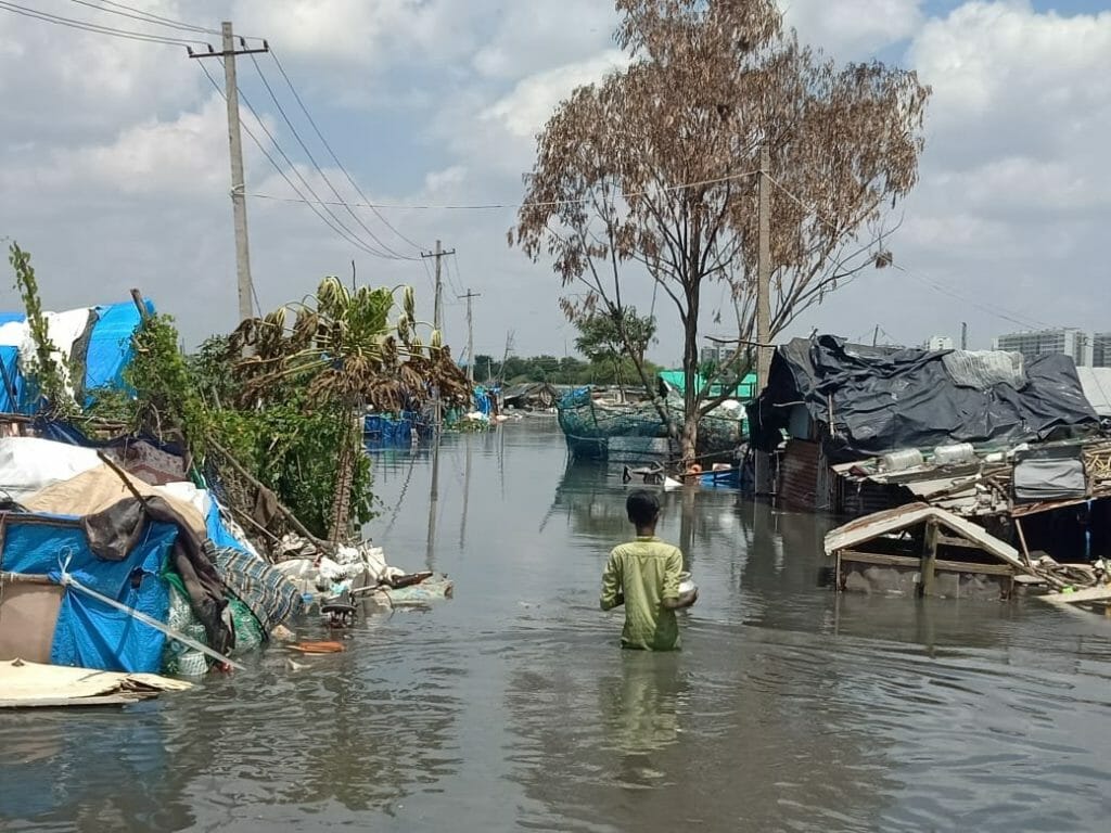
On September 4th, Bengaluru experienced one of its wettest days on record, causing large parts of the city to get severely flooded. This was after weeks of heavy rainfall that turned roads into rivers in some of the city’s rapidly developing ‘high-tech’ areas. This is going to happen again and again unless we fundamentally change how we approach urban planning. We need to proactively work with the assumption that such severe extreme weather events are the new normal and what can be done to prevent flooding in the city under these circumstances.
As a sustainable architect and environmental modeller, I have been passionate about saving our biosphere for more than 15 years, trying to do it one building at a time. A decade into that approach, I realised that we need systemic change to solve the problems we are faced with before it is too late.
The effects of climate change
Climate change is not in the distant future, it is happening now, with rising temperatures, floods, water shortages, and extreme heat likely to occur with increasing frequency and intensity. This is why it is critical that we plan towards this on a war footing, by honing on aspects such as wastewater reuse and data transparency on the location of waterways.
Bengaluru has seen a 30%-50% rise in rainfall over the past three years. This year we have already surpassed the average rainfall of 900 mm and it is only September. Not only is climate change causing seasonal variability, but is also leading to the rain, which we receive, getting concentrated over fewer days. As a result, we experience more intense and extreme rain events in short bursts that are more likely to cause floods.
So, the question remains: How do we adapt to the changing climate and undo the mess that we find ourselves in?
Let’s begin with the good news, there are solutions
Nature, being wonderfully complex and incredibly evolved, has provided us with a host of solutions for the three seemingly disparate natural disasters: floods, droughts, and extreme heat. Restoring the city’s natural waterways and lakes, increasing green cover and permeable surfaces, and being more sensitive to natural slopes for new development are all ways to rectify the trajectory we are on now.
Now the not-so-good news, the drawbacks of poor urban planning
The way our city is planned and managed hampers the efficiency of natural landscapes to buffer the city from excessive damage during severe climate events. The manmade infrastructure of the city is operated by the utility department and natural resources are maintained by urban local bodies. The two, however, seldom interact and, as a result, the synergies between them are lost. Lakes and waterways are encroached upon, stormwater drains are filled with solid waste, sewage, and wastewater. More than 90% of the city is paved, leaving very little room for water to percolate down into the aquifers.
Some immediate fixes to mitigate Bengaluru flooding
a. Increase data transparency
Having publicly-accessible maps of the waterways and lakes is essential so that they are not built upon. We recently circulated a survey with architects and urban planners in the city to ask them if they had access to this data and more than 90% responded with a resounding ‘No!’ We should ensure that this is built into the system when buildings are sanctioned and funds are issued for construction. New homebuyers should have access to reliable data before they make choices they will regret in the long run.
Read more: BBMP checks no village maps or master plan, while sanctioning plans
b. Cleaning up waterways
It is essential to desilt waterways and ensure there are collection points for sewage and solid waste so that people are not forced to dump their garbage and sepatage (partially decomposed sewage), in the dead of night, into waterways.
Read more: 50% stormwater drains lost: Bengaluru’s flooding is no surprise
c. Finding uses for wastewater
It is estimated that around 1450MLD of wastewater is generated in Bengaluru everyday. A little less than half of this is treated in centralised STPs(Sewage Treatment Plants) and around 250MLD is treated in decentralised STPs everyday. Almost 560MLD of treated wastewater is discharged into stormwater channels, leaving our lakes perennially full and unable to buffer the city from floods. If wastewater were to become a valuable resource it wouldn’t be released into stormwater drains and, instead, would be reused for other purposes like construction and industries.
Decentralised STPs have the added advantage of being located in close proximity to areas where new construction and industrial manufacturing is happening, since the majority of them were built, after 2016, on the periphery of the city. We could have designated channels for transporting wastewater so that it does not interfere with the service that stormwater channels are meant for, i.e. direct flood water away from residential and office areas during extreme rain events.
Read more: Six reasons why Bengaluru apartments are not reusing their wastewater
d. Flood buffer zones
We should have designated zones in the city that allow the flood water to collect during high rainfall events. This will allow water to pool in areas of the city with little or no damage.
e. Increase permeable paving
The concept of sponge cities – an urban planning approach for flood management that uses a city’s green spaces, like rain gardens and sidewalk planters, to boost infiltration of water into the aquifer, while simultaneously increasing the efficiency of its drainage by improving the connections between lakes, waterways and rivers – is not new. However, achieving increased rainwater capture in a city that is already largely built is challenging without significant retrofitting, which requires massive funds, citizen collaboration, and political will.
Bengaluru is among the fastest growing cities in the world, with a year-on-year growth rate of 8.5%, according to a study by Oxford and World Economic Forum. We can assume that the city will double in size again over the next decade, so we can plan better for what is to come. Incident rainfall can be more effectively captured by ensuring that our new roads act as sponges for water and incorporating regulations for permeability for open spaces into our building by-laws.
In addition to these technical and data solutions, we need a climate action plan, co-created with communities and governments, so that people are better prepared for the battery of extreme weather events that are inevitable. We can view this tipping point in our history through two lenses, one which breaks us or another that helps us become more interconnected and resilient.