During the Open City biodiversity datajam held in December 2025, our group examined the ecological trends around Bengaluru’s lakes. Our analysis suggests a majority of waterbirds are declining across the city’s lakes.
Earlier, we addressed crucial questions on how migrant and resident waterbirds are surviving across 14 of Bengaluru’s lakes, how the shape of the lakes influence microhabitats, and how a scoring system can be used to record the decline in lake quality and bird populations. The last of our four-part series turns its attention to an individual site.
As part of this study of waterbirds in 14 city lakes, we undertook a site visit to one of the worst performing lakes in the city — Begur.
Located in the Koramangala-Challagattha valley, Begur Lake is part of the Dakshina Pinakini river catchment area. It is currently spread over an area of 0.46 square kilometres (km²), making it one of the larger lakes in South Bengaluru. The lake holds cultural significance as the first recorded mention of the name Bengaluru appears in an inscription in the temple located next to the lake.
Here are our findings from the visit:
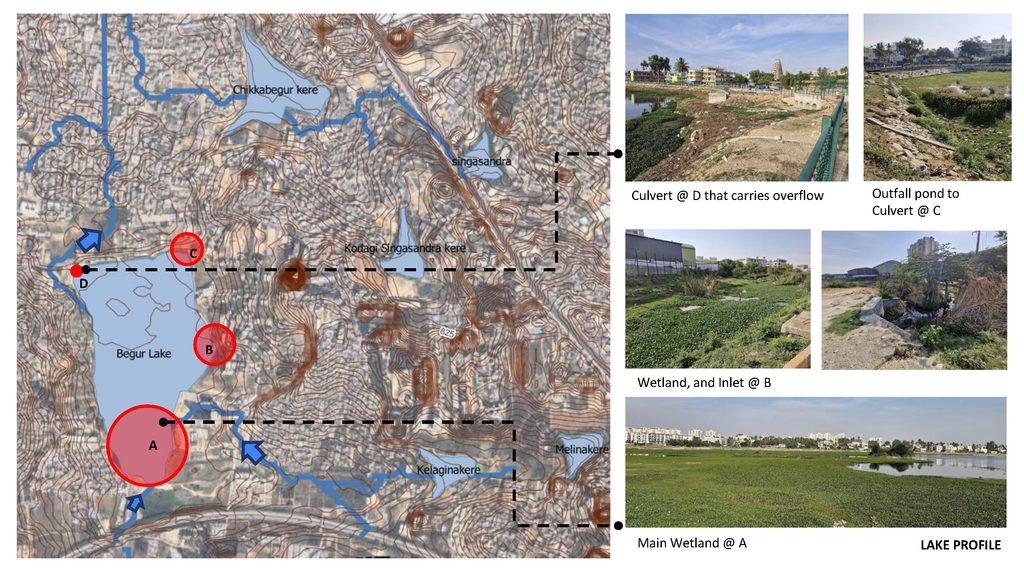
As visible in the terrain map, the lake has major inlet points along the southern and eastern extents. Inlet A hosts the main wetland, with a smaller wetland at Inlet B. The outflow is located in the north where the road along the Northern perimeter serves as the lake’s embankment.
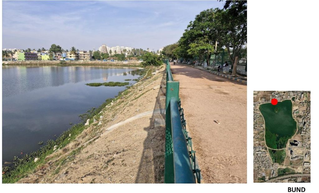
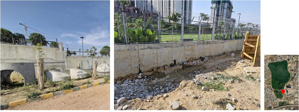
Moreover, the lake does not have shoreline vegetation for retaining the soil. These hard margins have little ecological value for birds that depend on a gradual transition from land to water.
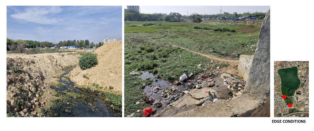
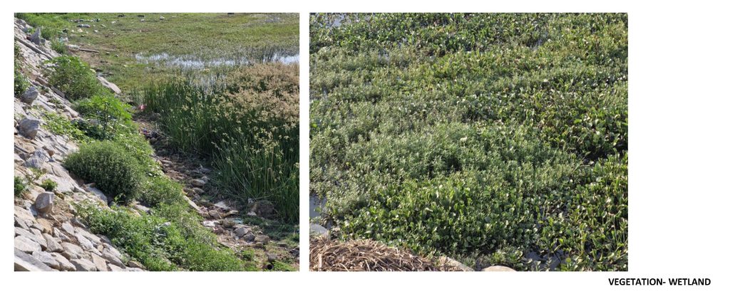
The wetland edges support shallow marshy conditions. There are no Sewage Treatment Pants (STPs) in the lake perimeter yet, but there is a proposal to pipe treated water from private STPs into the lake. Active earth dredging, observed during the visit, could be taken up for this purpose. Once functional, year-round flow from the STPs could inundate the shallow edges permanently, eliminating the marshy margins that support diverse waterbird activity.
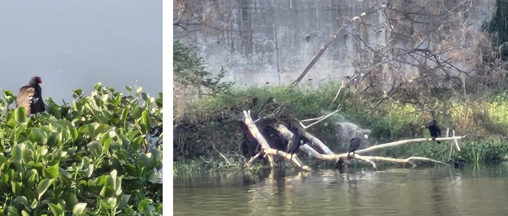
The lake has a large tree-covered central island, but its steep concrete edges limit its potential as a bird habitat. Floating vegetation and deadwood trees around the island were hosting cormorants and other marsh birds.
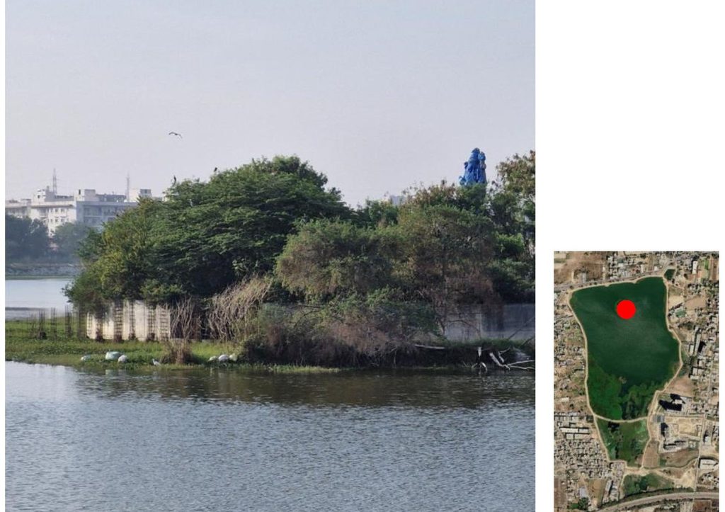
Vegetation within the lake premises
There are almost no mature trees in the lake perimeter, especially critical for birds of prey and generalists that roost on trees. The lack of shade also restricts the use of the lake by the community.
The few mature trees present include Ficus religiosa, Acacia nilotica, Tamarindus indica, Bambusa spp. and Eucalyptus spp.
On a positive note, Avenue tree saplings have been planted along the walking track.
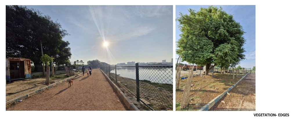
Tall shrub vegetation is also sparse. Isolated clumps of tall sedges in the wetlands and Milk weed (Calotropis gigantea) is all that is present.
Even with early monsoon showers, the water levels of the lake had receded, exposing the shallow margins along the edges. The vegetation here is dominated by invasive plants such as the Water hyacinth and Cecil joyweed. There is also a limited presence of Lantana camara, and Parthenium hysterophorus, pointing to an absence of any shoreline management.
Read more: Shrinking lake buffers: What Bengaluru citizens need to know
Birdlife in Begur Lake
Significant bird activity was seen along the shallow edges of the lake, during the visit. Eurasian Moorhen and Eurasian Coot dominated the parts overrun by floating aquatic vegetation. Shoreline specialists recorded include White-browed Wagtail, Red-wattled Lapwing and Paddyfield Pipit. Purple Heron, Glossy Ibis, Egrets, Cormorants and were some other wetland birds were also spotted. Ashy Prinia was the only bush-dwelling bird recorded.
Apart from birds, a few butterflies and dragonflies were also present.
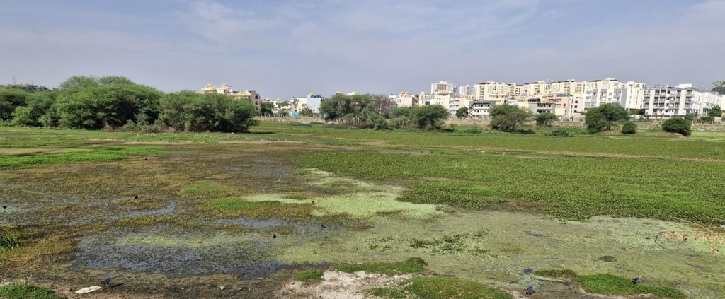
The Begur Lake site visit puts the results of our analysis in context. The wetlands are still attracting birds, with 80 species recorded in 2025–26. But a staggering 71% of the waterbirds are in decline, among the highest decline rates in our study.
Hardened bunds, absence of shoreline vegetation, proliferation of invasives and infrastructure encroachments are some of the pressures that became obvious during the visit.
At a broader level, the rapid rate of urbanization and the significant encroachments by NICE road have all contributed to a collapsing wetland ecosystem.
Some practical measures that can improve the habitat quality
Lake edges
- Integrating shallow terraces as vegetated wetlands into the lake edge detail. The water level for this edge should be allowed to have seasonal variation, so that shoreline and marsh bird habitats are retained.
- Dry stone pitching of lake edges with shallower slopes. With joints that are not concretised, deposited earth will allow plants to grow in the cracks and become insect habitats, while also allowing birds to better access these edges.
- Minimising hard surfaces and passive pedestrian infrastructure around lakes that ensures usability but reduces radiation. For example: pervious paving that allows seepage of runoff; material with high albedo value (reflects a lot of sunlight) to reduce radiation.
Vegetation
- Lake edges need planting for usability, habitat, and not just for beautification.
- Multilayered planting to accommodate- sedges, grasses, trees and shrub vegetation along the edges, while floating and emergent plants can also be addressed in the shallow terraces.
- Planting of trees for shade provision ensures usability of the lake edges as public space, and incentivising the community as active stakeholders in the maintenance and care for the lake environments.
- Predominant use of indigenous flora to help support local biodiversity that should help enhance the bird population.
- Active management of colonising invasive alien plants.
What our analysis tells us about the state of waterbirds
In this study, we set out to track the state of waterbirds in Bengaluru using eBird data. Over the course of these articles, we have highlighted some key trends — the declining migrants, the collapsing edge habitats, the homogenisation of birdlife — all contributing to the overall degradation of wetlands. Many of these issues have been flagged for over a decade; we have provided data-based evidence affirming them.
The numbers are stark. About 40% of the lake-species records have the declining or likely declining label; 12% have been lost. Among migrants, 23% of the labels read lost and nearly three-quarters of these losses have come from the edge habitats. The list of birds losing out is dominated by edge specialists reflecting the ecological gentrification under way.
The index we created to rate the city’s wetlands is best viewed as a long-term snapshot of its habitats. Factors like water quality, algal health, and bathymetric studies of the lakes are also important considerations, but the ecological signals conveyed by eBird trends can be valuable to decision-makers.
We explored the possible reasons driving these trends across cascades: the permanent inundation of lakes flattening the habitat mosaic, the transformation of lakes into bowls damaging the shorelines, the urban aesthetic destroying reedbeds and grassy shorelines, and local governance factors.
Ultimately, our results reflect the changing role of lakes in the city. Balancing the different roles a lake has to perform — water storage, flood control, and recreation — is a wicked problem. But as data shows, lakes are fast receding as ecological spaces. And at a time when nature is disappearing from our cities, every inch of it is worth preserving.