The Greater Bengaluru Authority (GBA) and the Bengaluru Development Authority (BDA) have released proposed Road Circulation Plans, inviting public suggestions and objections till December 11th, before the final approval. This is a necessary step to address the city’s mobility issues.
But before framing the suggestions and objections, citizens need to understand what is meant by a circulation plan and how and why it is prepared. This is critical for Bengaluru, as endless urban expansion without an updated master plan has strained the city’s mobility and transportation systems.
Bengaluru residents can send their feedback to the Office of the Chief Town Planner, GBA Head Office, NR Square, Bengaluru – 560002 (in person, registered post, or email to gba.masterplan@gmail.com by Dec 11, 2026. The BDA accepts submissions through its Town Planner Member on bdarmp2041@gmail.com. Deadline: Dec 8th, 2026.
Explore the maps shared by GBA and BDA here.
What is a circulation plan?
A circulation plan under India’s National Urban Transport Policy (NUTP) is a structured spatial and traffic management scheme that organises how people, vehicles, and goods move through a city or specific urban district.
Under Section 12(1)(b) of the Karnataka Town and Country Planning Act, 1961, a circulation plan is a mandatory component of the city’s master plan. It includes a complete street pattern indicating major and minor roads, national highways and state highways, together with a traffic circulation pattern to meet immediate and future requirements and proposals for improvement. The notification by the GBA and the BDA states that the circulation plans will be adopted as needed for the Bengaluru Master Plan.
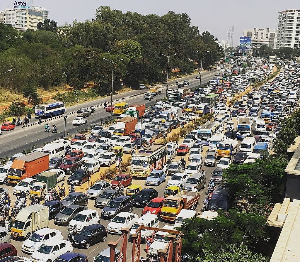
Given the substantial criticism surrounding the non-implementation of roads proposed under the Revised Master Plan (RMP) 2015, and the housing and commercial developments that have mushroomed in anticipation of these roads, Bengaluru faces a crisis in transportation and traffic management. In this context, several concerns regarding the proposed circulation plans need to be examined.
Emerging concerns
Here are some concerns regarding the circulation plans that need to be addressed:
- Lack of a holistic approach: A major concern is whether the circulation plans for the GBA jurisdiction and surrounding areas by the BDA are being developed contiguously and holistically. This issue applies to both the circulation plans and the master plans for the two jurisdictions. Currently, the plans have been notified as grids. An overall circulation plan would help provide the much-needed larger vision.
- Outdated baseline data: The data used to develop the circulation plan dates back to around 2007, raising critical questions about whether the proposed roads remain relevant today.
- Alignment discrepancies: While the published plans extend beyond the RMP 2015 proposals to include NHs, SHs, MDRs, village roads, railway and metro lines, and new peripheral roads, a quick review of the grids reveals significant gaps:
- Several proposed roads and ring roads already exist on the ground, while others remain unbuilt.
- Many proposed road alignments no longer align with current ground conditions, with planned routes cutting through existing built-up areas. This gets further complicated as there is no clear distinction between roads that exist and are being incorporated into the proposed circulation plan and new roads that are being proposed.
This requires updating, especially if these are to become a part of the 2041 Master Plan. Notably, the 2031 Master Plan, although never notified, could serve as a more relevant starting point. The plan provides a more recent data for understanding the city’s transportation network and its development.
Assessing data to improve mobility
It is crucial that the datasets accurately represent the current conditions of the city and the changes that have taken place since the earlier plans were prepared.
As specified in the KTCP Act, the circulation plan is one of the contents of the Master Plan. The NUTP defines it expansively to include the organisation of people, goods and vehicles. An efficient circulation plan therefore requires a measured reading of the existing and likely land-uses, as these determine the movement of people.
A circulation plan is not simply about roads. It concerns the hierarchy of roads, their interconnections and the movement of people between different locations. A road network that appears well-connected on a map does not necessarily translate into effective circulation on the ground. Proposing additional roads statically in the circulation plan, even where they are feasible to implement, may not be sufficient to resolve existing circulation problems.
By overlaying and analysing the available datasets on existing development, proposed roads and the current road network with mobility patterns, it should be possible to assess which proposed interventions are likely to improve circulation, which may have limited benefits, and which require more careful consideration.
Would implementing the circulation plan developed for RMP 2015, based on datasets prepared around 2007, improve existing conditions or be counterproductive, considering the city’s unbridled growth? A recent article in the DH (Sep, 2026) discusses how several layouts and apartment complexes were given permissions in anticipation of the proposed circulation plan of RMP 2015 that never saw the light of the day for multiple reasons.
Read more: A decade without a Master Plan: Who should be planning Bengaluru’s future?
Where should the Circulation Plan go from here?
The authorities’ initiative to prepare and publish these circulation plans is useful.
If these plans are an initial step towards the next Master Plan, they serve as a useful starting point. But implementing them as they are , may cause bigger problems, as they currently lack sufficient information to ensure integrated planning and development across Bengaluru.
This makes an understanding of the actual traffic circulation pattern essential. Such an assessment can begin by examining existing travel behaviour in relation to the city’s current spatial economy and land-use patterns. Understanding where people live, work and travel, and how these movements interact with the existing road network, is necessary to determine whether the proposed circulation plan will address the city’s mobility needs.
Such a process should draw on the contributions of multiple stakeholders, particularly citizens, professionals and the government. We lay out some thoughts on the role of the multiple stakeholders.
The role of citizens
The published circulation plans are currently presented as PDFs, with the road network represented in grids. OpenCity has made these plans available in an accessible digital format that would enable people to view the proposals in relation to their geographical locations and identify where proposed roads conflict with existing buildings and development on the ground.
Beyond identifying such conflicts, meaningful citizen participation is also necessary to understand existing gaps and needs in the city’s public transport system. Residents and road users can contribute information about the actual conditions of mobility, the deficiencies they experience and the constraints that may not be adequately represented in the datasets used to prepare the plans. Notably, this is not an end itself, rather the means to the end.
The role of professionals
Advances in data availability, the use of proxy datasets and analytical techniques offer significant possibilities for improving the circulation planning process.
When provided with current datasets on land use, population distribution, travel demand, travel behaviour and public transport, professionals can use network analysis and transport modelling to identify bottlenecks, connectivity gaps and other mobility constraints.
Leveraging these professional capabilities is necessary to move beyond a road network represented on a map towards an evidence-based understanding of how the city functions and how proposed interventions are likely to affect mobility.
The role of government: local and state
The authorities have the critical responsibility of integrating these contributions into the Master Plan and aligning projects and major infrastructure investments with the city’s broader circulation requirements.
The circulation plan must also inform policy decisions concerning the different projects and infrastructure developments proposed for Bengaluru over the long term. This requires coordination across the relevant levels of government so that individual projects contribute to, rather than undermine, the functioning of the city’s overall mobility system.
Ultimately, the current approach to circulation planning, if restricted to roads and a hierarchy based primarily on road classifications, can only be a preliminary step. It needs to evolve towards planning for the circulation of people. This would make both the plan and the process through which it is developed more dynamic, responsive and robust.
The way forward
It is critical that multiple stakeholders start to focus on the ‘public’ in the circulation plan. The extent to which the proposed circulation plans integrate and account for Bengaluru’s public transport system remains unclear. The proposed circulation network needs to be considered alongside the city’s existing public transport system, including whether improvements to public transport are necessary to realise the network’s potential.
This would involve examining how proposed roads connect residential areas and employment centres with bus and metro networks, whether feeder connectivity and access to public transport are adequate, and where improvements to routes or supporting infrastructure may be required. The objective should be to understand how the circulation network and public transport can work together to enable people to reach their destinations more effectively.
Achieving optimal circulation across the entire city may not be possible because of the constraints created by Bengaluru’s historical development and past planning decisions. However, even where complete efficiency cannot be achieved, detailed data-driven analysis can help establish the extent to which the proposed plan is likely to improve circulation, identify its limitations and determine how these can be addressed.
The purpose is not to assume that the entire city can be made to function optimally through a uniform set of road interventions, but to systematically identify where improvements are possible and where specific constraints require different approaches.