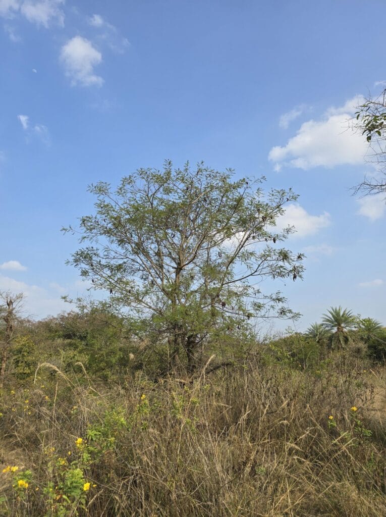
When we discuss urban nature, we often forget about real natural habitats. In Bengaluru, widely called the Garden City, most talks about urban nature focus on landscaped parks, roadside trees, and manicured gardens; in other words, artificial ecosystems designed for looks and human comfort. As lay citizens, we usually notice only such nature as we see around our homes, workplaces or other areas we generally pass by. While these places do have some ecological value, they mostly support a few highly adaptable species. This has strong negative implications for native flora and fauna that depend on open scrublands, grasslands, rocky outcrops, seasonal wetlands, and uncultivated soil.
So given that we only see nature that is close and visible, “wastelands” as a land use class beg intrigue – the known unknowns within urban nature discussions. In urban land-use and land-cover (LULC) classifications, “wastelands” refer to areas that are underutilised, constrained by various factors, and often just waiting to be built upon. This led us to investigate the biodiversity of wastelands in Bengaluru at the datajam hosted by OpenCity, an initiative of Oorvani Foundation, in December 2025.
We wanted to find out: What kind of plants and animals live in these wastelands? Are they different from what we see in parks and gardens closer to the urban mainstream? And if these wastelands are about to be developed, what unique nature will we lose—or even drive to extinction?
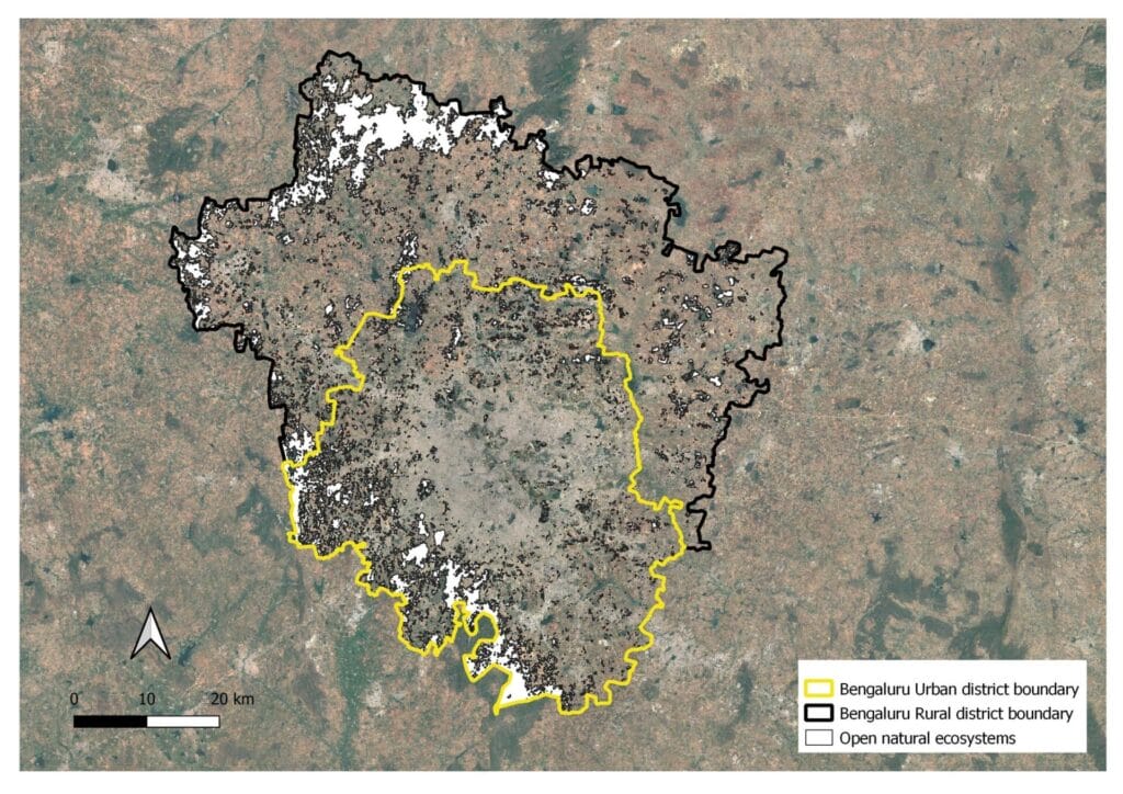
Within the city limits of the Greater Bengaluru Authority (GBA), wastelands proved to be very scarce (114 sq.km in the 712 sq.km area under GBA), and underrepresented / under documented in citizen science apps such as e-bird and iNaturalist. This signalled the need to look beyond the urban area, opening up the research question to the relevance of Open Natural Ecosystems (ONEs) within the larger Bengaluru Urban District (BUD).
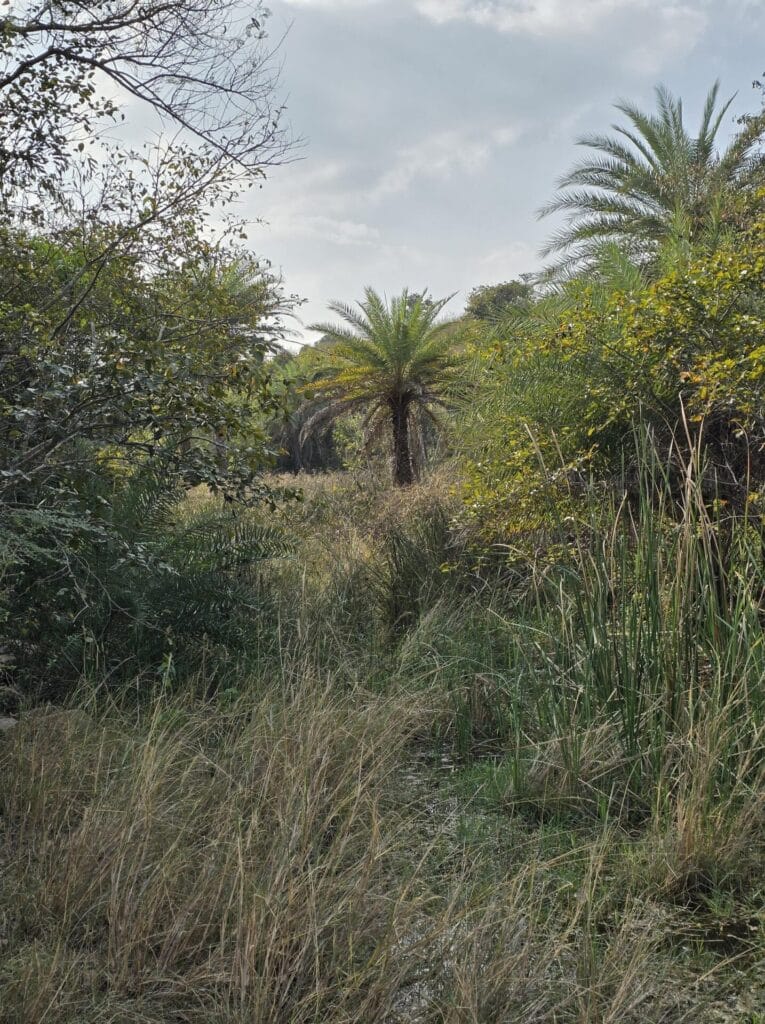
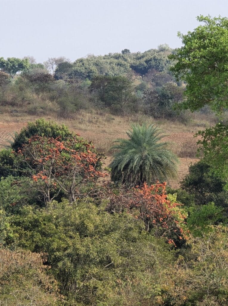
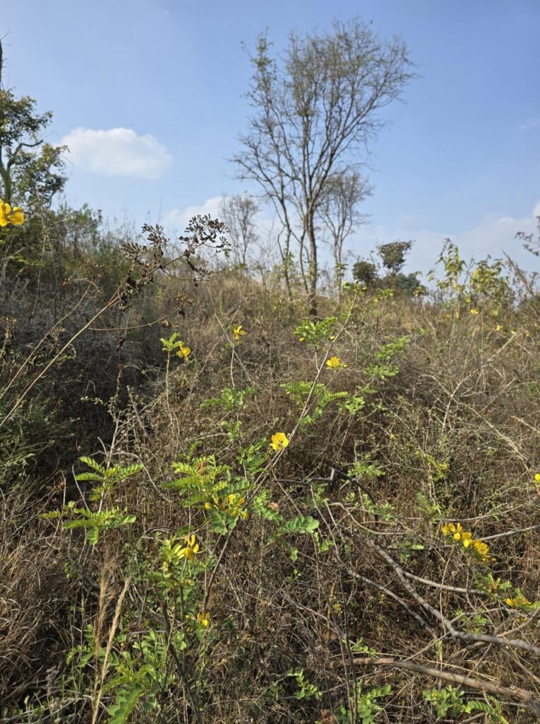
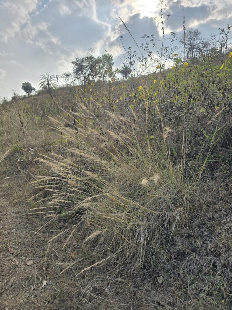
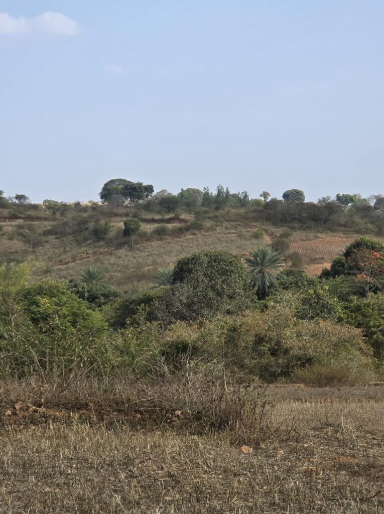
“Wastelands” all fell within this broader ONE classification but also included ecologically relevant scrublands, ravines, fallow land, and other naturally open systems.
What the biodiversity data shows
In the Open Natural Ecosystems ( ONEs ) area (excluding built-up land), area extracted using Google Earth Engine, biodiversity data were analysed for the year 2024. This included research-grade observations extracted from iNaturalist and bird records from eBird.
The results show that 798 species were recorded within ONEs, compared to 1671 species recorded in the non-ONEs areas across Bengaluru urban district. This supports the fact that most citizen science observations are dominated by urban parks and institutional campuses, and outcrops like ONEs are under-observed.
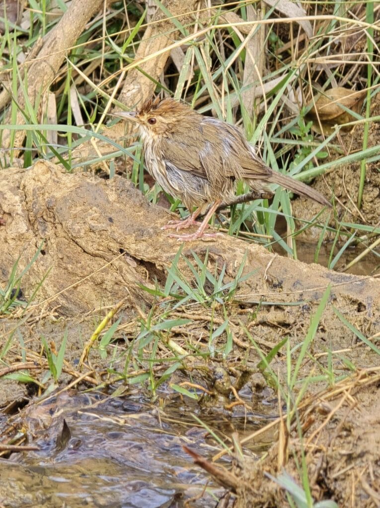
Looking deeper, of the species recorded, 142 species were exclusive to the ONEs in 2024. These “unique” species include mammals like Golden Jackal and Chital; butterflies like Common Silverline, Plain Hedge Blue, and Oriental Great Eggfly; and birds like Yellow-throated Sparrow, Indian Vulture and Tickell’s Thrush. These are dependent on open-scrub, grass-dominated systems or mosaic landscapes that do not resemble manicured parks or dense tree cover seen across the urban core of Bengaluru.
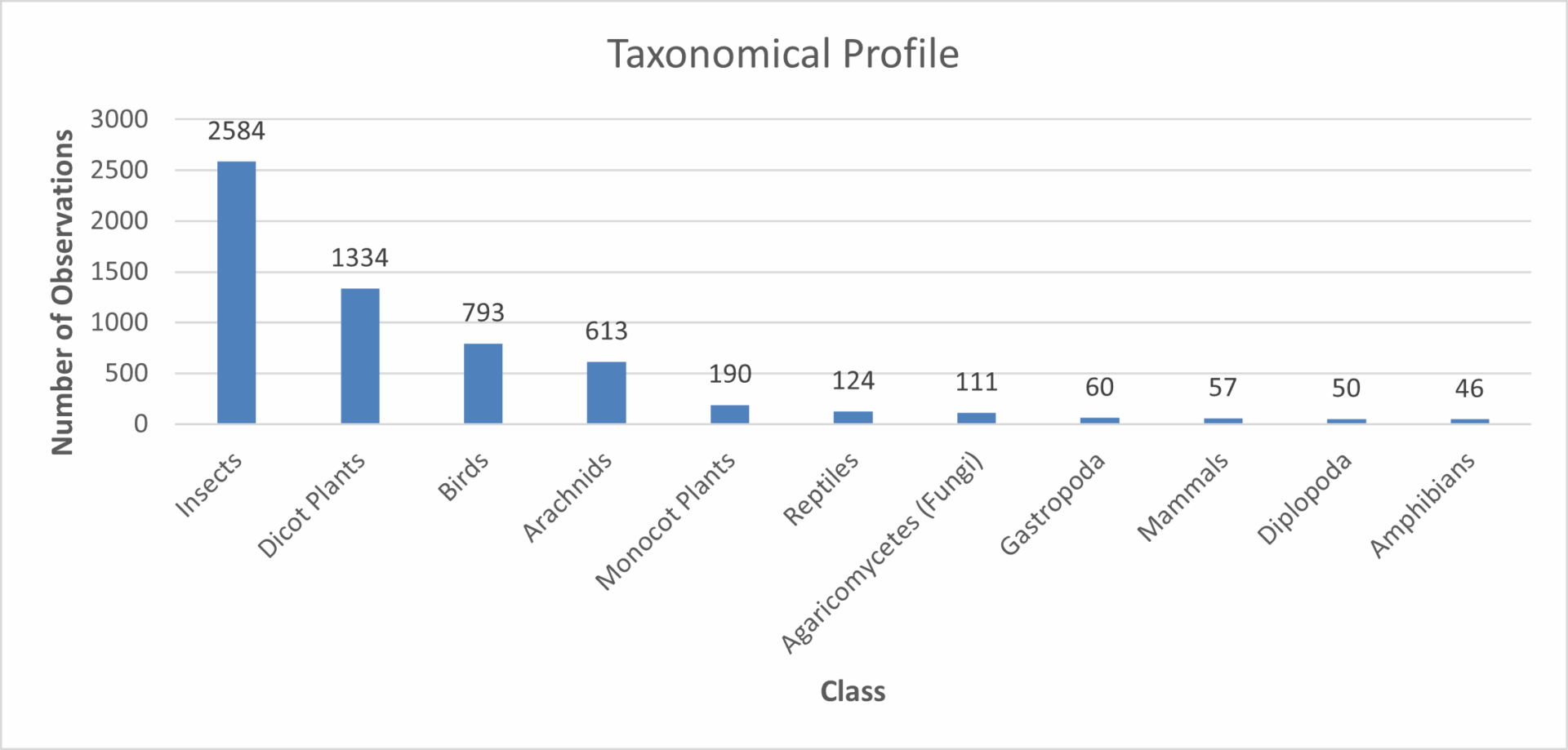
At higher taxonomic levels, ONEs contained 84 unique genera, 23 unique families, and six unique orders not recorded in non-ONE areas during the same year. While some expected species may not appear within ONE boundaries due to the absence of spatial buffers and coordinate uncertainties in citizen science data, the species that do emerge consistently underline that these landscapes are ecologically distinct.
Development pressures on ecological proximity
Now that we understand what these ONEs hold, we are also better placed to understand what we are set to lose, given these ONEs are most vulnerable to development when the city is bursting at its seams. To assess development pressure, real estate project data from the Karnataka Real Estate Regulatory Authority (RERA) was analysed to identify upcoming built-up area expansion in Bengaluru Urban District.
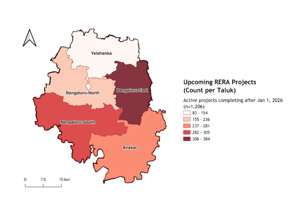
Of the 3,897 projects, 1,206 were classified as scheduled for completion after January 2026 — effectively representing the city’s upcoming built footprint. At a macro level, a taluk-wise heatmap shows that development pressure is concentrated in Bengaluru East, Bengaluru South, and Anekal — precisely the zones where large, contiguous ONE patches still exist. At a micro-level, buffer analysis around ONEs was undertaken to understand inherent threats to ecology due to proximity of construction – on a gradient from direct encroachment to minimal risk beyond 500 metres.
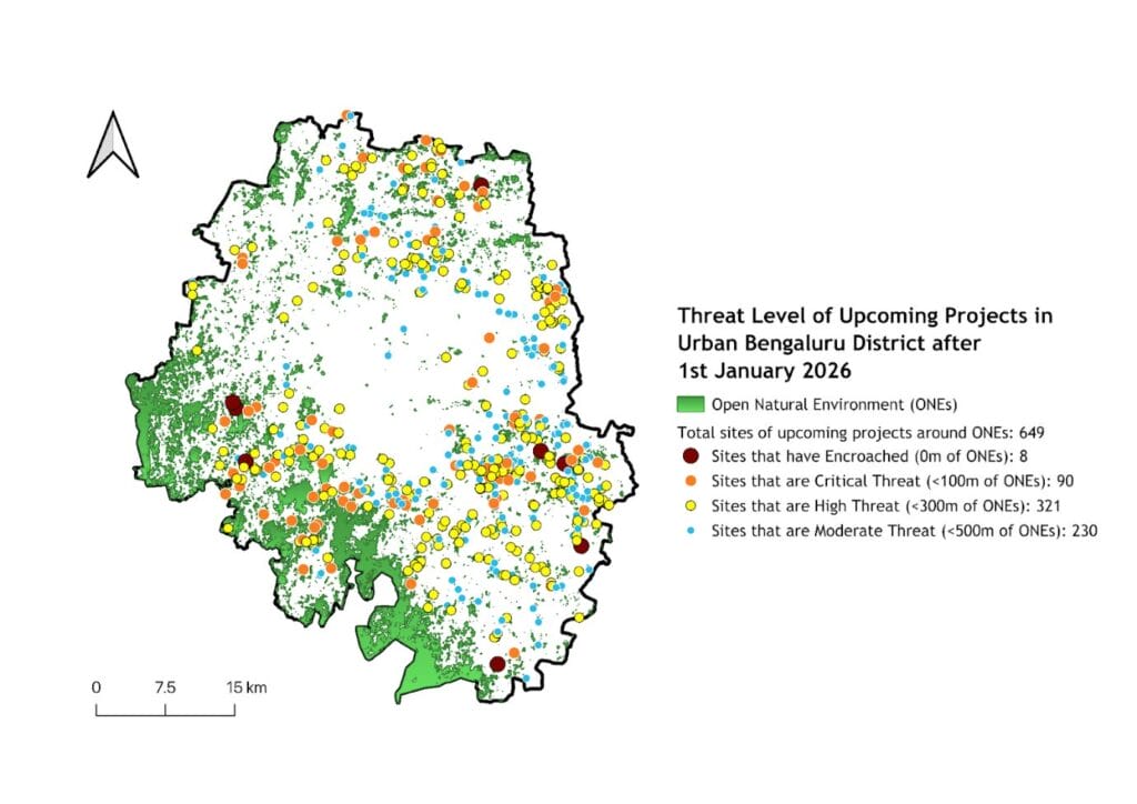
Of the 1006 projects that had GPS coordinates intact/present, 64.5%(649) fell within 500 metres of the ONEs. This directly means that these projects are situated close enough to alter the ecological integrity through noise, light, fencing, road expansion or secondary resource depletion measures. Extrapolating this pattern to the full set of 1,206 upcoming projects suggests that nearly three-quarters of Bengaluru’s imminent urban growth may be occurring within the ecological influence zones of Open Natural Ecosystems.
Why this matters now
What disappear from view are species that are not always the large mammals or dramatic landscapes, but species that rely quietly on the open, less-managed habitats. Amphibians like Bengaluru Burrowing Frog and Common Cricket Frog; reptiles like Indian Green Keelback, Bengal Monitor; and mammals like Grey Slender Loris, Schneider’s Roundleaf Bat and birds like Bonelli’s Eagle and the Yellow-throated Bulbul are among those tied to scrublands, rocky outcrops and open mosaic systems.
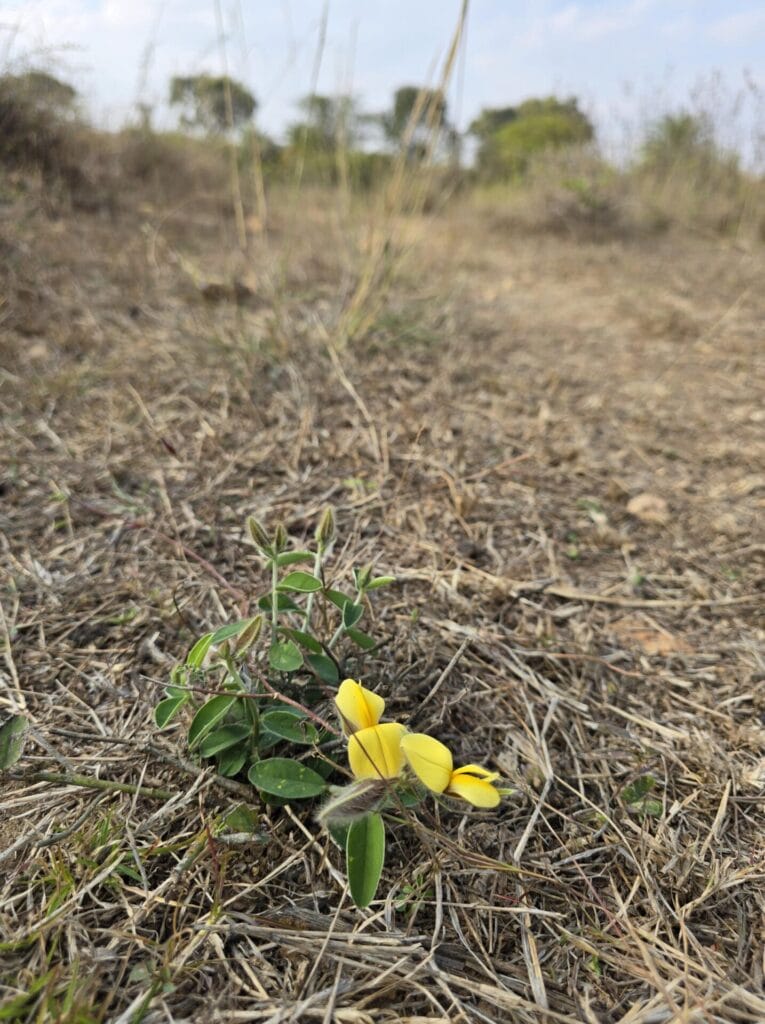
Alongside native plants such as Curculigo orchioides (Golden Eye Grass), Catunaregam spinosa (Mountain Pomegranate), and Memecylon umbellatum (Ironwood), the ONEs represent the last living frontier on endemic biodiversity interfacing with urban living. These are not park species; they persist in open natural ecosystems that remain lightly managed and structurally diverse.
With rapid expansion on these urban edges, what is lost is not just land cover to concrete, but also rich, diverse ecological functions that have varied contributions to ecosystem services across the landscape. Designed green spaces may increase tree count, but cannot replicate the habitat complexity of the ONEs. If lost, it would be impossible to replicate the same in its fullest sense.
If Open Natural Ecosystems are to be recognised within Bengaluru’s growth story, they first need to be better documented and differentiated from generic “vacant land” categories. Baseline biodiversity assessments in peri-urban zones, conducted before large approvals are granted, could help identify the ecological functions at stake.
It’s equally important to acknowledge that not all green spaces are interchangeable. Scrublands and open habitats perform roles that landscaped parks cannot. Planning conversations around climate resilience, biodiversity, and adaptation would benefit from explicitly accounting for these differences.
At the very least, these landscapes deserve to be visible in the city’s spatial imagination — not as leftover land awaiting conversion, but as ecosystems with distinct ecological value.
[Shashank HP also contributed to the analysis.]