What do we talk about when we talk about climate change? In Mumbai, most people hark back to the 2005 deluge. Between July 26 and 27 that year, the city received 944 mm of rain in 24 hours. Many parts of the city and its suburbs were flooded; the water rose to our knees, our waists, even our necks. According to a 1992 report by the Central Water Commission, this could be considered a once-in-a-hundred-years flood.
Scientists predict that with global warming the frequency of extreme climate events is likely to increase in the future. So Mumbai’s once-in-a-hundred-years flood could recur before a century is up. The question is: Is the city ready?
This was one of the many questions that inspired A flood-resilient Mumbai?
This 23-minute documentary tries to assess the causes of flooding in the city and its effects on communities living in flood-risk zones. As Mumbaikars, we had all registered the 2005 deluge as a climate disaster, but was it just this? Wasn’t it also a breakdown of the city’s water infrastructure? And hadn’t the nature and intensity of the monsoon been changing even before 2005? Had we paid this no heed? The city saw waterlogging every monsoon, but had it seen floods of this nature since the deluge?
With these questions in my notebook, I began researching the 2005 deluge and subsequent floods in the city. The overflowing of the Mithi River in 2005 had flooded many areas in the western and central suburbs – and this got much media attention. But had other parts of the city and other rivers flooded too? If so, which ones? This last question took me to the northern parts of the city, towards the more neglected Dahisar River, which I discovered had overflowed not only in 2005 but almost every year since 2017. How did people living near the river cope with this? I’ve tried to answer some of these questions in the film.
I spoke to academics, researchers, scientists, government officials and of course, communities afflicted by the flooding. People in adivasi padas (hamlets) in the Sanjay Gandhi National Park and those in chawls and multi-storey buildings in Dahisar and Borivali spoke of how they experienced heavy losses each time their homes and shops got flooded.
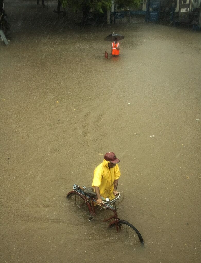
I found that climate impacts such as extreme rainfall, cyclones, storms, storm surges and sea level rise were only exacerbating already existing vulnerabilities due to unplanned development, inadequate drainage systems and the concretisation of large swathes of the city. Thus, climate change in conjunction with urbanisation was making many people, particularly those living near rivers or in low-lying areas, vulnerable. And many of them were already disadvantaged socio-economically, thus increasing their susceptibility to climate extremes.
As I was making the film, I kept thinking: How can these people be safe from the flooding? Resettlement was one of the solutions suggested by P Velrasu, additional municipal commissioner (projects), BMC. However, I learnt that rehabilitation of affected communities is a complicated process and is likely to take a few years at least.
Read more: Despite promises by political parties, annual Mumbai floods still a problem
So, what of those who are on the frontlines of climate change, those who fear the wrath of the river each time it rains heavily? While solutions are awaited, what we need in the present is more reporting from citizens, journalists, researchers, academics and civil society in general. Because when the city gets flooded, we don’t even know the names of all the places where water has risen. What we do know is whether our neighbourhoods are flooding and by how much. So, perhaps we can begin this reporting by posting and tweeting information about flooding in our own localities.
The Climate Studies department, IIT Bombay, is trying to gather this data online and get an overview of flooding in the city. Perhaps with this information, we could be one step closer to pushing our governments and policymakers to take notice. So pull out your phones, shoot photos and videos, and tweet them with the location and amount of flooding (ankle high, waist high). Remember to use the hashtag #mumbaiflooddata and tag @climateIITB.