Mumbai’s M/East Ward, a sprawling peripheral area including Mankhurd, Govandi, Deonar, Trombay and Chembur, embodies a tale of two cities. It is a vital economic engine, home to major industrial facilities such as the Bhabha Atomic Research Centre (BARC), Tata Power, RCF and HPCL. At the same time, it lies on the city’s fringe where its unseen have been pushed over decades, from the mountains of waste at the Deonar landfill to the marginalised communities resettled in its cramped colonies.
Our study on the impact of rising urban temperatures reveals just how this deep-seated inequality is baked into the very fabric of the ward, creating deadly heat traps for its most vulnerable residents.
Over decades, through various waves of development and displacement, such as the mass evictions during the Emergency that created Cheeta Camp, the city’s poor have been systematically pushed to this fringe. The result: sprawling, central government colonies with ample greenery and luxury high-rise towers stand in stark contrast to dense resettlement colonies and vast, tightly packed bastis.
This ward, with the city’s lowest Human Development Index (HDI) of 0.2, and where over 70% of the population lives in slums, is now on the front lines of a climate crisis. With one of the highest infant mortality rates in the city, its residents are dangerously exposed to extreme heat.
A recipe for risk: How urban form dictates heat vulnerability
The heat vulnerability of the M/E ward’s population is not an accident; it is a direct consequence of the living conditions due to the built form. Inadequate housing, often consisting of shanties with metal or asbestos sheet roofs that absorb and radiate intense heat, offers little respite from soaring temperatures. This is compounded by a severe lack of public services, lack of open spaces and absent green cover. This official neglect of essential amenities and healthcare provisions solidifies the ward’s precarity.
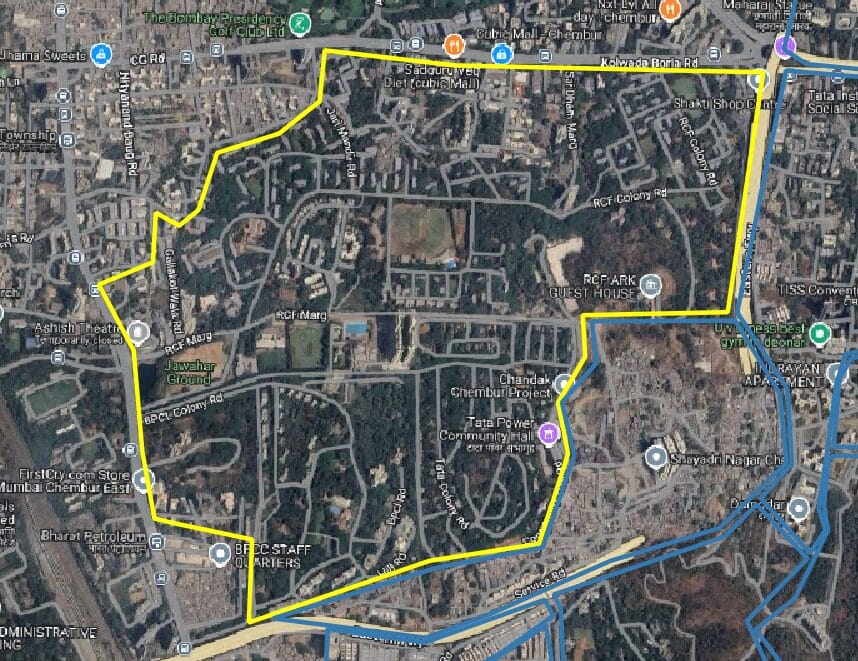
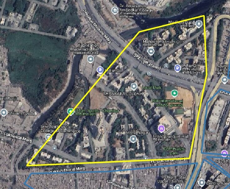
The built environment of the ward varies dramatically, creating distinct thermal profiles across its different housing typologies. On one end of the spectrum, government colonies remain relatively cool, characterised by low-rise, low-density buildings with abundant open spaces and vegetation. High-rise luxury apartments, while denser, often mitigate heat through private green spaces, modern construction materials, and air conditioning.
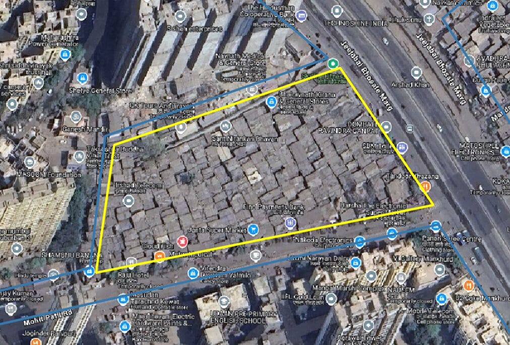
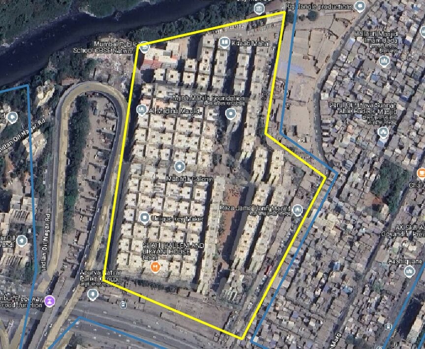
In stark contrast, Slum Rehabilitation Authority (SRA) housing and resettlement colonies effectively function as vertical heat traps; these high-rise, high-density structures are frequently built with compromised norms, lacking the setbacks, adequate open spaces, or cross-ventilation needed for cooling. The most precarious of all are the bastis, where low-rise, extremely high-density settlements have virtually no open space, and shabby construction with heat-absorbing metal roofs exacerbates the heat—a fact starkly visible in temperature data.
Read more: Lasting heat: How is the Urban Heat Island effect impacting Mumbaikars?
Science confirms the obvious: Bastis suffer the most
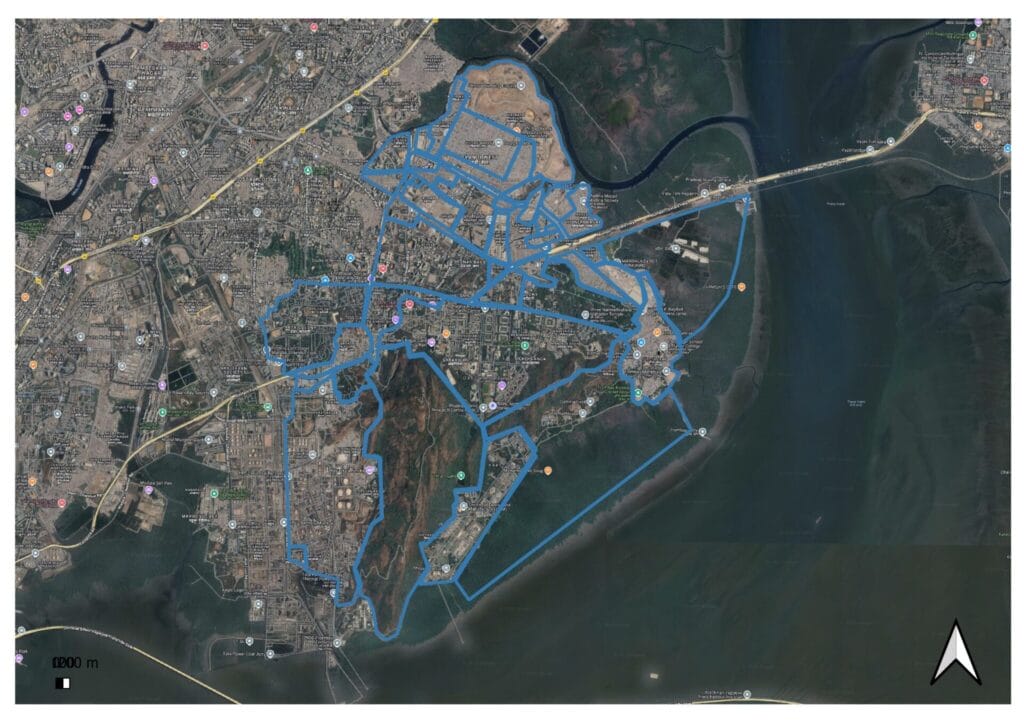
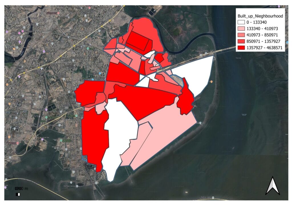
In this study, M East Ward was systematically divided into 44 distinct neighbourhoods based on their specific urban typologies, such as slums, SRA settlements, and colonies. For each of these neighbourhoods, we first analysed the building volume, a metric derived from a combination of building footprints and heights (Google Open Buildings), to understand the three-dimensional structure of the built environment.
This volumetric data was then correlated with other crucial environmental factors, including Land Surface Temperature (LST) and indices such as NDVI (green cover) and NDBI (built-up surfaces). By employing a mathematical analytical model, the research was able to create a sophisticated framework. This model allowed for a detailed examination of the individual factors’ contributions and their impacts on urban heat, ultimately providing a clear understanding of which specific urban characteristics were most significant in driving up temperatures at a granular neighbourhood scale.
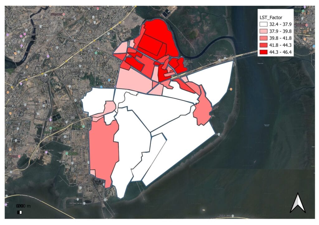
The results of the analysis explained 85% of the temperature variations within the ward, and revealed that the ratio of built-up volume to vegetation was the single most powerful factor driving up temperatures.
The verdict was damning: bastis were found to be the worst-suffering typology, experiencing the highest land surface temperatures. Following closely behind were the SRA resettlement colonies. In stark contrast, the spacious government colonies and high-end residential buildings, with their mandated setbacks, open spaces, and lush vegetation, remained the coolest pockets in the ward.
A call for dignified housing and climate justice
This study moves beyond a scientific exercise; it is a critical alert. The findings demonstrate an urgent need to address the intense heat vulnerability concentrated in the ward’s informal settlements and SRA colonies. The study underscores that simply rehousing people is not enough. Future developments must provide dignified housing that adheres to, rather than dilutes, building norms that ensure safety, ventilation, and thermal comfort.
The M East Ward houses one of Mumbai’s largest concentrations of informal service staff—the drivers, domestic workers, and labourers who form the city’s backbone. Trapping these essential workers, alongside children and the elderly, in a relentless double jeopardy of heat makes this ward the prime example of climate inequality.
What action must be taken
- Enforce green cover rules to increase vegetation
- Promote retrofit interventions such as cool roofs
- Formulate local area plans in each ward for targeted interventions to reduce heat.
- Create Urban Heat Vulnerability Zones to focus efforts in high-risk pockets.
As Mumbai continues to grapple with rising temperatures, this study serves as a stark reminder that climate change is not a great equaliser. It is a threat multiplier that preys on existing inequalities. Without a conscious effort to protect its most vulnerable, the city risks cementing a future where one’s address determines one’s chances of survival in an ever-hotter world.
This analysis was part of a datajam on urban heat in Mumbai conducted in partnership with the Maharashtra State Climate Action Cell, and supported by Climate Group, C40 Cities, Heatwave Action Coalition India, WRI India, and the Blue Ribbon Movement. It was held at St. Xavier’s College (Autonomous), who were the venue partners.