Frequent floods are becoming common in many cities – including Bengaluru, Chennai, Hyderabad, and Pune. These damage private properties and lead to economic losses.
However, the typical response by city administrations is very disappointing: They merely point fingers at encroachment of drains and make some perfunctory token efforts to clear that encroachment, often selectively. After a couple of weeks, the matter is forgotten, and the flooding is repeated in the next spell.
As a result, this crisis visits us every year. This gives politicians a chance to exploit these floods for their own benefit. On the other hand, the city administration neither prevents the urban flooding nor addresses them systemically after they occur.
The solution is to educate the public, so that we can demand specific measures from the local administration in a time-bound manner.
This article identifies root causes for the floods, and then explores short-term and long-term remedies to address these root causes.
There are multiple factors that lead to floods, like terrain, drains, roads and lakes, as explained below:
Flood factor 1: Design and maintenance of drains
Stormwater Drains (SWD) are the most neglected and abused elements of our urban water system, because they are often inconspicuous, and their poor state is mostly hidden from view. However, they have an enormous impact on our water system.
Inadequately sized: Typically, city drains are designed to carry only rainwater. But in practice, much of the sewage (1400 MLD of it is generated in Bengaluru!), ends up in these drains, either as treated wastewater or often just raw sewage. In fact, as the population grows, the wastewater inflow will also grow.
The city must plan for reusing wastewater using a parallel drain or pipe network; Else we must account for this extra volume: drains must have an adequate carrying capacity keeping the future population in mind.
Encroached: This is probably the most known cause of flooding. Builders, who have drains inside their real estate project area, typically reduce its width, which reduces the carrying capacity of the drain. Another form of encroachment is to build a slab on top of the drain and hide the drain with landscaping.
Read more: 50% stormwater drains lost: Bengaluru’s flooding is no surprise
Eliminated: This is the extreme form of encroachment, where a stretch of drain is filled up, and converted into a road or a building.
Displaced: In nature, water always finds the path of least resistance. Over a long time, this becomes a stream. But if the stream passes through someone’s plot, the property owner tries to divert the drain around the plot. However, this often obstructs the flow.
Disconnected: Often roadside drains are not connected to the valley system at all. For example, in Bengaluru’s Outer Ring Road, the road passes over undulating terrain. Unlike the road, the roadside drain cannot conform to the terrain, as it has to have a gradient in only one direction. Therefore it must be connected to the valley system to drain away the accumulated water. Neglecting this aspect causes flooding.
Choked: Drains are often choked with garbage, silt, organic waste and vegetation. The problem becomes acute in case a stretch of the drain is covered with an RCC slab, because such drains cannot be cleaned periodically. To eliminate this problem, all major drains must be fitted with garbage traps and silt traps along its length. Civic bodies need to plan for the logistics of disposing accumulated garbage and silt.
Blocked: At times, pipes and cables are taken through drains. The garbage and vegetation carried by the drain gets trapped at such points. Even the remaining gaps are blocked by silt deposits. Over a long period, this forms a solid dam-like barrier, and causes flooding.
Flood factor 2: Terrain
Bengaluru city, for example, has a highly undulating terrain because of valleys and watersheds. If the developer of any property does not make proper provision for drainage, surface water can be easily trapped, and cause flooding in the downstream area.
There are five major terrain-related factors behind urban floods:
Loss of green cover: A few decades ago, this was a small town, with many wetlands and much green space. The vegetation and soil absorbed and held the rainwater. But in the last 30 years, the city has grown, and lost the bulk of its green cover. This means the rainwater cannot be held within a given area. This has increased surface water flow across the city.
Read more: Nature-based solutions: The answer to flooding in Chennai?
Reduced percolation: The area has not only lost tree cover, but it is now covered with cement and asphalt, which do not allow any percolation. Thus even more water now flows.
Faster runoff: Water runs across cement and asphalt at a much faster rate compared to soil. As a result, it reaches downhill much faster after a shower, resulting in flash floods.
City planners have not accounted for the above three factors. We do not have new drainage infrastructure to handle the larger amount of water flowing faster across the city. The undrained surface water contributes to the flood.
Alterations: When a builder develops a property, they level the ground, which often raises its level. In low-lying areas, some builders have raised the ground level by as much as three floors!
Even a small alteration in the gradient or level diverts the water flow in a different direction downstream. As a result, the diverted water may start flooding another downstream area, which does not have public infrastructure (drains and culverts) to handle the additional flow.
Thus development of one property may create a major flood in the downstream area, which is extremely difficult and expensive to solve. Those older buildings cannot be protected from this new flood threat.
Building in floodplains: In any terrain, certain low-lying areas are identified as floodplains. These areas get waterlogged when a specific amount of rainfall is received in the upstream area. It is prudent not to build in such areas. However, if the government does not formally declare such areas as floodplains, then unwary customers end up buying properties in such areas. They then suffer from regular inundation.
Flood factor 3: Design of roads
In an undulating area, road engineering must be mindful of surface water flows and waterlogging levels in the low-lying areas. Neglecting this creates flooding of the road and surrounding area.
Poor drainage: All roads are supposed to have adequate drainage through roadside drains. If these drains are inadequate, then roads get waterlogged. After a heavy shower, many multilane roads get waterlogged on the left lane, because all roads have a downward slope toward the left by design (this feature is called “camber“).
However, the water accumulated on the left lane is not drained. As a result, as soon as there is a shower, many roads lose one lane. All vehicles have to drive in the centre lanes only, which causes traffic jams. Meanwhile, bus travellers are inconvenienced with bus stops located right next to the flooded left lane.
This problem is most acute in underpasses, where inundation becomes so deep that cars and two-wheelers cannot pass.
Lack of culvert: When a new road is laid, it is always built at a higher level compared to the surrounding ground, to avoid waterlogging. Most road construction projects do not include milling – further increasing the height of the new road. When a road is laid across a valley, it will need a culvert to let the water pass underneath it. Bengaluru has an undulating terrain, which means any given road must have multiple culverts for free passage of water. But this is often neglected. As a result, the road acts like a dam and causes waterlogging on the upstream side. In some cases, the road itself gets waterlogged.
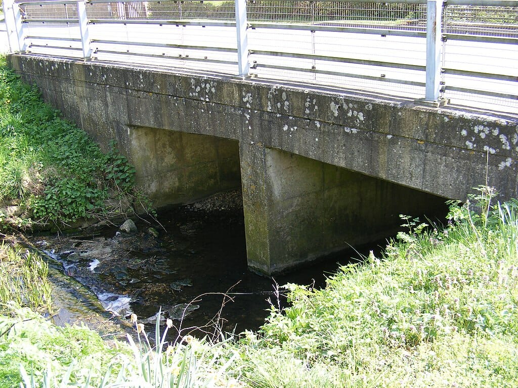
Representational image. Pic courtesy: Geograph Project/CC BY-SA/2.0
In some cases, a road may have a culvert for a drain. But that drain may be passing through a roadside property. The owner of that property often tries to divert the drain around his property. As a result, the drain is no longer aligned with the culvert. But the owner does not want to shoulder the expense of shifting the culvert. This obstructs the drain, and causes regular floods at that spot.
Roads in floodplain: Some road stretches may be located in floodplains. They get waterlogged when a certain amount of rainfall is received in the upstream area. The only solution is to elevate such roads above the maximum flood level, and introduce culverts to let the water pass across.
Read more: Why road milling work calls for active involvement of Chennai citizens
Flood factor 4: Lakes
Cities like Bengaluru have plenty of lakes, which play a major role in mitigation of floods. However, to do this effectively, they need to be extensively re-engineered.
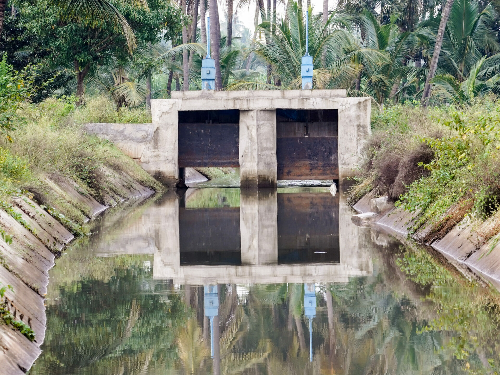
Lack of sluice gates: The primary role of a flood-mitigation lake is to act as a buffer storage body. Before rains arrive, the lake is emptied adequately, so that it can absorb the incoming floodwaters. For this, the lake must have a sluice gate on the downstream side of the lake. By opening the sluice gate, a lake can be drained. But none of our lakes have such sluice gates!
Any lake assigned a flood-mitigation role needs to have sluice gates installed.
Heavily silted: In order to act as a buffer tank, a lake must have a large holding capacity. But most of our lakes are heavily silted, and therefore they don’t have any holding capacity. Even if such a lake does have a sluice gate, it cannot handle floodwaters at all.
Therefore, the solution is to desilt all lakes completely, and install silt traps at all inlets to prevent new silt from entering the lake.
Bypassed: Many lakes receive contaminated water. The right approach is to treat this water and then release it into the lake. But authorities adopt a shortsighted approach, installing a bypass channel to divert the contaminated water downstream.
This approach creates more problems:
- The lake is no longer available as a buffer tank. All the incoming floodwater rushes downstream and creates havoc.
- The lake stops receiving water during the non-rainy season, so it goes dry.
When there is a chain of lakes, and the contaminated water is not intercepted anywhere, all the downstream lakes in the chain end up being bypassed.
Lack of flood management: It is not sufficient to just desilt the lakes and install the sluice gates: we need a well-planned flood-mitigation strategy to operate the sluice gates.
- When heavy rains are predicted, flood-mitigating lakes must be emptied in advance.
- With the rains, floodwaters will flow into the lakes. At this time, sluice gates must be partially opened to release a controlled amount of water to safely dissipate the accumulated floodwater.
All the sluice gates in the chain must be operated in tandem, according to a well-planned logic. We need well-trained sluice gate operators and a communication system to coordinate the areawide operation in real time.
Sadly, our city agencies have no such strategy to prevent floods, or to handle the floodwaters. As a result, some areas get flooded repeatedly, and the authorities’ role is limited to rescue the stranded people post facto. There is no preemptive action to prevent loss of property and loss to the economy because of lost productivity.
Encroached: If the government publishes an online map of all drains, lakes and buffer zones, it is possible to monitor and even prevent encroachment of these assets. However, the state has doggedly avoided making such information online, as if this is a deliberate plot to help violators. Consequently, most encroachments remain undetected. Even when detected, the government fails to book the lawbreakers and recover the encroached commons property immediately.
Worst of all, the government allows the original encroacher to sell off the unlawful property to unwary buyers, and then avoids taking any action to recover the property, citing losses caused to innocent buyers. Thus the whole system is systematically undermined to facilitate encroachments.
Government agencies have themselves actively encroached many drains and lakes, thus setting a poor example for the public.
The only solution is to establish rule of law ruthlessly, and punish all encroachers, including the officers who colluded in such encroachments.
Converted: In some cases, lakes have been converted into another kind of commons property such as a stadium or bus stand (as in the case of Bengaluru). However, every such conversion has a tremendous impact on the water management system. The resultant change worsens flooding in the neighbourhood.
Read more: Chennai rains: The real reasons why urban floods are a never-ending problem in city
Flood factor 5: Climate change
As described above, things were bad already. But climate change has made it far worse.
In recent years, climate has changed globally and we hear much more frequently about flash floods and dry spells. In the context of flooding, the following changes are significant:
Heavier spells of rain: Earlier, the rains rarely exceeded the maximum of historical rainfall figures. The probability of a heavy rain was predictable. But in recent times, the rains have become unpredictable, and we have very heavy rains. This overwhelms our ramshackle system, and causes widespread misery.
Bunching of showers: For example in Bengaluru earlier, we would see 60 wet days spread over 7 months in a year. This meant that the city received rainwater evenly, and we did not have to grapple with floods often. But in recent years, the showers are bunched together. Even before the previous floodwaters recede, we have a fresh shower, which adds to the previous waterlogging. This means our flood-mitigation system must be able to deal with larger and more sudden floods.
Remedies for urban floods
Given the frequency of such floods in our cities, and the resulting damage to property and economic losses, it is imperative to look at remedies — both for the short and long terms.
Immediate (short-term) plan
Remote sensing techniques like Normalised Difference Water Index (NDWI) maps should be adopted to track water levels and mark all waterlogged areas. The next step is to carry out a hydrological analysis of these waterlogged areas, and identify the root causes behind urban floods in each area. Simulations can predict how much flow will be generated with a specified amount of rainfall, and how the water will flow across the terrain. Thus simulations can show which areas will flood when we receive a certain rainfall.
Note that we cannot use the decades, or a-century-old village maps for calculating the hydrological flow today, because the flow has changed drastically. In the old times, there were no mega cities. There were no sources of water like borewells or pumped water from far-off rivers and lakes. Therefore we used water frugally. The green cover and open soil in the towns used to absorb the surface water easily.
However, now we use a lot more water, thanks to borewells and water fetched from far-off rivers and lakes. All that water turns into sewage, which flows across the terrain. We have also manipulated the direction of the flow for the sake of roads, buildings and other infrastructures. However old maps do have a critical role in establishing which area belongs to the government, in order to identify encroachments.
The next step is to address the identified root causes. The government must clear encroachments from lakes and drains, as well as wetlands, kharab land and other commons in the path of water flow. Drains must be redesigned and enlarged to accommodate the flows. This may need acquisition of additional private land.
Note that these are meant to be only local solutions for temporary relief: The long-term solution requires a complete revamp of the drains (see the following section), during which many of the temporary solutions may become incompatible. Therefore, we must not invest too much in the temporary steps.
Most of the clearance drives are first stalled and then scuttled by vested interests. It is claimed that innocent citizens would lose their life savings if their house is demolished or land seized. Claims of compensation and rehabilitation are made. To prevent such scuttling, the government must share the analysis and proposed actions in public domain. Active citizens can then monitor the action-plan to prevent vested interests from influencing or scuttling these action-plans.
- Gather NDWI maps of the city to mark waterlogged areas.
- Carry out hydrological analysis of the flood, and identify root causes.
- Share the results and proposed corrective action publicly.
- Address root causes: Clear encroachments from drains, lakes, wetlands and other commons. Clear clogged drains, and redesign and enlarge where necessary.
The long-term plan
Climate change in South Asia has brought sudden flash floods and dry spells. According to scientists, these disturbances would only worsen in the coming years. Therefore we must prepare for water security and at the same time, also prevent flash floods.
For that purpose, the following measures must be taken urgently:
- The city government / civic agencies must have the latest drainage data in digitised form.
- At present, our SWDs are designed to carry only rainwater, but not treated sewage. But the city has a lot of residential and commercial complexes that have their own STPs. These STPs discharge a large amount of treated sewage into the SWD network. Therefore, the SWDs must be redesigned to carry the combined volume of the rainwater and treated sewage.
- At present, the lakes and SWD network are designed separately and independently.
This is a completely wrong approach. The lakes and SWD network must be designed as a single integrated water system. - The government must conduct hydrological analysis of the terrain, to find out how much flow is generated when we have a certain amount of rainfall. The hydrological analysis must identify how lakes are interconnected, and what should be the carrying capacity of these linking channels. The authorities must compare this model with the actual situation to find if any channels are missing, or if properties have encroached the linking channels partly/fully. These encroaching properties must be demolished to restore the required capacity of the channel. This may also need acquisition of additional private land.
- The authorities must conduct floodplain analysis to find which areas would be inundated with specific amounts of rainfall. If this data and model is available with other agencies like state disaster management cells, they must be involved in this collaborative planning.
- Disaster management cells and meteorological departments issue rainfall predictions and possible effects on the ground. For example, the Megha Sandesha app from Karnataka State Natural Disaster Monitoring Centre (KSNDMC) predicts that specific areas of the city would be inundated based on rain prediction. Rather than merely using the prediction to take rescue action post facto, the government must launch an action plan to prevent the flooding.
- All lakes must be desilted immediately, so that they can start acting as buffer tanks to absorb the rushing flood water coming from the upstream area.
- Lakes identified as flood-mitigation lakes must have sluice gates so that they can be emptied well before heavy showers, so that when the flood comes, the lakes are ready to receive the full quantity without overflowing.
- The government must develop a detailed Standard Operating Process (SOP) about how to operate the sluice gates in tandem to achieve three conflicting needs simultaneously: (a) To prevent floods in the neighbouring areas, (b) to prevent the lake from running dry, and (c) to prevent floods in the downstream area with sudden and excessive discharge.
We need to act quickly and decisively to tackle and mitigate the risk of urban floods. A business-as-usual approach can only lead to unlivable cities.