When the northeast monsoon hits Chennai, a foreseeable result of the heavy downpour is severe flooding in several areas, including Porur Lake. As residents living near this 200-acre water body battle inundation every year, our team set out to investigate the root causes of flooding using available data.
Environmental issues have often been dealt with a one-size-fits-all approach, but our study aimed to provide specific solutions tailored to the Porur catchment area. For this, we mapped inundation patterns, land gradient, land use change and the outlay of stormwater drains (SWDs).
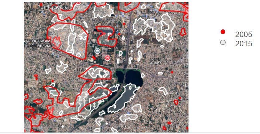
At a recent datajam organised by the Oorvani Foundation and OpenCity, we compared flood extents from 2005 and 2015, studied stormwater drain (SWD) connectivity at inundated sites, and assessed land elevation to map water flow. This also led us to analyse the impact of the newly-built Dr MS Swaminathan Wetland Eco Park in Porur, the city’s first wetland sponge park.
Water flow obstructed due to Chennai-Maduravoyal bypass, lack of sewage patterns
A pattern of uneven elevation under the ground was a part of the problem. Significantly, the analysis found that the west side of Porur Lake — an important source of water supply in Chennai — faced heavy inundation, compared to the east. However, areas on the west prone to inundation are not low-lying lands but elevated.
This is linked to the Chennai-Maduravoyal Bypass, which bisects the lake, and unregulated development around it. Both make the topography uneven, obstructing the terrain slope gradients (steepness). Due to the land elevation difference, this bypass obstructs the flow of water coming from the west.
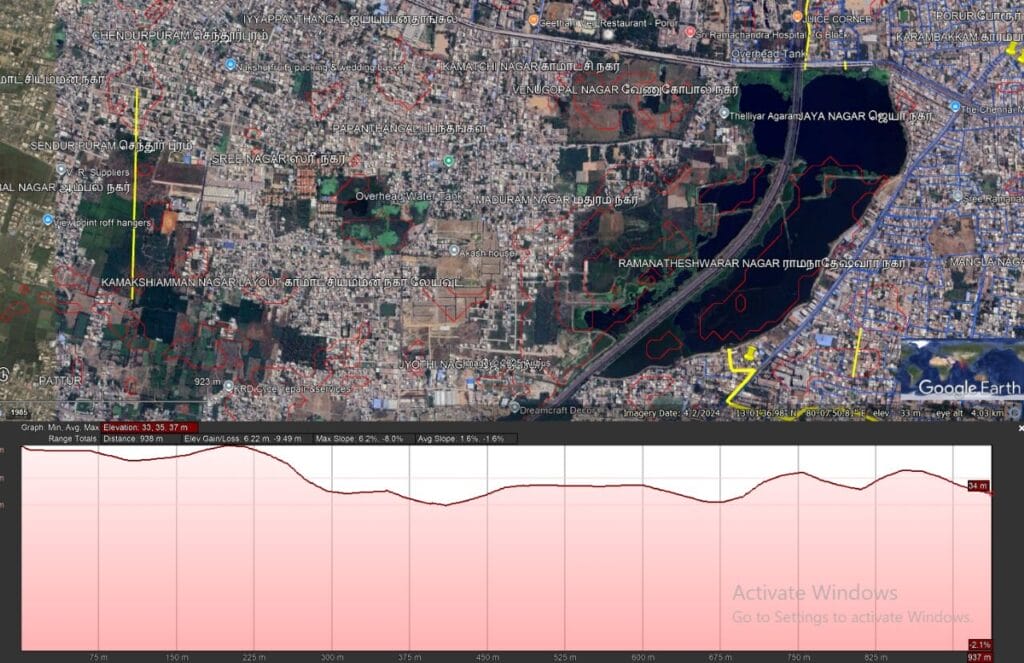
The primary explanation for severe inundation is the lack of proper SWD patterns in this western area. Over the years, the entire lake system has suffered a loss of connections to channel drainages in the lake catchment area. These blockages, created by changes in the built environment, have been a major reason for inundation in residential areas. Implementation of an adequate drainage system is crucial for the prevention of inundation.
Underutilised design, eco-park potential
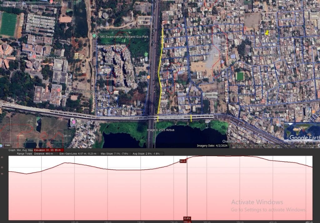
Urban design is a tricky territory, where unexpected problems may crop up and intended infrastructure may be underutilised. The Dr MS Swaminathan Wetland Eco Park is one such example. The sponge park is aimed at increasing the groundwater table and providing relative flood mitigation. However, we find that its design contributes to localised flooding.
The eco-park, with a capacity of 30 million litres, lacks connectivity to the surrounding SWDs in the catchment area. It only receives inflow from the nearby Sri Ramachandra University. To achieve efficient utilisation and reach full capacity, the study recommends that the park be connected to the surrounding SWDs in the catchment area.
This implementation of connectivity could avoid flooding in eight to nine areas surrounding the eco-park.
Read more: From degraded wetland to community space: Porur sponge park redefines flood control in Chennai
Encroachments and ecological stress
Apart from the infrastructure flaws, encroachment and pollution exacerbate the flooding problem and threaten the lake’s function as a critical drinking water source and an aquifer ecosystem.
The Ramachandra Medical College Chennai, next to Porur Lake, was founded by industrialist NPV Ramaswamy Udaya. It is built over a water body, according to archival sources. This adds to flooding in the catchment area of the lake on the western side. The eco-park is what remains of that system.
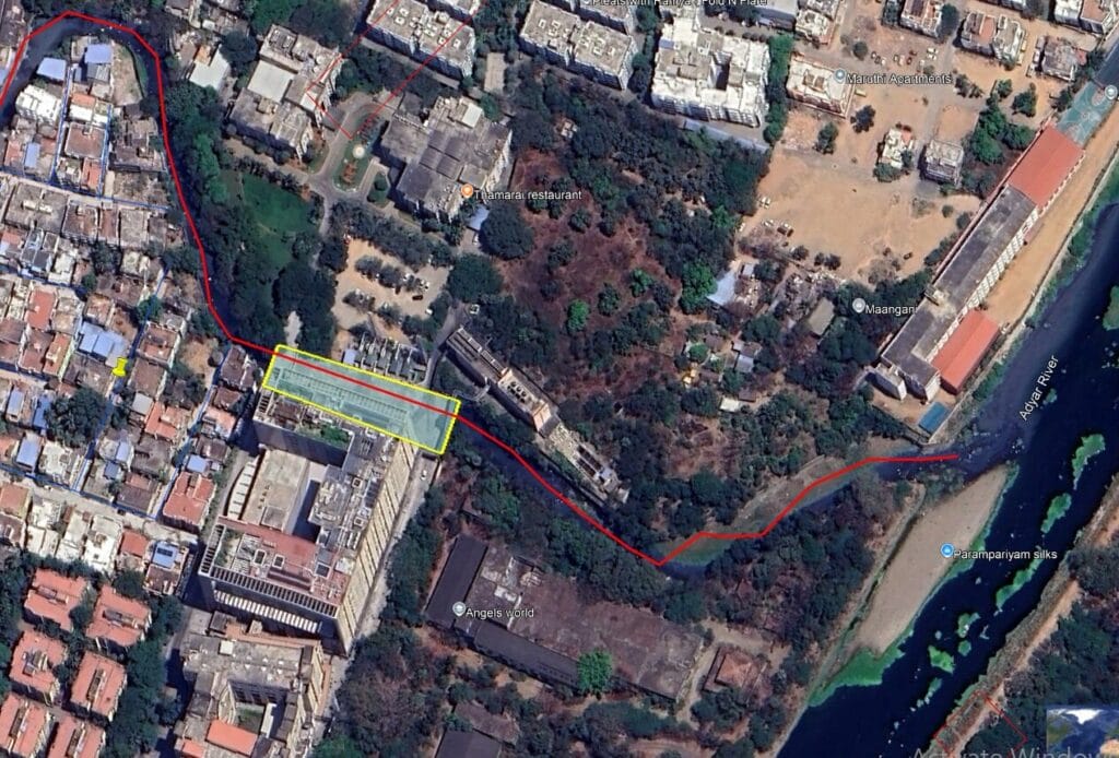
The construction of MIOT Hospitals over the Ramapuram Nalla (a canal that connects to the Porur Lake) also proves detrimental to the system. Moreover, the connection of the canal on the northern side remains uncertain.
Building on wetlands is highly risky, as shown by the 2014 collapse of an 11‑storey building on Porur Lake that killed 61 people. Beyond flooding, turning lakes into real estate endangers both human lives and public safety.
Read more: Chennai floods and the real estate conundrum: Need for sustainable solutions
Structural checks are also necessary for existing flood mitigation infrastructure; for instance, the Moulivakkam Cut and Cover Canal needs to have openings every 100 meters to have siltation checks in place.
The lake faces severe ecological stress as well:
- Dumping of waste around the bunds and lakes causes flooding.
- Dumping of untreated sewage, including biomedical silts since 2021, contributes to “forever chemicals.”
- Invasive species, such as water hyacinths and water lettuce, affect the ecosystem, including the flora, fauna, and migratory bird patterns.
A holistic approach is necessary to understand how human activities affect this ecosystem, the lake’s degradation, and its impact on living beings.
Recommendations for hydrology management
- Connect SWDs on the northeastern side of the lake.
- Connect the eco-park to the surrounding SWDs to enable full utilisation of its 30 million litre capacity.
- Ensure openings every 100 metres on the Moulivakkam Cut and Cover canal to allow for siltation checks.
- Improve the drain system on the west side.
- Reclaim Ramapuram Nalla or create an alternate pathway for flow of water near Manapakkam.
- While Porur Lake is slated for a Rs 9.12 crore makeover through the Chennai Metropolitan Development Authority’s Lakefront Development project (covering a 1.5-kilometre stretch along the lake’s edge), the proposal includes heavy built/concrete constructions, which should be avoided.