This article is part of our special series Environmental Sustainability & Climate Change in Tier II cities supported by Climate Trends.
In Part 1 of the story, we saw how pollution of the Daya river and lack of a proper sewerage system is affecting Bhubaneswar.
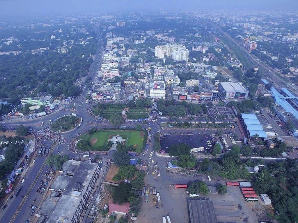
Bhubaneswar’s other problem is drainage. The city used to have 10 natural drainage channels that carried rainwater coming from the uplands in Chandaka forest and other areas around the city. But in the last few decades, most natural drainage channels have been encroached by illegal constructions blocking water flow.
“We have asked the state government to give Rs 1000 cr to stabilise the city’s drainage problem,” said Debasunder Mohapatra, engineer with the Bhubaneswar Municipal Corporation (BMC).
Changing rainfall patterns
“Presently, because of erratic rainfall due to climate change, we have to prepare for unexpected sudden heavy rainfall. We have been experiencing this lately. In 2018 we had an unprecedented 200 mm rain within 4 hours. If there is 40 mm rainfall per hour continuously for 3 to 4 hours in Bhubaneswar, some areas will be submerged”.
Scientists in the meteorology department say that the last 3-4 years has seen more rains in short time spans, as mentioned by Mahapatra, in several places of Odisha including Bhubaneswar. Since Bhubaneswar is a larger urban centre and rainwater does not drain easily, waterlogging has become a recurrent problem.
“Whenever there is a low pressure centre in the Bay of Bengal at a 80-100 km distance from the coast particularly in east of coastal districts of Kendrapara and Bhadrak, it rains heavily at Bhubaneswar and nearby areas,” explains Sarat Sahu, Director, Meteorology (Retd), Bhubaneswar.
If the low pressure system becomes stationary at that location, it will generate more rainfall. During monsoon when there is cyclonic circulation or north to south trap (extended low pressure system), it leads to heavy rainfall. Such traps are associated with traplines, a mapping device which marks these spots prone to such weather phenomena. The trapline extends from Bihar to Andhra Pradesh. Sahu adds, “these days, one sees sudden temperature fluctuations which leads to more rainfall.”
Bhubaneswar used to have pleasant weather all year round. But the expanding concrete jungle has warmed up the city considerably as compared to the 80s. “After the afternoon heat, Bhubaneswar used to get airy and pleasant in the evening,” recalls Prof Radhamohan. “That has been affected.” However, Ananta Jena, MLA from Bhubaneswar Central and two time Mayor insists that “Bhubaneswar is still a greener city in comparison to other cities of India!”
Depleting water table
Old Bhubaneswar, developed around the 11th century temple, is now facing a major water problem. The city badly needs rainwater harvesting and other water conservation measures as groundwater level has fallen to 300 ft plus.
Though the city is getting its major water supply from Naraj at Mahanadi, many households have installed borewells to augment supply which further affects the groundwater table.
The old city has several old tanks which if properly maintained can recharge ground water. The 34km west canal of the Daya, meant for agriculture and which passes through the city has become a sewage and wastewater carrying channel. The water resources department is trying to renovate it at a cost of Rs. 395 crores.
Since the twin cities of Bhubaneswar and Cuttack are the most populous urban areas of the state, most people from other districts prefer to settle here leading to lopsided development of the region. The green belt around this area has become a concrete jungle and natural drainage channels have got encroached leading to flooding of low line areas.
In 1982, Mahanadi overflowed on the Kolkata-Chennai national highway that passes through twin cities, cutting off road connectivity between. Bhubaneswar and Cuttack. Since then, nothing has been done to prevent another such natural disaster.
A second dam on Mahanadi besides Hirakud, built just after independence, is not feasible as it would submerge much of western Odisha. The populated low lying areas between the two cities face a real danger if and when floods happen. Experts have pointed out that growth towards Cuttack should be curbed as the area linking the two cities is the main flood discharge plain and has valuable agricultural land.
New masterplan
Now, a revised master plan for Bhubaneswar has been prepared by IIT Kharagpur. But urban planners say the masterplan lacks in several aspects. Retired IAS officer Fanibhushan Das, who was Secretary of Urban Development and Housing in the nineties, feels Bhubaneswar’s planning and execution did not move in the manner its planned counterparts Chandigarh and Gandhinagar did.

“The ambition was to develop Bhubaneswar from a small temple town into a well planned metro. But unplanned distribution of land and haphazard infrastructure development has messed up everything,” says Das.
Unfortunately, Odisha’s urban planning is yet to take notice of environmental and climate change challenges. When asked, Pratap Jena, Minister for Urban Development and Housing, said, “Considerations of climate change have not been thought of yet.”
READ OTHER ARTICLES IN THE SERIES:

Dozens of studies, hundreds of crores, but Buddha Nullah pollution still threatens Ludhiana

State-of-art early warning system to save more lives in Shimla, Kullu, Manali during extreme climate events

Smart city Bhubaneswar yet to get proper wastewater treatment infrastructure