Editor’s Note: This article is the third in a three-part series.
Part 1: Bengaluru’s Peripheral Ring Road: Two decades on, who really benefits?
Part 2: Peripheral Ring Road: Bengaluru farmers allege unfair payouts threaten their future
Two decades after the Peripheral Ring Road (PRR) was announced, the project is far from completion. For farmers, it has meant years of uncertainty and mounting financial losses, while residents remain unsure about the usefulness of the long-pending road development.
In an earlier article, we explored how the PRR project could lead to forced migration and threaten the livelihoods of farmers. In Part 2 of the series, we did a deep dive into the manipulation of compensation options that landowners strictly oppose. However, farmers and environmentalists raise different concerns: even if the road is built, will it truly ease traffic congestion, and what will be the environmental cost of the project?
Will the road address traffic issues?
Krishna Ramesh, one of the farmers whose land is notified, says, “Farmers have gone through a lot of struggle since the project was announced two decades ago. But, I am sceptical whether the design of the project will actually ease the traffic.”
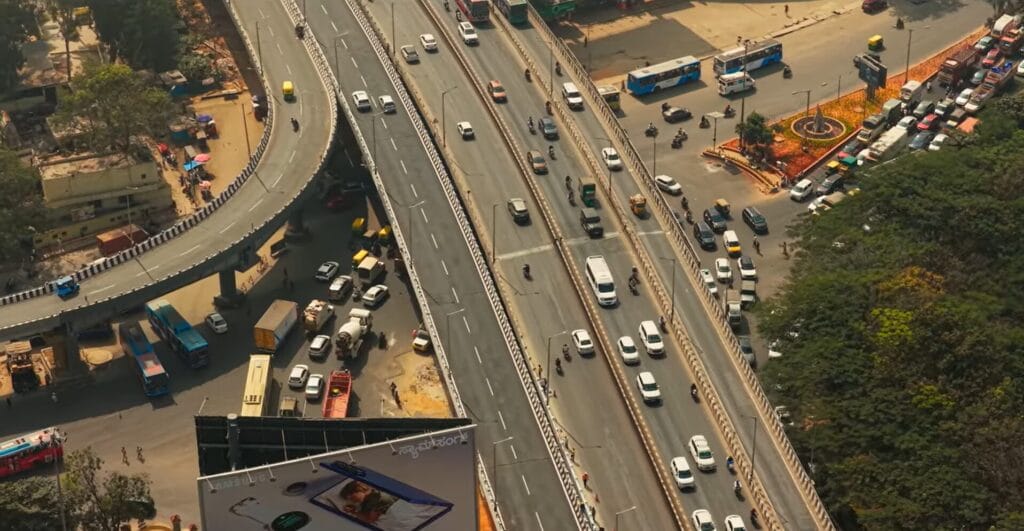
According to the draft Detailed Project Report, the main carriageway will only be 28 metres wide (14 metres on each side). Experts suggest that the space is not enough for the free flow of vehicles. Allowing commercial development along the corridor and shrinking the carriageway for it would only defeat the very purpose of the road project.
“Though it is 28 metres, it is an eight-lane road and including the median, shoulder, a corridor reserved for metro and service roads, the width would be 65 metres,” Atheeq, chairperson of Bengaluru Business Corridor, told Citizen Matters. “The road will be access-controlled, and the traffic flow will be smooth and uninterrupted.”
V Ravichandar, Urbanist and member of Oorvani Foundation’s advisory board, observed that while the road ideally should have been wider, the government seems to have made compromises due to affordability constraints. “Such infrastructure projects demand a long-term vision, looking at least 50 to 75 years into the future,” he adds. “But unfortunately, the government has taken a shorter view of how much they can afford right now.”
However, Ravichandar believes that the road’s width is still reasonably adequate for current needs, including provisions for a future metro line. “I think it will meet the requirements at this point in time,” he says. “It would have been better, though, to have some buffer space between the road and the properties that will eventually abut it.”
Read more: Bengaluru’s Peripheral Ring Road: Two decades on, who really benefits?
Request to start the project early
According to a Times of India report, a revised DPR is under preparation. BDA has sought permission to invite tenders after acquiring 60% of the land, deviating from the prevailing practice of completing around 80% of land acquisition before tendering. This rush has further raised concerns among landowners.
Atheeq denied this. “BBC has not made any such requests, and there is no official statement on this,” he told Citizen Matters.
Ravichandar emphasises that the project should not evolve into strip development, and the surrounding areas must also be planned in a holistic manner. “For me, the larger significance of the Peripheral Ring Road lies in the local area development it enables. All the adjoining landowners stand to benefit from the development and the resulting increase in market value.”
There is a growing concern that too much time has already been lost. “Delaying action further will only worsen the situation. Decisions must be taken now, but the more forward-looking and flexible the vision, the better the long-term outcomes.”
Environmental impacts
While concerns about shrinking the carriageway are mounting, the environmental impact of the project is an equally serious issue. According to the Environmental Impact Assessment (EIA) report, this project would lead to the felling of more than 32,000 trees belonging to 122 different species. The alignment runs close to Bannerghatta National Park and the Puttenahalli Bird Reserve. Experts warn that the eight-lane corridor could disrupt wildlife movement and expose protected areas to encroachment, as per a public petition by Jhatkaa.org.
According to the EIA, the construction and maintenance of the road alone could generate approximately six lakh tonnes of carbon dioxide. This is equivalent to burning 24 crore litres of petrol. These figures do not include the additional emissions from vehicles once the road is operational, nor the loss of carbon sequestration capacity resulting from the felling of trees.
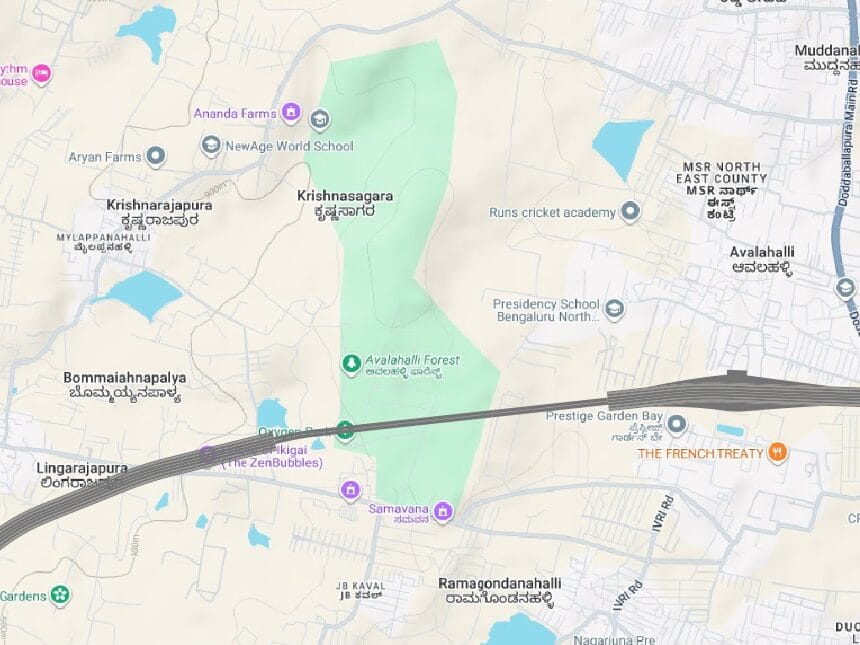
Authorities estimate that the road project will cut down more than 600 trees in one of the city’s last remaining lung spaces, the Jarakabande Kaval Reserve Forest, also known as Avalahalli Forest.
Read more: Peripheral Ring Road: Bengaluru farmers allege unfair payouts threaten their future
“The government has not provided the environmental clearance certificate, and no DPR or master plan is in the public domain,” notes Simar Kohli, founder of Lifetide, a citizens’ collective for sharing best practices in water conservation and tech for eco conservation.
However, civic authorities refute reports of increased carbon emissions. Atheeq explains that once completed, the road is expected to ease traffic congestion and significantly reduce travel time. “This will lower carbon emissions. We also plan to build a metro in the future, which will promote public transport and sustainability,” he adds.
The ecological impact seems more widespread, according to experts. The project poses risks to the Thippagondanahalli Reservoir, an important drinking water source. The loss of over 13,000 trees in the catchment is likely to affect water quality, run-off patterns, and local flooding, the public petition noted.
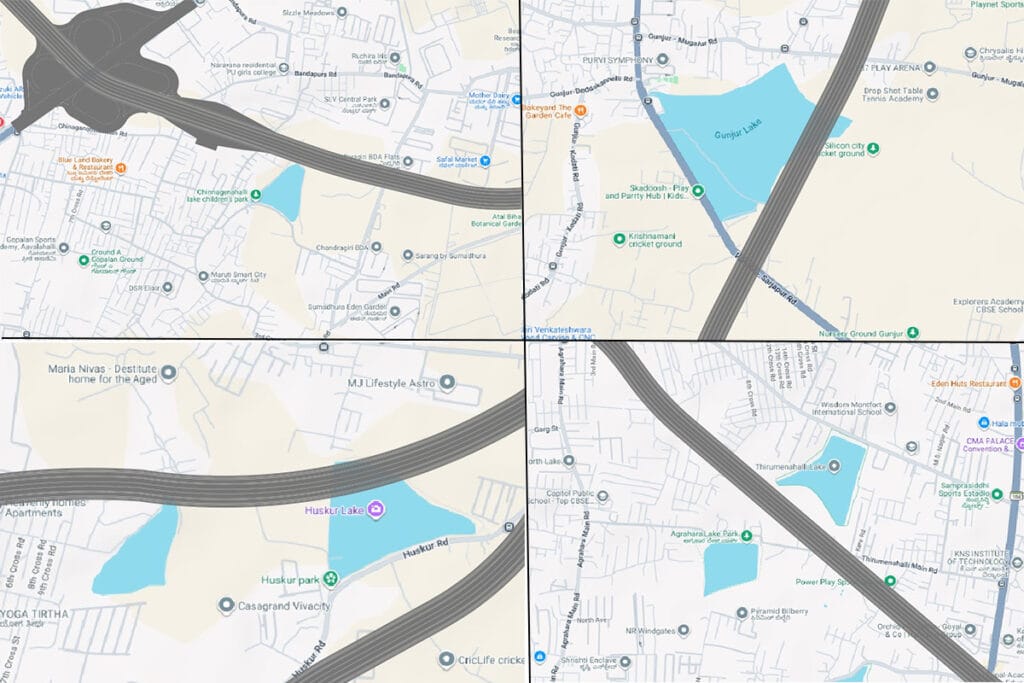
The road also passes through six lakes, namely
- Jarakabande Tank (adjacent to Jarakabande Kaval Reserve Forest)
- Chinnagenahalli Lake
- Chikkabanahalli Lake
- Gunjur Lake
- Chikkatogur Lake
- Thirumenahalli Lake
“As far as the lakes are concerned, the road will pass on the lake periphery without reducing the watershed area. And as it will be an elevated corridor, it won’t affect the water level,” claims Atheeq.
Demands for environmental protection
- Make the final Environmental Impact Assessment (EIA), Environment Clearance (EC) and the Detailed Project Report (DPR) fully accessible to the public.
- All ongoing land acquisition and tree felling exercises must be halted with immediate effect until the aforementioned documents are made accessible.
- Conduct a fresh and transparent public consultation.
The public can sign the petition by Jhatkaa by clicking this link.
[Disclosure: V Ravichandar is a member of the Oorvani Foundation’s advisory board.]
good urban planning recommends that expressways be used to bypass traffic from the city . that is the primary purpose of a ring road.
by developing the bypass area itself, they are defeating the purpose of the bypass ring road.
in 20 years, this PRR will become the next ORR.
if bangalore really wants to properly plan it’s growth, it should ban all development beyond the PRR except within 800m of planned metro and suburban rail stations.
development along wide roads is outdated and obselete planning. we should be prioritising transit oriented development instead.
People cry lakes are getting affected whenever a progressive project is planned.
but they stay silent when lakes are gulped by RE mafia.
We all are double faced citizens