The Supreme Court deadline of eight weeks starting May 20 to complete Bengaluru’s ward delimitation exercise was looming. That perhaps left little time for the subcommittee led by Special Commissioner Deepak K L to seriously consider all the 3833 objections that the public had filed on the ward delimitation draft prepared by the Bruhat Bengaluru Mahanagara Palike (BBMP).
Experts, civic groups and individuals had shared their feedback, suggestions and concerns over the ward boundaries in the proposed plan. Concerns included understanding who initiates the ward delimitation process, the shortcomings in relying on 2011 census data and the absence of a statutory and independent commission for ward delimitation, to name a few.
Not surprisingly, few of these issues have been considered. The official reason given by BBMP Chief Commissioner Tushar Giri Nath was that most objections were over the new names given to some wards. Objections that the whole exercise was unscientific seem to have received scant attention.
Read More: Gayathri Nagar or Srirampura? How ward names can highlight Bengaluru’s millennium-old heritage
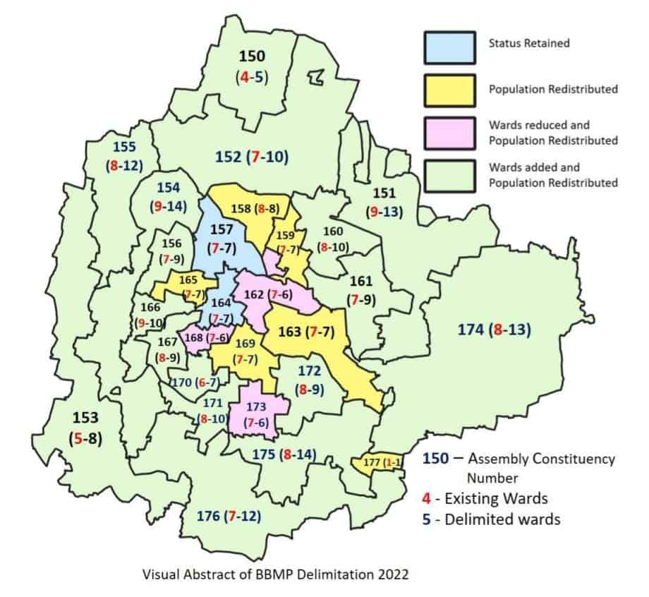
The delimitation draft got officially notified in its original shape and form on July 14. Which means the proposed increase in the number of municipal wards from 198 to 243 is now the new reality.

Why wards need restructuring
As per the census data, Bengaluru’s population increased by 47.18 percent, from 6.5 million to 9.5 million during the decade 2001-2011. The World Population Review suggests that the estimated population of Bengaluru in 2022 is about 13.1 million, implying an increase of 3.6 million between 2011 and 2022.
This increase obviously is not reflected in the 2011 census data which has been used in preparing the revised draft. Raising doubts over the official claim that the wide disparity in ward population that existed earlier has now been corrected.
The objective of the restructuring exercise of the existing wards is to improve civic governance and for citizens to better access the authorities. The revised ward delimitation was supposed to take into consideration how ward populations have changed over time and redraw their boundaries based on the changed demographics. This is to ensure wards with rapidly-rising populations will not miss out on equitable representation in the Municipal Council.
Read also: Here’s how to check your new ward as per BBMP’s draft delimitation
Issues with the current delimitation process
That the population increase has not been taken into account in the new ward proposals is a major bone of contention. Srikanth Narasimhan, General Secretary, Bengaluru Nava Nirmana Party (BNP), pointed out: “The population has grown exponentially in the outskirts while it has not grown by much in the central parts of Bengaluru and hence, if we use the 2011 census data, we will still end up with a delimitation outcome which is very uneven across wards.”
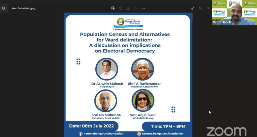
As an example of that unevenness, for the first time, there will be a situation where 60% of the wards are outside the Ring Road. This was pointed out by Dr Ashwin Mahesh, Urban Expert and founder of Mapunity, at a panel on ‘Population Census and Alternatives for ward delimitation’ organised by the Namma Bengaluru Foundation (NBF) on July 6th. “For the BBMP council elections, there are only about 90-95 wards inside the Ring Road region while the outer region has about 140-150 wards,” added Dr Ashwin.
Ashwin also commented on issues of representation, “the ward delimitation exercise of the Greater Bengaluru Region will need structural changes. There have been communities in the outlying areas that are left excluded from the decision-making process, as major development projects happen in the insides of the city.”

Suggestions aplenty
One significant suggestion offered by civic group members, including Srikanth and Anjali Saini of Whitefield Rising, was utilising the Electoral Roll of 2021 or 2022 issued by the Election Commission for the ward delimitation exercise.
Another important factor not taken into account in the new draft is the connectivity of the wards, especially the contiguity of the roads and other infrastructure like lakes, parks, etc. Anjali Saini and V Ravichandar cited the examples of Austin Town and Hoodi Ward. ”Hoodi has four separate sections,” said Anjali. “And they are more than a kilometre apart, which makes no sense.” Ravichandar, who was part of the erstwhile Bengaluru Restructuring Committee, referred to how Austin town alongside Hosur Road has been divided despite it falling under the same ward.
Read More: Why I like Ward Committees so much – and how you can too
Concerns have also been raised that the ward delimitation exercise was to further the interests of some political parties.
Ward delimitation — a political exercise
“Typically, it is left to the state government to initiate (the process of delimitation),” said Ashwin Mahesh at the NBF panel discussion. “In theory, the Urban Development Department should create a draft proposal. But there is a fundamental political problem: The state government is made up of people who are themselves contesting the election. The government is constituted by a political party and that political party is also interested in contesting the municipal elections.”
Hence, the separation of the process of ward delimitation from the interest of any one political party is an important precondition, said Mukunda N S of the Bengaluru Praja Vedike, who emphasised the need for an independent ward delimitation agency funded by the state government to conduct the ward delimitation exercise every 10 years.
Additionally, the existing block level census data should be used in carving out new wards. Ravichandar pointed out that the newly digitised data from all 16,000 census blocks was not used by the ward delimitation committee headed by the BBMP Chief Commissioner. “What we have is an arbitrary drawing of the 243 wards,” he says.
Lastly, as much as the delimitation exercise is based on demography, economics and infrastructure, it needs to also have a geographical and historical understanding. “It is due to the lack of these nuances that communities and identities get split,” said Kathyayini Chamaraj, Executive Trustee of CIVIC.
But all that is moot now.
Koramangala 4th block so far identified as 4th Block, 4th’B’ Block, 4th ‘C’ Block. After delimitation entire 4th Block is identifying as 4th ‘C’ Block. Residents of 4th Block can’t accept this. BBMP must look into this and retain identification of 4th Block, 4th’B’ Block and 4th’C’ Block a it is without any changes.
Wards 198 to 243 need to be brought
under BBMP at the earliest. The central government should requested to
lift the embargo on addition of new areas in this regard