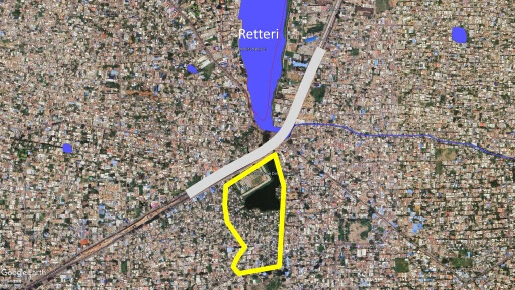
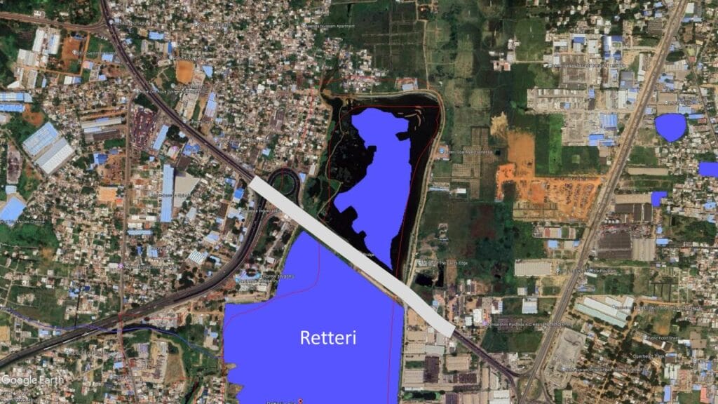
Chennai’s unregulated urbanisation has destroyed its water bodies and disrupted its natural drainage systems. This is true for the Kodungaiyur Canal System in North Chennai which includes the Ambattur, Korattur and Retteri lakes.
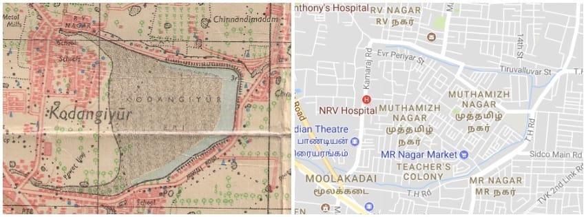
This crucial waterway is designed to drain floodwaters into the Ennore Creek but is marred by encroachments and illegal sewage discharge. In fact, Kodungaiyur Lake, a part of Kosasthalaiyar and Cooum basin, is one of the lakes that has been eaten up and has been reduced to narrow canals because of human activity and government negligence.
Flooding in encroached area, vulnerable groups affected
During a datajam organised by Oorvani Foundation and OpenCity, we examined the impact of urbanisation on these lakes and how they have been affected. Our study analysed changes in lake areas using satellite images from 2005 to 2024 at five-year intervals, along with older maps from online archives to compare historical and current lake extents. Lake boundaries were digitised in GIS, and encroached areas were identified and measured using overlay analysis.
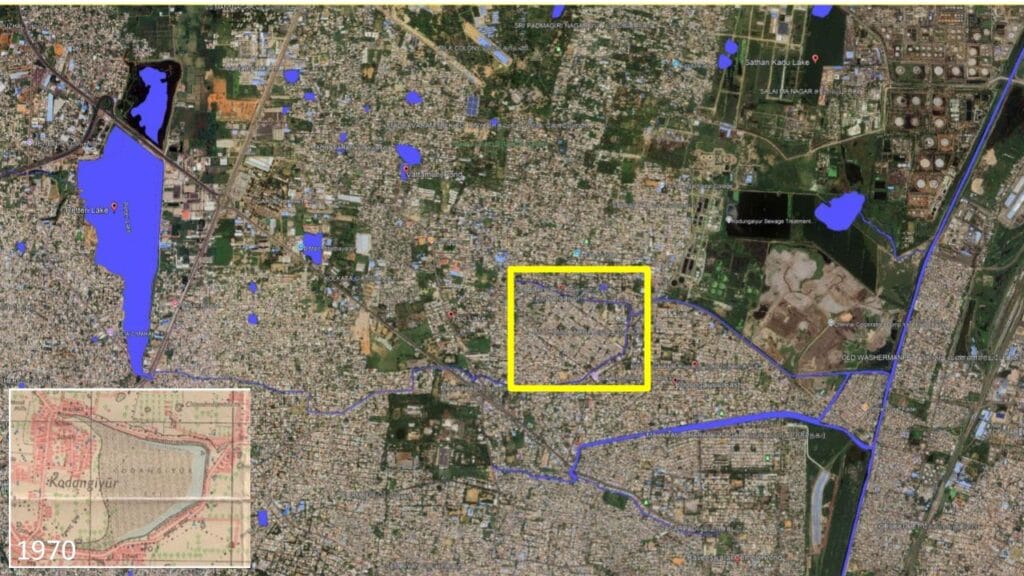
Land-use classification helped determine who occupied these encroachments, revealing that many were government-led housing projects such as Tamil Nadu Housing Board (TNHB) EWS/LIG settlements. Flood maps, news reports, and photographs were then overlaid with the encroached zones to examine flood impacts. This comparison showed that filled lake beds and their surroundings experienced heavy flooding. The socio-economic implications were assessed by noting that vulnerable low-income groups were housed in these high-risk areas.
Read more: Nearly a third of Kodungaiyur residents have difficulty breathing, but no action on waste dump
Reasons for the deterioration of the canal system
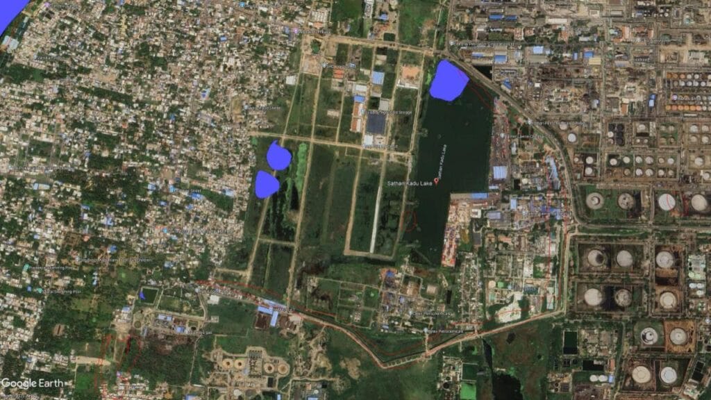
- Lack of availability of data on water bodies, which ultimately leads to encroachment and urbanisation over the lake. For example, Sathan Kadu Lake has not been digitised.
- Public road infrastructure has cut larger lakes into smaller fragments, narrowing inlets and outlets and thus paving way of settlements over the lake.
- Industrial effluents from private and government firms are directly discharged into the canal without water treatment.
- Untreated sewage from settlements along the narrowed canal.
- Encroachment of flood plain area even though the government has the buffer area of 15 m.
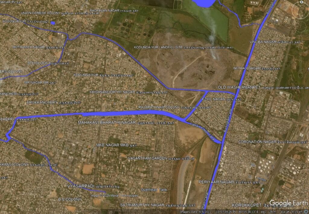
- Planning of the Kodungaiyur dump yard along the basin.
Effects on canal, surrounding area
- Blue-Green-Brown pollution (water, air, soil pollution)
- Kodungaiyur canal considerably narrowed down because of rise in settlements in that area.
- Spread of diseases, loss of biodiversity, flooding in monsoon, lack of groundwater recharge and loss of flood plain.
- Directly or indirectly contributing to climate change.
Impact of encroachments and sewage discharge
- Lack of resilience to deal with floods.
- Muthamizh Nagar has 18,565 houses with a population of 82,000 and are prone to flooding.
- Mental health issues among residents in flood-prone areas (based on assessments conducted by one of our team members).
What the Greater Chennai Corporation must do
- Involve local stakeholders in the decision-making process.
- Scientific approach to mapping, restoration, reclamation, and bioremediation.
- Involve experts, institutions in planning and design processes and competitions.
- Biomining projects must be carried out with transparency and accountability to the public.
- Strict enforcement of the policies, regulations.
- Creation of a cell for water systems under environment cell.
What can we do:
- Create awareness about lakes, waterbodies, and drainage systems.
- Hold campaigns to conserve water bodies.
- Active participation in public hearings and decision-making process.
- Educate younger generations.