You can map your own neighbourhood katte HERE

The focus at Neralu this year was on Trees & Public spaces – including ashwath kattes, neighbourhood parks and streets. Alongside that, MapUnity developed an online platform where people could upload the location of their neighbourhood kattes, with photographs and a story. Please do log on to: Mapping the Ashwath katte if you have something to share about your own neighbourhood katte or one you’ve seen elsewhere.

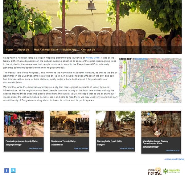
We hope that as we all share our stories about the Ashwath kattes we have seen and help to map them, we may uncover yet another story about the city of Bangalore – a story about its trees, its culture and its public spaces.

 If you can, do share the link on FACEBOOK so that more and more people can add their kattes to the map! If you would like to read the research paper on which this work is based, click here: The practice of tree worship and the territorial production of urban space in an Indian neighbourhood.

Leave a Reply

Your email address will not be published. Required fields are marked *

Similar Story

Beyond the parks and gardens, Bengaluru’s ‘wasteland’ ecosystems call for protection

Open Natural Ecosystems in Bengaluru harbour rich biodiversity. Take a look at what they hold and what we risk losing to unchecked development.

When we discuss urban nature, we often forget about real natural habitats. In Bengaluru, widely called the Garden City, most talks about urban nature focus on landscaped parks, roadside trees, and manicured gardens; in other words, artificial ecosystems designed for looks and human comfort. As lay citizens, we usually notice only such nature as we see around our homes, workplaces or other areas we generally pass by. While these places do have some ecological value, they mostly support a few highly adaptable species. This has strong negative implications for native flora and fauna that depend on open scrublands, grasslands, rocky…

Similar Story

The wild in the city: What citizen scientists tell us about Bengaluru’s biodiversity

Spatial and temporal biodiversity patterns, as observed by citizen scientists in the city during 2016-2025, were studied at a datajam in December 2025.

Imagine you’re out on a morning walk, phone in hand, when you spot a butterfly you’ve never seen before. You snap a photo, log it into a citizen science app, and voila! You’ve just contributed to crucial biodiversity monitoring. This isn’t just a hobby; it’s part of a global movement where ordinary people collect, record, and sometimes analyse data about plants, animals, and ecosystems. Citizen science stretches the reach of ecological research. Every observation adds to unique longitudinal datasets that reveal phenology — periodic events in the life cycle of a species — along with species distribution shifts and population…