In the first part of The Secret Life of Bengaluru’s Lakes, the history of the city’s lakes and how they are connected were explored. In the second part, the author looks at the future of lakes and how protecting lakes could improve our transit experience.
Uses and Users of Lakes
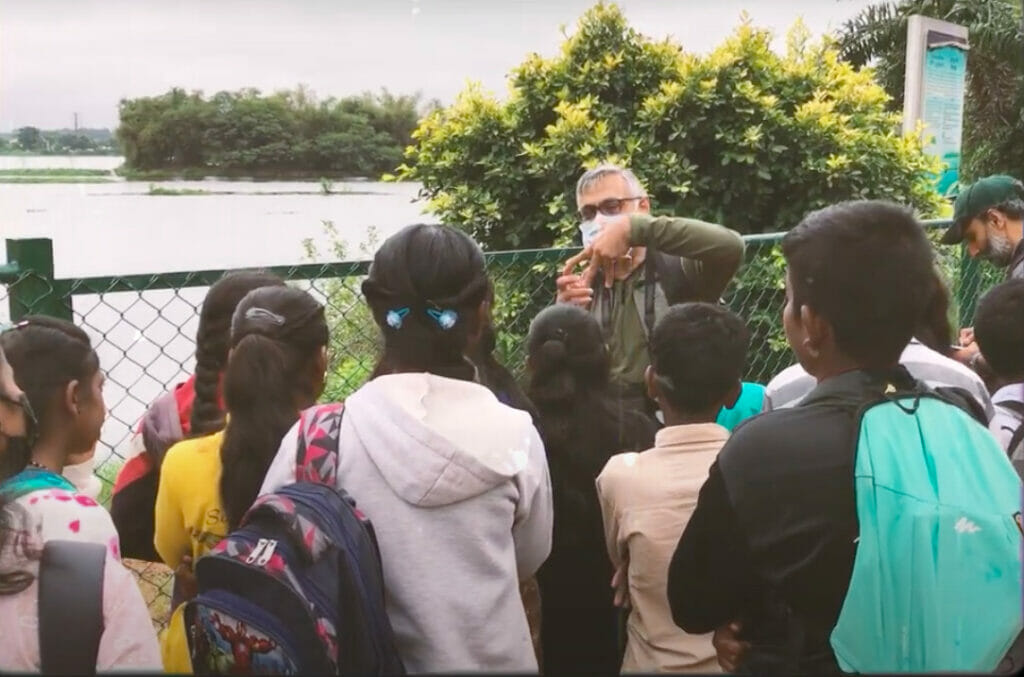
There is a lot more going on in our lakes today than we are aware of. Here is a short video that highlights some of the activities in some of our lakes.
Read more: In pictures: Backyard birding at Kaikondrahalli and Kasavanahalli lakes
The future of lakes
Our relationship with lakes has been cyclical, changing with the needs and aspirations of each generation. Irrigation tanks became bus stands and housing, which became dustbins, which became parks for evening walks.
Public space
Today, the revival of lakes has gathered momentum because our generation is re-imagining these village-side agricultural tanks as public spaces in a modern city. Public spaces are something all cities need and something Bengaluru severely lacks. Mumbai has a Marine Drive, Delhi has thousands of parks and forests and monuments, and Chennai has a beach. Name one place in Bengaluru where you can spend time for free at any time of the day!
While there is a lot of potential for lakes, as commons there is also a long way to go before they become real public spaces. The few healthy lakes in our city are locked to the public for most of the day, and when they are open, they allow only very specific activities. To do something as simple as an educational nature walk, it is possible you may need permissions from BBMP, RWAs, and various others. In the recent long-awaited BBMP announcement about opening parks for longer, lakes were left out due to ‘ecological reasons’.
It is really sad that in the previous scene in the video, an evening at the lake, a lot of the people were technically breaking the law. This needs to change. If I can fish, play, waste time with my friends and walk around lakes whenever I want to, I am more likely to be involved in taking care of it.

Unless more people build new relationships with lakes and find a good use for them, they will remain ignored. We are not going to fight for something we don’t even know about. And reviving the remaining lakes of Bengaluru is a fight for sure, a losing one probably, but a fight nonetheless.
An essential first step in this is just knowing how big the lake actually is. The extent of lakes, drains or their buffer zones are not officially defined and are missing or incomplete on public databases like Google maps or OSM. As a result, the general public is unable to watch out for any encroachments, and they easily fall prey to land-grabbers.
The map of the SWD network from the BBMP, shown in this video, is missing tertiary drains entirely. And this lake and its boundaries are just not shown on Google Maps.

Read more: Citizens’ Water Way Project: How Bengaluru is revamping the Majestic-Bellandur drain network
Ecology
There is also an issue with our current vision for lakes. Healthy lakes are public spaces, yes, but they are also critical habitats for plants and animals. BBMP’s model of lake rejuvenation considers mainly water holding capacity, but experts argue that this is not ideal.
Balaji Ragotham Baali has a deep understanding of lakes in modern Bengaluru. He has been working for years now with local communities in east Bengaluru, saved trees along Beninganahalli lake from BMRCL, and spends nearly every weekend at a lake. Here are his thoughts on the design of lakes.
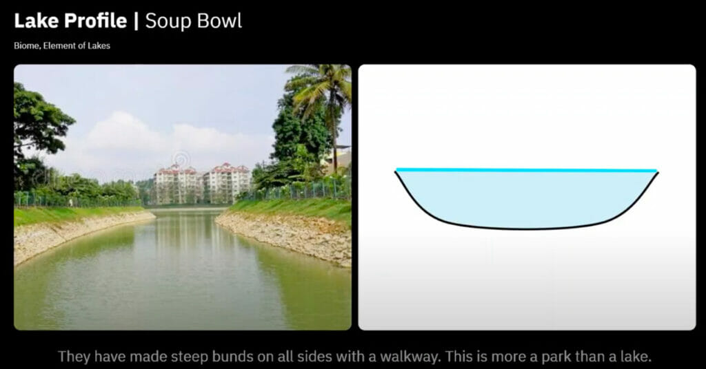
“We have requested BBMP several times that a lake should look wild. After 1996, the BBMP has made lakes like a bowl. Lakes were under the forest department before that and they made something called a watch guard. As watch guards, they built steep bunds on all sides of the lake. The BBMP has also adopted the same model. They have made steep bunds on all sides with a walkway. This is more of a park than a lake.”
He adds: “In a natural habitat, different species live in different levels of the lake. You would have noticed that a stork always hunts on a specific level of the lake. There are crabs, fish, and leeches, all these creatures live on different levels of the lake. If you make a bowl-type lake, there is just one level. My suggestion to the lakes department is that there should be a steep bund only on one side. Other sides should have a gradual slope and wooden walkways on stilts. If there is a wooden walkway, like in other countries. Then our lakes won’t have just one level but a variety of levels. That’s when different species can live there.”

Transit
You know how Bengaluru’s biggest problem is traffic? I really think that lakes can help us fix this.
As we have learnt, we have hundreds of lakes in the city that are connected to each other naturally. We also know that of the many things missing in Bengaluru, footpaths and safe pedestrian infrastructure probably top that list.
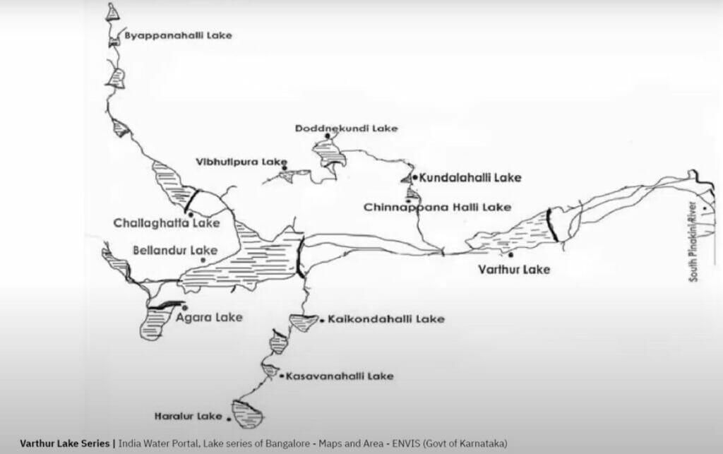
Imagine a Bengaluru where our lakes and parks are all connected. Imagine being able to go from Bellandur to Varthur without dealing with the chaos of Marathalli, while also enjoying the company of plants, animals and some beautiful Bengaluru weather.
This is not a crazy idea. Lots of countries already do this. Bengaluru, in fact, is working on a project that is kind of a start to this dream, the K100 project, where soon you will be able to walk or cycle along a SWD from Shanitnagar to Koramangala.
By doing this, we give people a genuine alternative, that is often shorter in distance, and even when it is actually a longer distance, will be something to consider because lakes and parks are wonderful.
Of course, there is a lot to consider in such a proposal besides just people, but it is an idea that I personally can’t stop thinking about.
And for whatever reason even if we can’t connect all the lakes, we should at least be able to walk along existing lake bunds for commuting without being made to jump fences or be harassed by the BBMP.
Conclusion
Things are constantly changing, and each lake has its own fascinating history and journey. If you have a lake near your house and found inspiration in this video, do consider getting involved in its future. It is likely that there are some local enthusiasts who already have a head start here and can use your support. If not, maybe you can be the one to start something.
This is an absolutely fantastic idea! Kudos for coming up with it! The laws are also supportive. Under the law, Every lake and every storm water drain have to leave mandatory buffer zones without any construction on all sides. So, picture this, we have about 30 M available on all sides of lakes and up to 50 M on either side of Rajakaluve for greenery, parks and mud tracks (no roads can be constructed). The mud tracks can be used as walking paths and cycling lanes. What is required is proper fencing of this patch, and also we need to ensure no motorised traffic can invade the space.
We require to build a Masterplan for this project, maybe we could have pro-bono support from some of the city’s planners / architects and map collectives like Mapunity or Opencity. This could be presented to the MPC / BDA / to include in the Masterplan.