I have been following the K100 stormwater drain (SWD) project for some time and had loosely worked on it in the past. Once neglected, this stretch from Majestic to Bellandur Lake has gradually been transformed into a critical part of the neighbourhood’s civic infrastructure.
As I have a theoretical understanding of what Bengaluru’s stormwater drains are intended to do and why they matter, a citizen audit of the K200 SWD held on January 31st felt like a chance to move beyond theory and see things up close. The proposed audit focused on a stretch of the K200 running from HSR Layout towards the Silk Board junction along the Outer Ring Road.
Stormwater and the city initiative
Oorvani Foundation, in collaboration with MOD Foundation, has organised a series of educational and participatory sessions to build a data-driven understanding of Bengaluru’s stormwater infrastructure—systems critical to the city’s resilience but often invisible in daily urban life.
- Typology Workshop on Stormwater Drains: Exploring the forms, functions, and challenges of Bengaluru’s drainage systems.
- Masterclass: Citizens & Stormwater — Participatory audits for better cities – Types of drains, governance structure and the challenges of encroachment, flooding, sewage mismanagement, and neglect
- Audit guide – Practical tools and methods for citizen-led audits
- Guided audit tours conducted at C100 – Ulsoor, K-200 – HSR Layout, Vrishabhavati Valley and
- Dashboard – Data collected through the citizen audits
- Masterclass Video – https://www.youtube.com/watch?v=BrJg9Iy0NhQ
Details recorded during the audit
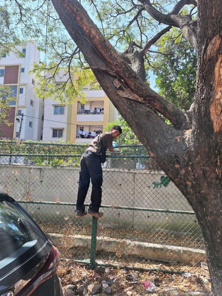
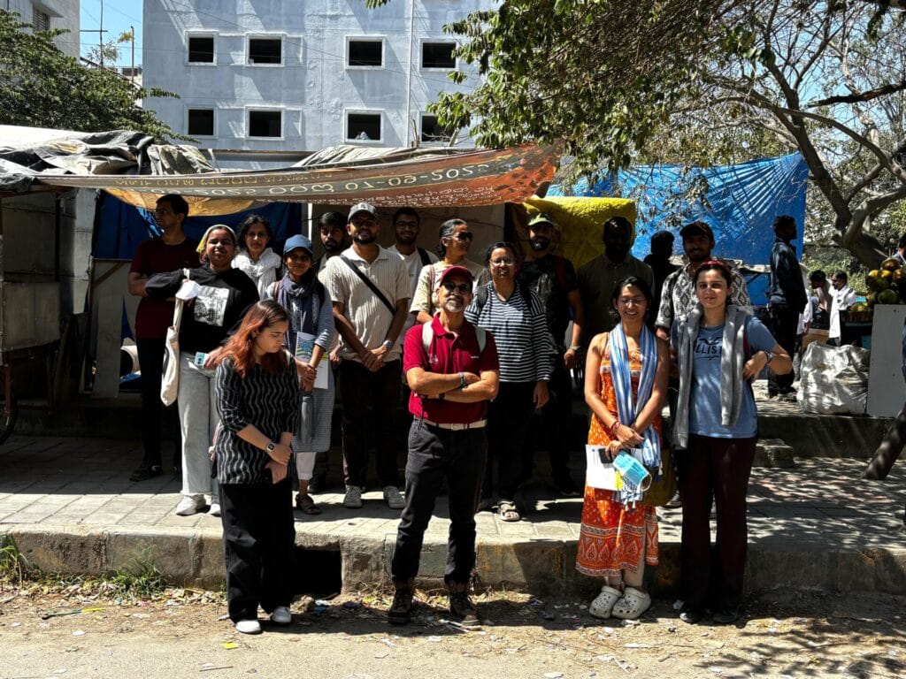
That morning, around 20 of us gathered near the starting point. After a brief introduction, we split into smaller groups of four and were given a plan for the day: walk along the drain, stop roughly every hundred metres, observe what we saw, take photos, and log our observations using a mobile data collection app. The idea was to identify factors such as the condition of the drain’s infrastructure and the state of its water quality.
There were three forms in all to be filled out. With one person in the team of four being the navigator, each of the others had to fill in one form each. Form 1 recorded details on the general structure of the drain, such as retaining walls, cables, illegal discharge into the drain and piers. The second recorded the quality of water, solid waste dumped inside and outside the drain, if any. The third form was for documenting the details obtained by interviewing locals about flooding.
Read more: Explained: Bengaluru’s stormwater drain system and the city’s water story
The initial stretch we audited ran through a relatively quiet part of HSR Layout. It didn’t smell bad and the water looked dull, but not alarming. This section felt relatively well maintained, recently desilted and with clear stormwater inlets feeding the drain. A resident from the neighbourhood who was accompanying us explained that this particular stretch rarely floods due to the slight slope, and that semi-regular desilting occurs because local RWAs actively push for maintenance.
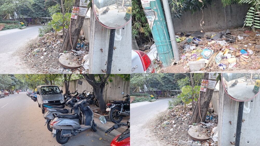
However, as a team we also noticed that in several places, debris cleared from inside the drain had simply been dumped along its edges. The drain itself was cleaner, but the problem had merely been displaced a few feet to the side.
The condition deteriorates
About two hundred metres later, things began to change. The closer we got to the water, the heavier the smell became. It was difficult to tell whether it came from the drain itself or from the waste scattered around it. A little further along, one side of the drain ran next to a small solid waste management centre.
While there was clearly no discharge or contamination from the centre, the smell was unmistakable, and the water looked visibly darker. Fencing was patchy, the walls were more worn, and the overall standards of upkeep had dropped. The resident pointed out that this stretch floods badly during heavy rains, the water reaching up to knee height on some occasions.
As we continued walking, the drain began running alongside the Outer Ring Road and its service lane. The sewage smell faded, though replaced by vehicle exhaust, road dust, and constant traffic noise. The drain widened noticeably here and held far more water. It also had a few visible design interventions, including a trash-stopping device installed across the channel. Two workers stood inside the drain, manually sorting through the waste caught in it.
Reflections from the neighbourhood
Near the end of the route, we spoke to a street food stall owner along the service road, who pointed out a nearby stretch that floods frequently. When we traced it back, we noticed a covered secondary drain running beneath concrete slabs. It was still present underneath, but no longer able to function effectively as part of the catchment system.
By the end of the walk, a realisation had set in that every hundred metres of the drain told a different story. Conditions changed based on land use, surroundings, maintenance practices, and small design decisions. It was clear that any attempt to redevelop or fix the K200 drain cannot rely on a one-size-fits-all plan. Individual stretches require specific, context-sensitive solutions.
What stayed with me most, though, was the sense that this wasn’t hopeless. The base infrastructure exists, and in some sections, it clearly works. With careful planning, consistent maintenance, and attention to these hyperlocal differences, flooding can be reduced significantly.