A childhood memory of devastation caused by a cyclone that hit India’s east coast way back in 1971, left such a lasting impression on the six-year-old boy that he decided to devote his life learning about the weather and predicting unusual weather events like Cyclones. Today, that six-year-old has risen to be the 25th Director General of the Indian Meteorological Department (IMD), Dr Mrityunjay Mohapatra, also known as the “Cyclone Man”.
Dr Mohapatra received international recognition for accurately predicting the path of the ferocious cyclonic storm Phailin that hit the Orissa coast in 1999. As head of the IMD’s cyclone division, Dr Mohapatra has seen over 40 cyclones. “My responsibility is to motivate colleagues and try to minimize loss of life and property,” says Dr Mohapatra.
A PhD in Physics, Dr Mohapatra has received many national and international awards including the Young Scientist Award from the Ministry of Earth Sciences and Achievers Award from the IMD for his research and service in the field of atmospheric sciences.
Read more: How one of Delhi’s tallest structures is contributing to climate change
In an interview to Citizen Matters, Dr Mohapatra spoke on various aspects of weather forecasting, ranging from the recent heat wave that swept the capital, how much hotter Delhi will get to the coming monsoon, and the measures taken to track and forecast cyclones which have been hitting the country’s east coast with alarming regularity.
Excerpts from the interview:
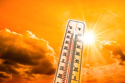
What is the cause of the sudden heat wave conditions in the capital in the March-April?
Heat wave conditions prevailed in two spells. The first one began in the second week of March and the second spell began on March 27th. The first spell lasted about a week. The second spell continued till April 11th.
Both these heat wave spells commenced from south-west Rajasthan and covered Gujarat, Rajasthan, Maharashtra, Madhya Pradesh, Chhattisgarh, Odisha and some parts of Telangana.
At the same time, heat wave conditions also prevailed over some parts of north-west India including Jammu and Haryana, Punjab, Delhi, Uttar Pradesh and one or two days in Bihar.
Basically, the cause for these heat wave spells are identical. It happened because of the development of an anti-cyclonic circulation in the troposphere. Whenever an anti-cyclonic circulation rotates clockwise, there will be downward subsidence of air and as the air subsides, it gets warmed up and hence surface air temperature increases. This phenomenon occurs over south Pakistan, south Rajasthan, Maharashtra, Gujarat and adjoining areas, which is why these areas were the first to face heat wave conditions.
At the same time, winds blowing from areas to north-west India and other parts of the country propagated the heat wave towards the north-west and eastern parts of the country.
As a result, areas like Punjab, Haryana and Delhi, which usually does not experience heat wave conditions, also faced a heat wave. In the Himalayas too, temperatures rose by a few degrees. We will issue the forecast for May and its impact on April 30th.
What causes heat waves in cities and does IMD prepare action plans to deal with it city wise ?
Heat action plan is prepared by concerned state authorities in association with NDMA and IMD. Urban heat island effect is another reason apart from the general heat wave over a region.
5-day weather forecast for Delhi
April 28: MAINLY CLEAR SKY. HEAT WAVE CONDITIONS AT ISOLATED PLACES.
April 29: MAINLY CLEAR SKY. HEAT WAVE CONDITIONS AT ISOLATED PLACES. STRONG SURFACE WINDS (SPEED 20-30 KMPH) DURING THE DAY.
April 30: PARTLY CLOUDY SKY. HEAT WAVE CONDITIONS AT ISOLATED PLACES.
May 1: PARTLY CLOUDY SKY WITH POSSIBILITY OF THUNDERY DEVELOPMENT. HEAT WAVE CONDITIONS AT ISOLATED PLACES.
May 2: PARTLY CLOUDY SKY. HEAT WAVE CONDITIONS AT ISOLATED PLACES. STRONG SURFACE WINDS (SPEED 20-30 KMPH) DURING THE DAY
Like cyclone forecast, do you have any such warning system for heat waves?
There is a heat wave warning system by IMD. Temperature forecasts are issued everyday, for the next five days, at meteorological subdivisions and district levels, by the national weather forecasting centre and state level meteorological centres. Heat wave conditions, whenever expected, are flagged through this warning system. (See the prediction for Delhi in box above).
Read more: Why Chennai needs to put its ‘heat action plan’ to practice right away
What is the monsoon forecast for this year compared to previous years?
The south west monsoon rainfall this year is expected to be normal. We have predicted seasonal rainfall from March to September this year will be about 99% of last year’s average, plus or minus 5%. The Long Period Average (LPA) rainfall during monsoon is about 87 cm based on 1971 data. So the forecast is about 99% of this.
Also, the rainfall is expected to be uniformly distributed over different parts of the country. We are, however, expecting below normal (rain) over north-eastern States, southern parts of Tamil Nadu and Kerala, some parts of Jammu and Kashmir and Ladakh, Haryana, Himachal Pradesh and south Rajasthan. The remaining parts of the country are expected to have normal to above normal rainfall.
You are known as “Cyclone Man”. Why does India’s east coast experience the maximum cyclones?
Usually we experience about five cyclones in a year, of which four occur in the Bay of Bengal and one in the Arabian Sea.
Because of the rotation of the earth, these cyclones go north-westwards and so cyclones that develop across the southern part of the Arabian Sea go towards Arabia or sometimes, because of the surface winds, they can change path and move towards Pakistan or Gujarat which is most prone to cyclones followed by southern parts of Maharashtra.
But in the east coast, most cyclone developments take place in the Andaman Sea or the eastern parts of the Bay of Bengal. These too move north-westwards and hence they come directly to our east coast.
Read more: Rising temperatures in Mumbai call for mitigation measures, but where are they?
The most prone states are Andhra Pradesh and Odisha, though sometimes they can change course and move north-eastwards towards West Bengal, Bangladesh or Myanmar. They move southwards too, towards Tamil Nadu.
Another reason why cyclones are more frequent in the Bay of Bengal is the fact that cyclones which develop in South China Sea also go north-westwards and towards south-east Asia and after passing through Vietnam, Thailand, Laos and other areas, they emerge in the Andaman Sea.
But they do not completely dissipate and when their remnants emerge in Andaman Sea, they experience favourable Oceanic and atmospheric conditions and as a result these remnants intensify again to become cyclonic storms.
A study says that of the total number of cyclones that emerge from the Bay of Bengal, two thirds are remnants that emerge from the north-east Pacific or the South China Sea. This is the reason why Bay of Bengal experiences more cyclones.
This mechanism does not happen over the Arabian Sea, because the cyclones that cross the east coast have to pass through peninsular India or by the land mass and so their remnants do not reach the Arabian Sea and sometimes dissipate.
You had suggested that money invested in cyclone warning would save money by way of protecting people living in the cyclone’s path… would you like to elaborate?
There is enormous loss of lives and property due to cyclones. Consider the super cyclone that hit Odisha 20 years back, when about 10,000 people died and there was complete devastation in coastal and interior areas. A modernization programme was taken up in 2007 by IMD to modernize weather forecasting and cyclonic system.
At the same time, a national cyclone mitigation project was also taken up by the National Disaster Management Authority which was started in Andhra Pradesh and Odisha and is now being implemented in other coastal states.
We invested Rs 435 crore in the modernization programme to upgrade our early warning system. The gains of this can be seen if you look at the response and effects of recent super cyclone storms like Phani and Ampan. There has been a paradigm shift in cyclone warning, we have been able to provide almost five days advance information about the genesis, track, intensity and landfall process, and advance warning about the floods expected.
There has also been quite an effective response system with the improved national disaster management plan, as a result of which early actions are being taken along with the early warning. The media has also played a role in raising awareness and transmitting information to the last mile. We have been able to minimize loss of lives in the last 10 years.
In terms of cost savings, if you calculate the ex-gratia paid by the government at Rs 6 lakh per head, earlier you were paying Rs 6 lakh to 1000 people while now you are paying only 100 people or families, which is a huge saving to the exchequer.
Also, if you look at evacuation required, 10 years back it was 300 kms from landfall area. Now it is just 100 kms. So there is a big saving in evacuation costs too.
Similarly in the power sector, if you can provide accurate cyclone forecast, you can better manage generation and distribution of power, and also minimize damage to power infrastructure.
With early and accurate warning, we have minimized the losses. If you add up all this, it would be much more than the investment of Rs 435 crore. A rough estimation indicates an estimated savings of about Rs 500 crore arising from better cyclone forecasting.
Therefore, there is a need for investment in technology which enables improvement in the early warning system in terms of better detection, better monitoring, better modeling, better forecasting and better early warning generation over the last mile.
For this purpose, we have taken a few more initiatives in recent times. One is the impact-based forecast. For all types of severe weather events, we have impact-based forecast. That is we are telling what impact tomorrow’s weather will have and what steps need to be taken, down to the city, village or district level.