With different electoral constituencies in Mumbai for national, state and local elections, finding which one you belong to can be a little confusing, but is important to know before exercising your democratic right to vote for an elected representative at different levels of government.
What is a constituency?
A constituency refers to a geographical area which votes for an elected representative. Each constituency corresponds to a seat in a government body, depending on the election. Given there are three levels – national, state and local – of elections in India, each place falls into three constituencies of different sets.
What are the different types of constituencies in Mumbai? How many are they?
Parliamentary constituencies – The constituencies largest in size, India is divided into 543 parliamentary constituencies for the national elections (or, general elections). Apart from establishing the governing party in the central government for the next 5 years, each constituency elects a member of parliament (MP) to the Lok Sabha, the lower house of the parliament.
Mumbai has six parliamentary constituencies – Mumbai North, Mumbai North West, Mumbai North East, Mumbai North Central, Mumbai South Central and Mumbai South.
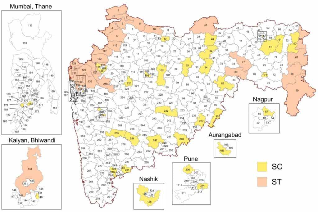
Assembly constituencies – All states are split into assembly constituencies, which correspond to seats in the Vidhan Sabha, the lower house of the state’s legislative assembly. Each assembly constituency elects a member of the legislative assembly (MLA) in the state elections, held every 5 years.
There are 288 assembly constituencies in Maharashtra, of which Mumbai has 36. Each parliamentary constituency is an amalgamation of 6 assembly constituencies.
Local civic constituencies, also called electoral wards – Independent of the constituencies above, Mumbai is currently divided into 227 civic constituencies, or electoral wards, for the local body elections.
Local elections are for electing corporators, also called councillors, of the local municipal body. These are the elected representatives closest to the citizen, and in Mumbai, make up the Deliberative wing of the Brihanmumbai Municipal Corporation (BMC), or, Municipal Corporation of Greater Mumbai (MCGM).


How are constituencies decided? Do they remain constant?
Constituencies are determined based on the population, so as to keep representation across constituencies equal and ensure no politician parties have an undue advantage. And as the population changes over time, constituencies are also changed accordingly.
Constituencies for the national and state elections are decided by the Delimitation Commission on the basis of a recent census. Currently based on the 2001 census, they will be altered next in 2026 based on the 2021 census, which has been delayed due to the pandemic.
Electoral wards for the local elections can differ from election to election. Before every election, ward boundaries are re-drawn, sometimes creating or subsuming wards, in a process called delimitation. It is done to ensure population distribution across wards remains roughly equal.
In anticipation of the 2022 BMC elections, the BMC had begun the process of delimitation on the authorization of the State Election Commission (SEC). They proposed nine new wards, taking the total to 236, and had invited suggestions and objections by 14th February. But the whole exercise and new wards were scrapped on 11th March, due to amendments to the Mumbai Municipal Corporation Act.
The amendments changed the responsibility of delimitation of the wards from the SEC to the state government, which is currently the Maha Vikas Aghadi (MVA) government. The process of delimitation will now start afresh.
This article will be updated with the new changes in the wards, as and when they are declared.
Read more: Explainer: What are the roles and responsibilities of councillors in Mumbai?
How can you find your constituency for the local body municipal corporation elections?
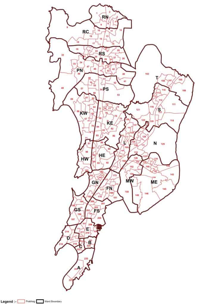
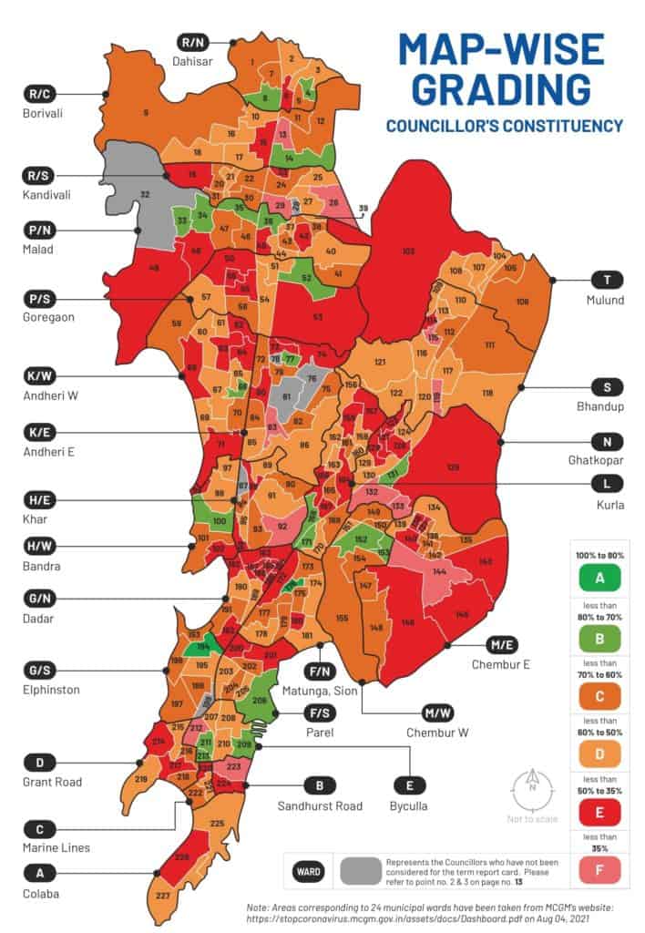
Mumbai’s 227 electoral wards are numbered starting from the north in Dahisar, to the last at the southern tip, Colaba. But these are also grouped together, in varying strengths, into divisions called administrative wards. There are 24 alphabetically-ordered administrative wards, starting from ward A at the southern tip to ward R/North at the northern tip.
To illustrate, ward A has three constituencies — 225, 226 and 227 — each of which will elect a corporator. Ward R/North starts at the north-western boundary of Mumbai in Dahisar and is divided into eight constituencies, numbered 1 to 8. Thus Ward R/North will have eight councillors.
Based on your address, identifying your administrative ward is the first step to narrowing down your exact constituency. This interactive map of each constituency, linked here, can then help you correctly identify where you will have to cast your vote.
| Constituency | Administrative Ward | Area |
|---|---|---|
| 1-8 | R/North Ward | Dahisar |
| 9-18 | R/Central Ward | Borivali |
| 19-31 | R/South Ward | Kandivali and Charkop |
| 32-49 | P/North Ward | Malad, Manori, Marve, Aksa, and Madh |
| 50-58 | P/South Ward | Goregaon |
| 59-71 | K/West Ward | Andheri West, Jogeshwari West, and Vile Parle West |
| 72-86 | K/East Ward | Andheri East, Jogeshwari East, and Vile Parle East |
| 87-96 | H/East Ward | Bandra East, Khar East and Santacruz East |
| 97-102 | H/West Ward | Bandra West, Khar West, Santacruz West |
| 103-108 | T Ward | Mulund |
| 109-122 | S Ward | Bhandup, Powai, Kanjurmarh, Vikhroli and Nahur |
| 123-133 | N Ward | Ghatkopar, Vidyavihar and Pant Nagar |
| 134-148 | M/East Ward | Mankhurd, Anushakti Nagar, Deonar, Cheetah Camp, Shivaji Nagar |
| 149-155 | M/West Ward | Chembur, Sindhi Society, Chheda Nagar and Tilak Nagar |
| 156-171 | L Ward | Sakinaka, Chandivali, Asalpha, and Kurla |
| 172-181 | F/North Ward | Matunga, Sion, Wadala, Hindu Colony |
| 182-192 | G/North Ward | Dharavi, Mahim and Dadar |
| 193-199 | G/South Ward | Worli and Prabhadevi |
| 200-206 | F/South Ward | Parel |
| 207-213 | E Ward | Byculla, Madanpura, Agripada, Nagpada, Dockyard Road, Reay Road, Chichpokli |
| 214-219 | D Ward | Grant Road, Walkeshwar, Malabar Hill, Breach Candy to Haji Ali |
| 220-222 | C Ward | Pydhonie and Bhuleshwar |
| 223-224 | B Ward | Masjid Bunder, Mohd. Ali Road, Dongri and Bhendi Bazar |
| 225-227 | A Ward | Churchgate, Colaba, and Navy Nagar |
The electoral ward numbers corresponding to the administrative wards and their maps in Mumbai. Data: MeMumbai & MCGM

How can you find your constituency for the state and national elections?
Similar to finding your local constituency, your address dictates which parliamentary and assembly constituency you belong to.
As assembly constituencies are subsets of parliamentary constituencies, identifying your assembly constituency by area using the table below will also inform you of your parliamentary constituency. Detailed maps of each constituency, linked here, can help you confirm your standing.
| District | Parliamentary Constituency | Assembly Constituency |
| Mumbai Suburban | 26- Mumbai North | 152- Borivali |
| 26- Mumbai North | 153- Dahisar | |
| 26- Mumbai North | 154- Magathane | |
| 26- Mumbai North | 160- Kandivali | |
| 26- Mumbai North | 161- Charkop | |
| 26- Mumbai North | 162- Malad | |
| Mumbai Suburban | 27- Mumbai North West | 158- Jogeshwari East |
| 27- Mumbai North West | 159- Dindoshi | |
| 27- Mumbai North West | 163- Goregaon | |
| 27- Mumbai North West | 164- Varsova | |
| 27- Mumbai North West | 165- Andheri West | |
| 27- Mumbai North West | 166- Andheri East | |
| Mumbai Suburban | 28- Mumbai North East | 155- Mulund |
| 28- Mumbai North East | 156- Vikroli | |
| 28- Mumbai North East | 157- Bhandup West | |
| 28- Mumbai North East | 169- Ghatkoper West | |
| 28- Mumbai North East | 170- Ghatkoper East | |
| 28- Mumbai North East | 171- Mankhurd Shivajinagar | |
| Mumbai Suburban | 29-Mumbai North Central | 167- Vileparle |
| 29-Mumbai North Central | 168- Chandivali | |
| 29-Mumbai North Central | 174- Kurla | |
| 29-Mumbai North Central | 175- Kalina | |
| 29-Mumbai North Central | 176- Vandre East | |
| 29-Mumbai North Central | 177- Vandre West | |
| Mumbai Suburban | 30-Mumbai South Central | 172-AnushaktiNagar |
| 30-Mumbai South Central | 173-Chembur | |
| Mumbai City | 30-Mumbai South Central | 178- Dharavi |
| 30-Mumbai South Central | 179- Sion Koliwada | |
| 30-Mumbai South Central | 180- Wadala | |
| 30-Mumbai South Central | 181- Mahim | |
| Mumbai City | 31 – Mumbai South | 182 – Worli |
| 31 – Mumbai South | 183 – Shivadi | |
| 31 – Mumbai South | 184 – Byculla | |
| 31 – Mumbai South | 185 – Malabar Hill | |
| 31 – Mumbai South | 186 – Mumbadevi | |
| 31 – Mumbai South | 187 – Colaba |
The parliamentary and assembly wards that make up Mumbai. Data: ceo.maharastra.gov.in
How can you use your knowledge of your constituency as a citizen?
Once you have identified your constituency, you can make an informed decision among the candidates standing for the seat in each election. And as democracy is not restricted to elections, you can continue to monitor and engage with the winning candidate throughout his/her term.
As it stands currently, the term of the councillors elected to the BMC in 2017 is over. Till elections are held, the Administrative wing of the civic body, comprising of the commissioner, additional municipal commissioners and department heads, have stepped in to continue running the BMC.
But in preparation of the next election, you can find out how your previous councillor fared in the past term through the civic organisation Praja’s Councillors Report Card. Ravi Raja of the Indian National Congress (INC), elected from ward 176 in Sion was awarded the highest score, while the councillor of ward 119 in Vikhroli, Manisha Harishchandra Rahate of the Nationalist Congress Party (NCP), got the lowest.
You can find out the MPs elected from the various constituencies in Mumbai here, and the list of elected MLAs here.
This explainer is part of a series on ‘Explainers and Information Resources for Mumbaikars’ supported by a grant from the A.T.E. Chandra Foundation.