Trinity Woods and Acres is a 7.5 acres residential community, near Sarjapur Road. As part of Rainwater Harvesting implementation, it was decided to dig a 6ft diameter and 40ft deep recharge well at one of the lowest points in the layout that is near their currently yielding borewell (which is adjacent to Sarjapura Road).
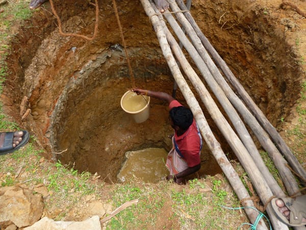
Dewatering with a bucket does not work out.
Work proceeded uneventfully till we struck water at about 9ft. The water had no odour, looked clean, with pH 7.5 and TDS 1100ppm. The water seemed to continuously flow in at about 6-10 litres per minute.

6ft of Water.
This made further digging difficult and with a dewatering pump we were able to deepen the well only till about 15ft below ground level. Water had to continually be pumped out every 5-10 minutes to aid digging. Rings were placed immediately to prevent the collapse of the mud walls.
Work was temporarily put on hold due to Ganesh Chaturthi. When we returned 4 days hence to the well this morning we saw clean water – about 6-7ft of it ( 5000 litres +). The apartment is of course very happy and would like to see the well as a source of water.
Some of the key questions to which we would like to find answers:
- How much water will this well yield per day and for how many days of the year ?
- Is this rainwater ? What is causing the high TDS .
- How are the soil/rock layers below this source of water ? How is it that water is available at 9ft below ground level and not at 1000ft below ground level in the same vicinity.
Further monitoring and data collection will reveal interesting results. We are quite looking forward to it.
Author’s note:
The area around Sarjapura Road, Bangalore is almost entirely dependent on rapidly depleting ground water. At the same time we do not understand our ground water/lakes very well At what depths is groundwater available ? What is the total quantum of water available? How deep can borewells be dug? What are the regulations around digging of borewells? How and where should we provide for ground water recharge ? What is the link between lakes and borewells? etc. It is in this context that it would be useful/critical to understand our groundwater better.
BIOME , WIPRO, ACWADAM (from Pune) and MAPUNITY (from Bangalore) are undertaking a study Participative Aquifer Mapping Program around the Sarjapura – Bellandur area. This study intends to be a participatory exercise involving citizens – as it is our stories, our experiences that are the most useful pieces of information along with geological and hydrological studies.
Related Articles
How much are you paying for your tanker water?
Water tankers: Making money when the sun shines and water flows!
I believe the area has a combination of rocky and clay soil. Clay soil can hold pockets of water even though surrounding areas may not have water. However this may be a small amount and may not last if used extensively.