In the past few months, I’ve been looking at how people continue to worship trees in Bangalore and how this can generate community space for a neighbourhood. I have been specifically looking at the Peepul tree and its ability to create places of memory and cultural value. The Peepul tree, also known as the Ashvattha in Sanskrit literature is a type of Fig tree (Ficus Religiosa) and the platform around it is locally called ashwath katte.
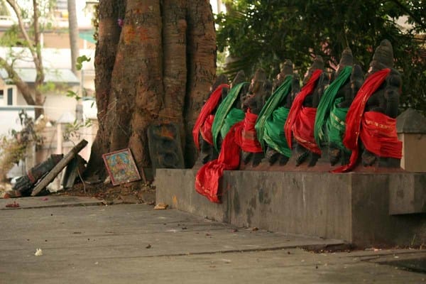
The Ashwath katte opposite the Meenakshi Mall on Bannerghatta road
While my research focus has been on how the practice of tree worship contributes to the territorial production of urban space, I have also been eager to explore if the idea of the katte can help develop a pedestrianisation plan for Gandhi Bazaar. There have been articles written in the last few years which have discussed the need for pedestrianisation in several parts of the city. In Where does the walker go? Ashish Verma suggests that some of the needs to be met are well-connected walking networks, good quality of footpaths and adequate widths for footpaths. In Reserve Gandhi Bazaar for Pedestrians only and in The why’s and how’s of pedestrianising Gandhi Bazaar, traffic-related and street vendor-related issues at Gandhi Bazaar are brought forth.
To add to this discussion, I’d like to propose that if people respect and protect sacred trees through the katte, perhaps the idea of the katte can also become an urban design strategy for streets such as the Gandhi Bazaar Main road which may not have Peepul trees, but have been covered with old shade-giving trees that may face a threat of being felled for easing traffic congestion. I think that taking inspiration from the Ashwath katte, we may be able to suggest a Pedestrianisation or Urban design plan for Gandhi Bazaar that responds to the natural heritage (the trees) as well as the social, cultural and economic activities of the Basavanagudi neighbourhood. I share below a few concept sketches:

Typical Street detail plan /of Gandhi Bazaar
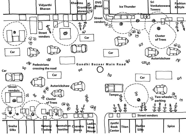
Existing Plan of Gandhi Bazaar : There is no distinction between where the pedestrians walk and where the cars move
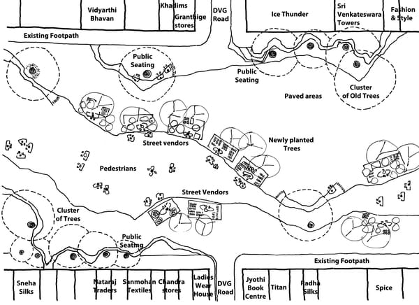
Proposed Urban design Plan 1: with the katte as platform surrounding each cluster of trees
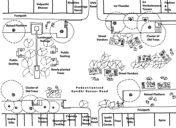
Proposed Urban design Plan 2: where the raised platforms are not rectilinear like the katte but have a natural flow as do the paved areas
For those who would like to know more about the social, cultural and economic activities of Gandhi Bazaar, do look at The Garland Makers in the Bazaar, Gandhi Bazaar and Street vendor eviction. And, for more on ashwath kattes, you could look at a paper that was published in Feb 2017 in the Journal of Urban design on The practice of tree worship and the territorial production of urban space in the Indian neighbourhood.