Devendra Fadnavis, the deputy chief minister of Maharashtra recently launched the Mumbai Metropolis Metaverse, an immersive virtual representation of the way Mumbai will look by the year 2025. This metaverse includes twelve infrastructure projects, which is said will transform Mumbai. One of these projects is the Mumbai Metro.
Citizen Matters looks at existing Metro Lines, their connections with Central and Western suburban railways and the prominent areas/stations they connect.
Which are the three lines currently operational in Mumbai?
Blue Line or Line 1
On 8th June, 2014 the first metro line was started in Mumbai. It was dubbed the Blue Line or Line 1. This line goes from Versova in Andheri west to Ghatkopar. It has 11.4 km of elevated portions and has 12 stations. These include: Versova, D.N Nagar, Azad Nagar, Andheri, Western Express Highway, Chakala (J B Nagar), Airport Road, Marol Naka, Saki Naka, Asalpha (Subhash Nagar), Jagruti Nagar, Ghatkopar.
The minimum fare on this line is Rs.10 and the maximum fare is Rs.40.
The Yellow Line or Line 2
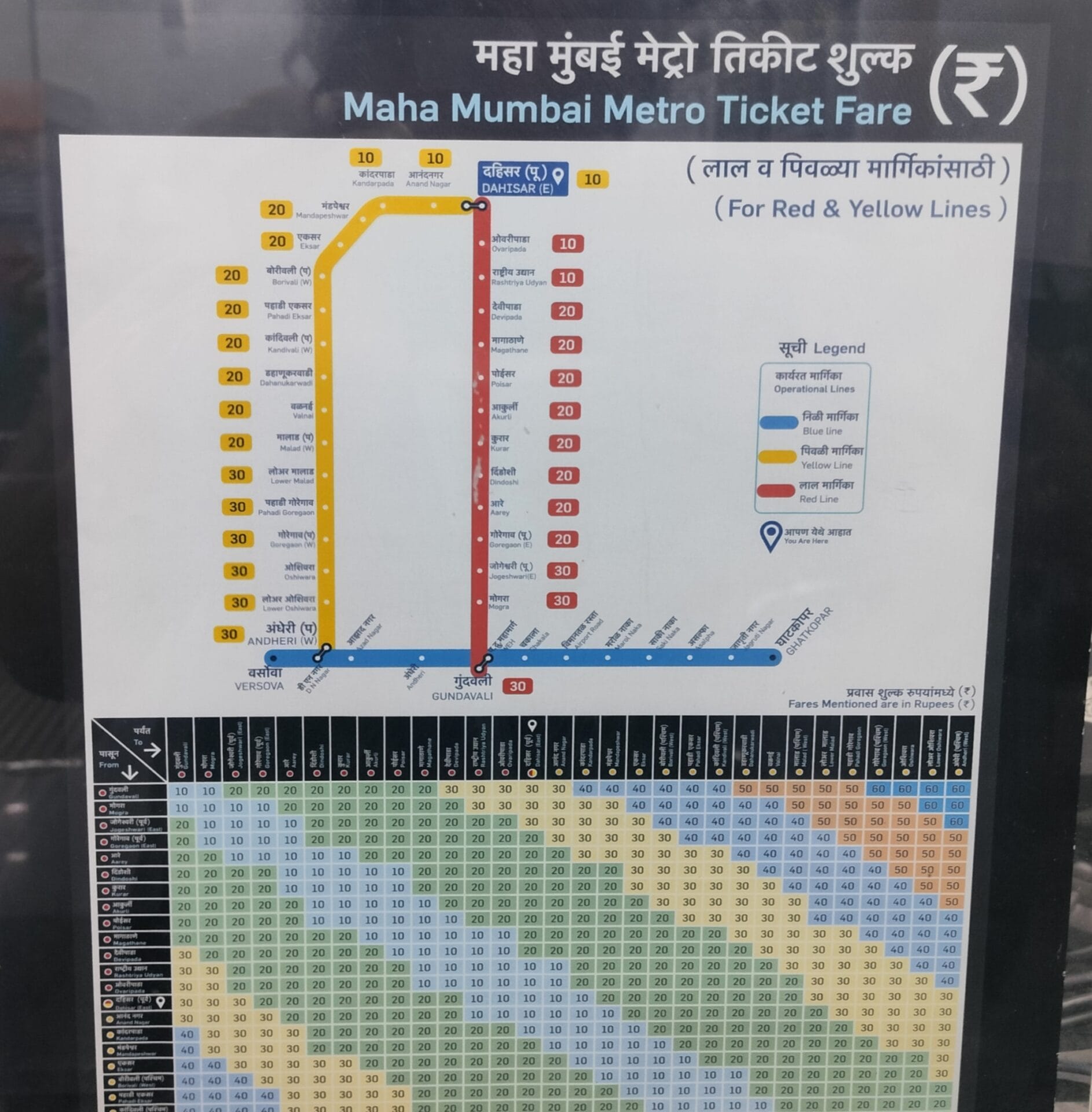
The second line, called Line 2, or the Yellow Line was started on 22nd April, 2022. The line is meant to go from Dahisar (East) to Mandale. Currently the line is operational partially: from Dahisar (east) to Andheri west (D. N Nagar). This line is called line 2A and is 18.589 km in length.
The stations on Line 2A are: Dahisar East, Upper Dahisar Station (Anand Nagar), Kandarpada (Rushi Sankul), Mandapeshwar (IC Colony), Eksar, Borivali West (Don Bosco), Pahadi Eksar (Shimpoli, then Shimpawali), Kandivali West (Mahavir Nagar), Dahanukarwadi (Kamraj Nagar), Valnai (Charkop), Malad West, Lower Malad (Kasturi Park), Pahadi Goregaon (Bangur Nagar), Goregaon West, Oshiwara (Adarsh Nagar), Lower Oshiwara (Shastri Nagar) and Andheri West (D.N. Nagar).
Following is the rate of the tickets on Yellow Line 2A:
| Distance | 0 to 3 km | 3 to 12 km | 12 to 18 km | 18 to 24 km | 24 to 30 km |
| Rate | Rs 10 | Rs 20 | Rs 30 | Rs 40 | Rs 50 |
Yellow line 2B which is still under construction will connect D. N Nagar to Mandale via BKC.
The Red Line
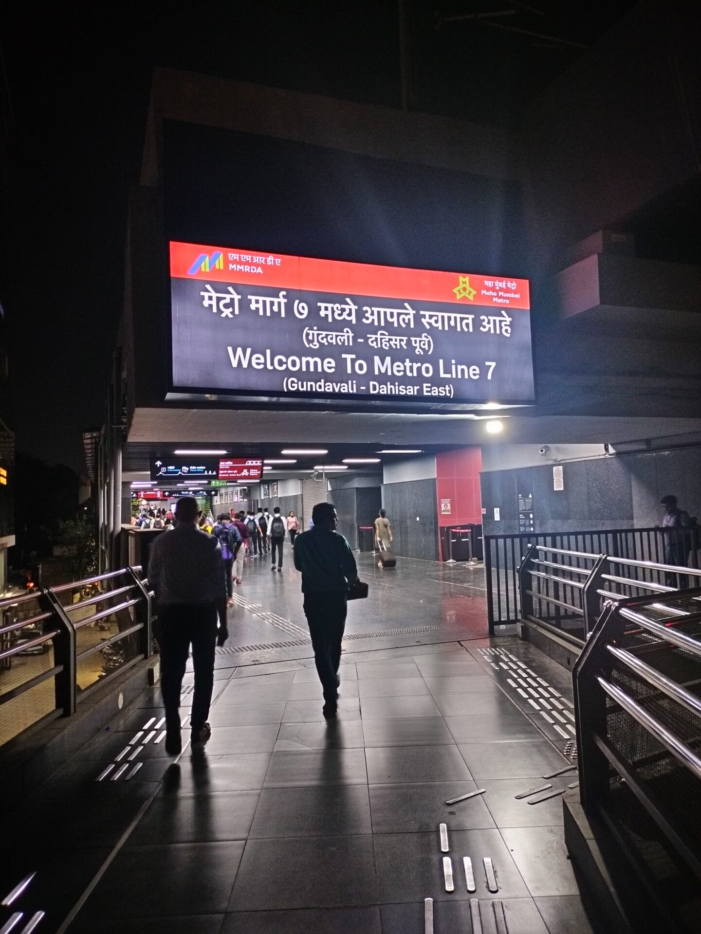
The Red Line has three parts to it: 7, 7A and 9. Currently Line 7 is operational and runs from Dahisar East to Gundavli (Andheri East). This route is 16.49 km long.
The following stations are there between these lines: Dahisar East, Ovaripada, National Park, Devipada, Magathane, Poisar (formerly Mahindra & Mahindra), Akurli (formerly Bandongri), Kurar (formerly Pushpa Park), Dindoshi (formerly Pathanwadi), Aarey, Goregaon E (formerly Mahanand), Jogeshwari E (formerly JVLR Junction), Shankarwadi, Gundavali (formerly Andheri East).
Following is the rate of tickets on Line 7:
| Distance | 0 to 3 km | 3 to 12 km | 12 to 18 km | 18 to 24 km | 24 to 30 km |
| Rate | Rs 10 | Rs 20 | Rs 30 | Rs 40 | Rs 50 |
A northward extension of Line 7 is under construction. This is called Line 9 and will connect Dahisar to Bhayandar and is expected to be completed by June 2025. The southward extension of the line is named line 7A and will connect Gundavli to Chhatrapati Shivaji Maharaj International Airport – that is T2.
Read more: Has the Mumbai Metro helped reduce traffic at all?
How do these three lines connect with each other?
The three lines, the Blue line, the Yellow Line 2A, and the Red Line 7 almost form a rectangle with the Yellow Line and the Red Line forming the lengths of the rectangle. The Blue Line forms one breadth of the rectangle, and the point where the Red and Yellow Lines meet forms the shorter breadth of this rectangle.
To switch from the Blue Line to the Yellow Line one has to get off at D N Nagar. And to switch from the Blue Line to the Red Line one has to get down at Western Express Highway (WEH) station. There is a connecting overbridge between WEH and Gundavli which falls on the Red Line.
How are the metro lines connected to the suburban railways?
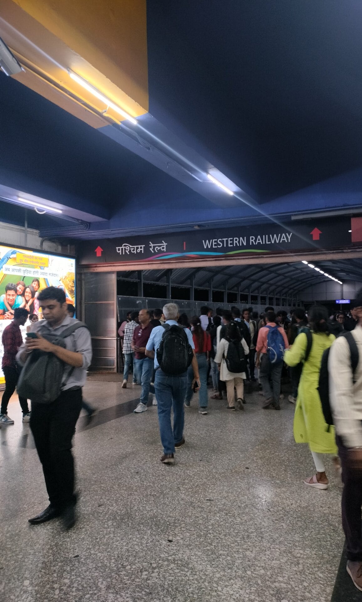
As of now, only two metro stations are connected to stations on the Mumbai Suburban Railway System: Andheri and Ghatkopar.
The purpose of building multiple metro lines is so that commuters can make use of more than one line via connecting stations to get to their destination. For instance, Yamini Purohit, who works at Juhu, says that initially she would use the Yellow Line 2A and the Red Line to get to Goregaon east where she lives. She would take the Yellow Line 2A from D N Nagar. The train goes up to Dahisar east and then turns from there to take the Red Line. It would take her nearly an hour by the time she reached her stop. She found instead that she could get down at Bangur Nagar and take an autorickshaw from Goregaon east to west.
Read more: Shared autorickshaws: Can’t live with them, can’t do without them
When Arvind travels from Navi Mumbai to Andheri east, he takes two train lines and then one metro line. He takes the Trans-Harbour line of the Mumbai Suburban Railway from Ghansoli to get to Thane. From Thane he changes to the Central Line of the Mumbai Suburban Railway to reach Ghatkopar followed by the Blue Line of the metro. He gets down at the WEH station and walks to his destination about a kilometre away. He finds this connectivity between the local trains and metro convenient but wishes there was also direct metro connectivity to the airport.
When he takes a flight, he gets down at the Airport Road station which falls on the Blue Line. Though the airport is a kilometre away, he cannot walk the distance when he has luggage with him and there is no option but to use an autorikshaw. Autorickshaw drivers, aware of this commuter conundrum, take disadvantage by charging significantly more than the actual fare.
Rupali Khandelwal stays at Asalfa and has to often travel to Film City for work. Using the Blue Line she goes to WEH, and switches to Red Line 7. She gets down at the Aarey stop from where she proceeds to Film City using an autorickshaw. The total journey takes her about 45 minutes, and she definitely prefers this to taking the local train, though she has to change lines.
As of now, last-mile connectivity still depends on road travel, with many passengers making use of autorickshaws. BEST has started three new bus routes from lines 2A and 7 to improve connectivity. The introduction of shuttle buses will truly make using the metro a convenient option in the future.
Which will be the next metro line to open?
The Aqua Line or Line 3 is expected to become functional next. Phase 1 of the line which will connect Aarey Colony to BKC will be open for use in April 2024. The next phase will connect BKC to Cuffe Parade.
| Do you use the Mumbai Metro and another mode of transport while reaching your work? Is it convenient? How can it be made better? Please share your thoughts with us at mumbai@citizenmatters.in. |