Bengaluru was once divided into two distinct centres: An urban settlement and a military cantonment. However, in 1948, the two centres merged together to form Bengaluru city corporation for a new, unified Bengaluru city.
Over the following decades, the city experienced large-scale development of public industries in sectors such as telecom, machinery, electronic goods, etc. It also saw the emergence of a large number of residential layouts, which made it a pensioner’s paradise.
One such locality is Jayanagar neighbourhood, which was laid out in 1949. Characterised by numerous art deco bungalows, abundant parks, playgrounds, an accessible schooling system and a neighbourhood commercial complex in modern architecture, Jayanagar quickly became an affluent neighbourhood .
Over the last two decades, Jayanagar has transformed in largely two aspects—along various sub-arterial streets and the redevelopment of the commercial block. Figure 2.1 shows all the redevelopment and transformation observed in Jayanagar.
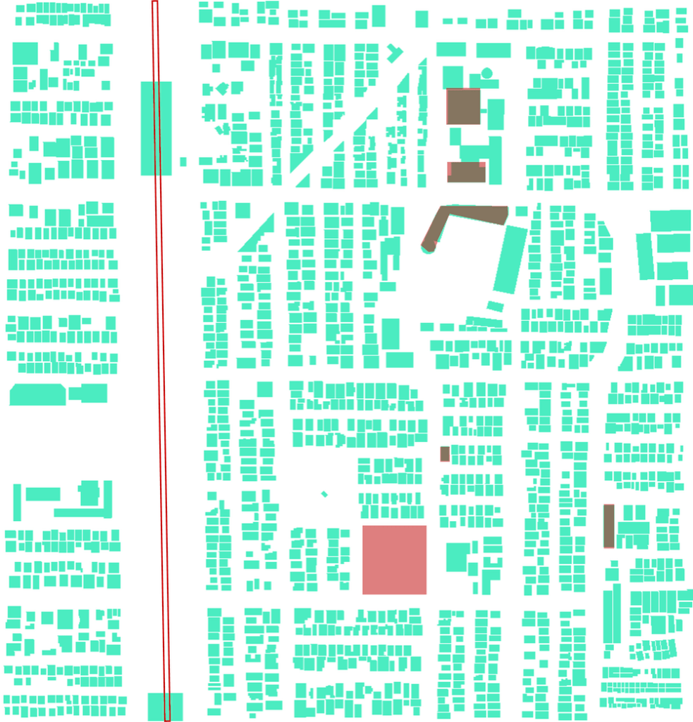
The double line towards the left indicates the metro line. The broad arrowed lines are the important roads in the precinct that have been affected due to the transformation. The red zones are the buildings that have been developed.
Read more: Citizens win PIL on reckless commercialisation in Bengaluru
Transformation of Jayanagar
Towards the end of the 20th century, Bengaluru had already witnessed large investments and influx of migrants. To cope with the growing infrastructure, the city maximised its funding opportunities by a national scheme, the Jawaharlal Nehru National Urban Renewal Mission (JNNURM) and built new bus terminals. A new metro line was also proposed for Bengaluru. Jayanagar benefited from both these developments, which changed the land dynamics of the neighbourhood.
Figure 2.2 shows the overhead metro line that was made operational for the public in 2017, which was developed along one of the most popular boulevards of Bengaluru with dense vegetation. This has been the most noticeable change in Jayanagar. This changed the appearance of the boulevard into a deforested, infrastructure-heavy corridor.
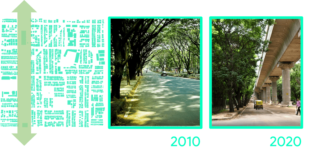
Transformation zones: The image on the left shows the 4th main road that had the metro line built post 2010. The other two images show the transformation of the boulevard over the last decade.
The metro rail, coupled with the construction of the bus terminal, resulted in a significant increase in high-density commercial activity along the secondary roads. This was a direct consequence of the overflow from the BDA commercial complex in 4th block, leading to the surge in property prices in the area.
For a long time, Jayanagar’s commercial complex had attracted residents from surrounding neighbourhoods for recreation and shopping.
This encouraged further development along other streets. Figure 2.3 highlights the roads with commercial penetration in the residential areas over the last two decades. The quiet residential roads transformed into busy commercial streets catering to the whole of Jayanagar and its surrounding localities.
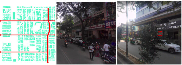
Figure 2.3 The commercial take over: The image on the left shows the roads that have developed into commercial spines. The other two images are street views of 33rd cross and Aurobindo Marg – 11th Main road reflecting the busy commercial streets.
The Government buildings and complexes were redeveloped from medium to high rise structures. One such example is the theatre in the BDA commercial complex shown in Figure 2.4. It was redeveloped to a seven-floor shopping and office complex in 2012. The surge in land value in this locality had given a reason for the development authority to begin redeveloping and constructing such structures.
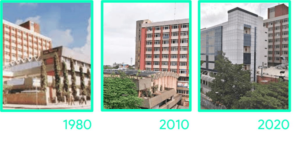
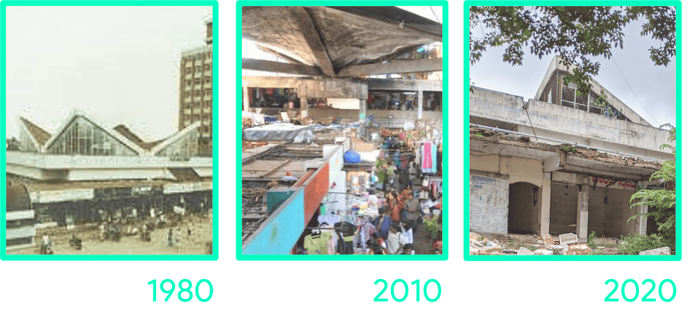
Figure 2.5 The deterioration of Janta Bazaar: The image on the left shows the BDA complex in its prime after its opening after 4 years. The centre image shows the busy complex corridors even in its rundown state. The image on the right shows the sealed out BDA complex.
Jayanagar 4th block was a planned residential layout that used to be a calm and peaceful place for residents, with necessities available right around the corner. The IT boom in Bengaluru has led to substantial development over the past two decades, transforming the area into a thriving commercial hub. This trend is expected to continue with further developments in the future.
The unrelenting and widespread commercialisation has transformed the entire area, affecting nearly every corner. Although this has made the neighbourhood vibrant, it encompasses a diverse spectrum of commercial activities, ranging from street vendors to glossy commercial complexes.
(Part 2 of this article is republished from the author’s Medium account with permission and with edits)