This is surely a map no one wants to see. Nearly 1100 garbage dumps across different wards captured on a map, in the city of Bengaluru, by citizens – a crowdsourced attempt, point to how common and ubiquitous is the problem of garbage in public spaces.
Each garbage dump has a story behind it. Some of the photos from the map:
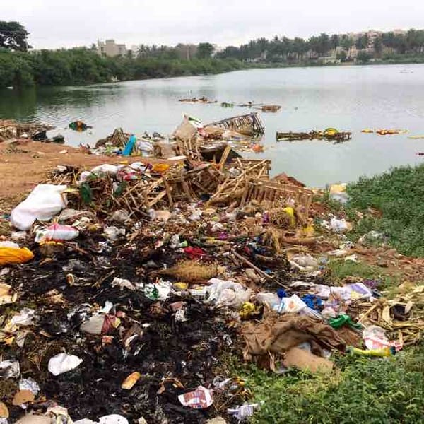
What’s happening near this lake?
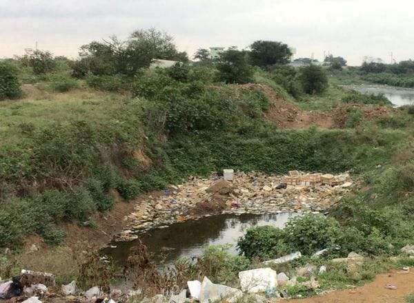
Thermocol is a type of waste Bengaluru cannot figure how to dispose. Dumped in a no-man’s land, it slowly pollutes the atmosphere and water bodies.
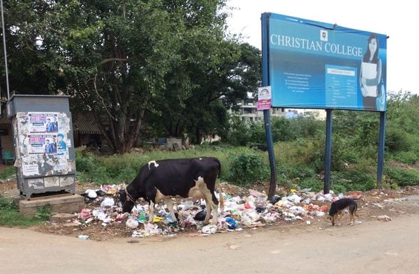
A cow feeds on garbage full of paper and plastic. What milk are we drinking?
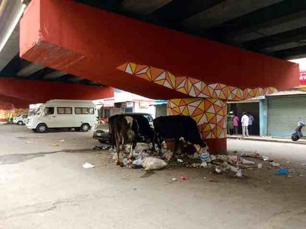
When symptoms are fixed without fixing the root causes.
Champions who spearheaded the project:
Bellandur ward, one of the biggest wards in Bengaluru, has an area of 26.4 sqkm. The volunteers in the ward captured more than 175 garbage dumps in their ward for this project.
The volunteers in the ward are also working towards responsible waste management. Read their latest blog on the subject here. Here are just a few Bangaloreans who have contributed to this project.
- Seema Sharma (mapping cordination- Bellandur)
- Nitin Seshadri (mapping cordination – Koramangala)
- MapBox team (mapping help – Indiranagar)
- Gangadhar (mapping)
- Kedar Thakar (mapping)
- K Madhubala
- Priyanka Bhatnagar (mapping)
- Meera Nair (mapping)
- Sumit Srivasthava (mapping)
- Ravish Yavagal (mapping)
- Nikita Vashisht (mapping)
- Nisha Thompson (Mapping cordination)
- Mapunity team (Tech support)
- Nishanth C (mapping cordination, tech support)
- And many, many more citizen volunteers who helped us put this map together, with their ideas, advices, suggestions and on-ground support, who preferred to remain anonymous.
We can never thank all of them enough!
According to Wikipedia, crowdsourcing is “a distributed problem-solving and production process that involves outsourcing tasks to a network of people, also known as the crowd”.
Through this project we aimed at more citizen participation in solving the garbage issue, and what Bellandur team did is remarkable.
Like any other crowdsourced project, this project also will not be fully free of errors. But if the errors are pointed out, we will make the required corrections. We don’t claim the data to be 100% accurate, but we will strive to make it better as and when we get data form people. You are welcome to send us updated photos and locations.
Our comments:
This is only the beginning, there’s a long way to go. The BBMP has said there are 8000 blackspots in the city, and we would like to host all of them on our map! Do help us in this process. Right now,
1) The number of broken footpaths mapped here may not be covering all the broken footpaths in the area, as the focus was more on garbage dumps.
Update: We have removed the foootpath layer from this map, to represent only garbage dumps.
2) We have covered only a portion of the city. Most mapping activity happened on East, South, Mahadevpura and some parts of other zones. Other zones remain to be covered.
We need volunteers in West, South, Rajarajeshwari Nagar, Dasarahalli, Yelahanka and Bommanahalli Zones. which are yet to be mapped. Do install the app from Android playstore or IOS appstore, register yourself, join the group named ‘Citizen Colab’ and get going! Here are more details about the project. To know more about how to get involved, click on this article.
If you have the data (photo and exact locations) and want to share it but don’t want to use the app, mail us, we will figure out a way to take data from you.
If you are also the developer of an app or a belong to a project or a team that is into documenting garbage dumps, do join hands with us. It’ll be a fun project – let’s capture them all together and put them in one place for all to see! Write to us.
When we shared the idea of this project initially with BBMP officials in Solid Waste Management division, they gave a thumbs up to this. We will be sharing the existing data with BBMP soon, officially. We are as curious as you are, to see how this citizen-driven project can help solve the issues. Fingers crossed!
Click on each point in the map, read the description that appears in each of them, see the photo by clicking on the photo link. Explore the map. Do share your thoughts below this article. There may be some posts where photos are missing, due to technical issues.
If you see a garbage dump that is in the map, that has been recently cleared or fixed so that it is not a garbage dump anymore, you can login to the Mapunity app and comment with a new photo, under the same post. You can aslo do send us a photo and its location. Detailed base map from the data collection app is available here to see.
Related Articles
Why are we mapping garbage dumps in Bengaluru?
Help Bengaluru map its problem spots!