The months preceding the Lok Sabha election this year was a season of sops. Prime Minister Narendra Modi unveiled several projects and announced more. But a sit-in protest of 200-odd farmers put a spanner in the works for one such big announcement.
The farmers have been protesting against land acquisition and inadequate compensation for the proposed site for Noida International Greenfield Airport project since October 2018. The proposed airport, 70 km away from the Indira Gandhi International (IGI) Airport, New Delhi, estimated to cost Rs. 16,000 crore, was believed to be the government’s showpiece ahead of the elections.
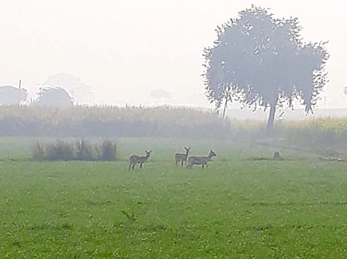
Although the state government officials claim that the farmers’ issues have been resolved as Allahabad High Court has dismissed land dispute cases in April, concerns regarding the long-term impact of the construction on the environment continue to bother experts as several wetlands and habitat of Sarus cranes, peacocks and blackbucks fall under the project area.
Development at what cost?
Vikrant Tongad, founder of Social Action for Forest and Environment(SAFE), questions the rationale behind setting up an airport so close to IGI airport while several other parts of the country are yet to be served.
The land at the project site is primarily agricultural in nature, with over 6,000 big trees – mainly arjun and babool – and plenty of wetlands.
Wetlands are part of the hydrological cycle, which begins with the evaporation of water from the ocean. As moist air is lifted, it cools and condenses to form clouds and returns to the earth as precipitation. Once the water reaches the ground, some of it evaporates back into the atmosphere and rest penetrates the surface and become groundwater. The wetlands are often primary source of water for human and animal consumption and irrigation in rural areas, they provide rich biodiversity, control floods, maintain groundwater table and are a source of recreation and livelihood to communities involved in boating, fishing, farming of water chestnut, fox-nut and lotus among others.
The Uttar Pradesh forest department’s documents mention three wetlands within the airport site and 60 within a 15-kilometre radius of the airport. These wetlands measure above 2.25 hectares, some are as big as 37 hectares. All wetlands measuring above 2.25 hectares must be protected as per the Wetland Rules 2017.
Asad Rahmani, former director of the Bombay Natural History Society and member of governing body of Wetlands International, South Asia, said, “Wetlands, even smaller ones, provide habitat to several Indian and migratory birds.”
In fact, the project site has a good population of Sarus cranes and peafowls. Of the 20,000 cranes in India, over 13,000 are in this state, primarily in the flatlands of western UP. Gautam Buddh Nagar alone has 140 of them.
Rahmani said, “The airport must be planned in a way so that there is minimum loss to natural habitat of birds and wild animals. Although it is true that aircraft are usually disturbed by smaller birds and not big ones like sarus or peacock, which don’t fly high.”

The upcoming airport in Noida could have an impact on wildlife and environment in the area. Photo Kanchan Srivastava.
According to Tongad, “Reclamation of three wetlands in the core project area seems inevitable. The authorities have no plans to dig out fresh ponds on their place. There is no clarity over the fate of 60 wetlands either – they might be destroyed sooner or later owing to further development in the area.” There are just 76 wetlands in the entire Jewar Taluka which will be reduced to 13 in the next few years, he adds.
Activists also fear that the project might use up groundwater adding to the woes of Noida and greater Noida, which are already marked as “critical zone” by the Central Ground Water Authority. The National Green Tribunal has even imposed a ban on extraction of groundwater in Noida since 2013.
The government seems less worried though.
The Yamuna Expressway Industrial Development Authority (YEIDA), an Uttar Pradesh (UP) government undertaking that is spearheading the project as of now, floated a global bid for the project in May this year with a deadline of 30 October 2019. A total of 14 domestic and international firms have responded to the bid so far. A new joint venture, Noida International Airport Limited, has been set up recently to take the project forward. Work on the project will start next year.
According to state officials, spread over 5,000 hectares of land in Jewar Taluka of Gautam Buddh Nagar in Uttar Pradesh, the Noida airport (also referred to as Jewar Airport) will comprise six runways and handle 65 million passengers and 4 million tonnes of cargo annually when fully developed.
The airport will be built in four phases on a public-private partnership basisand the first phase of two runways spread over 1,334 hectares is expected to be completed by 2023.
At present, Delhi’s IGI airport, with three runways, is the biggest in the country.
First conceptualised in 2001 by the Directorate General of Civil Aviation (DGCA) of UP region, the project hit the wall of clearances due to choppy relations between the Centre and the State ruled by different parties. Besides, the GMR group which had bagged the project to modernise the IGI airport in Delhi had put a spanner by stating that the proposed project would violate the Ministry’s rule of a 150-km distance between two airports.
As per Airport Policy, “No greenfield airport will normally be allowed within an aerial distance of 150 kilometres of an existing airport. The government can, however, approve a greenfield airport at places where an existing airport is unable to meet the projected requirements of traffic.”
The ball was finally set rolling mid-2017, soon after the Yogi Adityanath-led Bhartiya Janta Party government took over UP.
In July 2017, the Centre approved the airport. In December that year, the state allocated Rs. 1,800 crore for land acquisition, which was soon followed by an environment clearance from the Centre in June 2018.
However, the draft environment impact assessment (EIA) report of the project in October 2018 pointed out that project site falls in seismic zone 4 signifying high risk of damage from earthquakes.
The same report says that, “there is good population of Sarus cranes and peacocks” at the project site which may “pose a risk if birds come inside the operational area of the airport”.
Incidentally, peacock is the national bird of India and the Sarus crane is the state bird of UP. Standing at 1.8 metres, Sarus cranes are the tallest flying birds in the world and protected under Schedule 4 of The Wildlife Protection Act 1972. They are listed in the ‘vulnerable’ category in the International Union for Conservation of Nature Red List of Threatened Species.
The final EIA report of June 2019 gives details of nine major earthquakes (magnitude 6-9 on the Richter scale) in the area over the last two centuries. It further points out that Gautam Budhh Nagar is highly vulnerable to floods as it is in the flood-plains of rivers Hindon and Yamuna. The report details permanent long-term damage that could be caused to water bodies, trees, fauna, ground and surface water and air ambient quality due to this project. The report, nonetheless, terms the project as “beneficial, long term” on account of infrastructure development and livelihood opportunities it can generate.
The end justifies the means, feels government
The Centre cites the rising congestion at the IGI airport as justification for the Noida airport.
“In the last decade, passenger traffic at IGI airport has increased by an average of 14 percent annually, compared to 11.7 percent nationally. From the current 62 million passengers a year, the traffic here is expected to reach 110 million by 2024. Hence, NCR needs a second airport within the next five to six years,” a senior official from the Union civil aviation ministry, on condition of anonymity, said.
The IGI airport also handles 30 percent of the cargo of the country, a figure that is increasing by 14 percent annually. International air-traffic is also growing at 7.7 percent every year. The proposed airport will decongest the IGI airport before it reaches its saturation point.The spill-over is expected to gain momentum by 2029-30,” the techno-economic feasibility report of the project says.

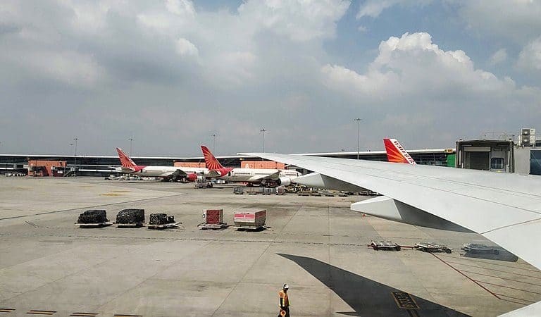
The new airport site is about 70 km from the existing international airport in New Delhi. Photo by Jnanaranjan sahu/Wikimedia Commons.
According to a senior official from Civil Aviation Department, Uttar Pradesh gains to reap several benefits from the project. “The Noida airport would cater to nearly 40 hinterland districts of UP, Rajasthan, Haryana and Punjab. Being close to the Multi Modal Logistics Hubat Dadri an integrated logistics facility to support Dedicated Freight Corridor, it will also handle a substantial amount of cargo,” he said. According to the feasibility report, over 12 percent passenger traffic and 50 per cent of the cargo traffic at the IGI Airport now comes from Ghaziabad and Gautam Buddh Nagar.
Quizzed about the situation, Shailendra Kumar Bhatia, officer on special duty, YEIDA, said, “All litigations with regards to land acquisition have been quashed. Now, we will take utmost care to protect the environment and wildlife as per the directives of the government.” He insists that the authorities are committed to not using water from the wetlands or groundwater for construction purpose. “The water for construction and during operations will be brought from a canal and a Sewage Treatment Plant at Kasna,” he said. Bhatia dismisses any concerns about earthquakes with “Even the IGI airport is in seismic zone 4.”
According to the EIA report, plans for tree plantation, rainwater harvesting, wildlife conservation and curbing noise pollution are ready.
District forest officer P.K. Srivastava feels that most wetlands are in the periphery of 15 km outside the project area. “If mitigation measures are taken, there is no reason to halt the project,”he said, adding though that project managers must keep in mind that wild animals in the vicinity would most likely migrate to other forest areas nearby in search of food and shelter once the construction starts.
[This story was first published on Mongabay and has been republished under a CC BY-ND 4.0 Creative Commons license. The original article can be read here. ]