It was a day filled with obvious contrasts – the kind that would ideally help make right decisions about the nightmare that we know as urban transport in Bangalore. The question of mass transit versus private vehicles was never answered more effectively for me.
On Friday, the last day of August, I was slated to cover the Rail Yatra that was being organised by Citizens For Bengaluru, to reiterate their demand for a suburban rail service for the city. The 3 pm train was to start from Yeshvanthpur and reach Heelalige, a picturesque little station (reminiscent of R K Narayan’s Malgudi Days), very close to Electronic City which houses some of the largest IT campuses in the city. Enroute lay Manyata Tech Park near Hebbal, RMZ and other IT parks near Bellandur, the RG Tech Park, the Wipro Headquarters and the New Infosys campus near Carmelaram Station before reaching its destination.
The 34-kilometre journey would take about 40 minutes and cost me just Rs 10.
However, because of a mix up at the metro station, I realised I was going to miss the suburban train by a minute. I was not going to make to Yeshvanthpur, so I got off at the Sandal Soap Factory and boarded an auto from there to try and reach the next station at Hebbal. Meanwhile, my friends on the train were sending me a blow-by-blow update about the where, what and how of the yatra so I could report it, but my first priority was was to catch that train.
At this point, Google maps told me I had a two-minute window between my arrival and the train’s at the Hebbal station. I crossed my fingers and prayed my auto driver would channel his inner Michael Schumacher and get me over the finish line. He quickly cured me of my optimism. “Madam you need a helicopter today,” he said. And he was right.
The Bangalore Traffic Police tweeted the start of white topping on ORR from Hebbal Circle to Nagavara Junction and warned users to opt for alternative roads. Friday was a disaster for those travelling from Sarjapur and HSR Layout into the city through BTM Layout. Those who chose not to heed the warning spent a better part of the weekend stranded in bumper to bumper to traffic.
The junction near Esteem Mall was a disaster worse than ever. I missed the train again because it had covered the the distance between Yeshwanthpur and Hebbal in less than ten minutes while I was still trying to make it past the Mekhri Junction! But the optimist in me refused to give up and I decided to try and make it to Banaswadi (which the train would reach in about 8 minutes).
My auto driver sniggered at the foolishness and asked me to check the map again. It read 26 minutes to Banaswadi. We were at the Esteem Mall junction by then. So I checked how long it would take me to reach the last station – Heelalige. If I could just reach somewhere and meet them. The time shown was 1 hour and 24 minutes. There was no point. I would not make in time and decided to return home in South Bangalore. As I inched back through that traffic (it did not help matters with my friends sending me videos of them zipping past us stuck in traffic), I got down to researching a few figures.
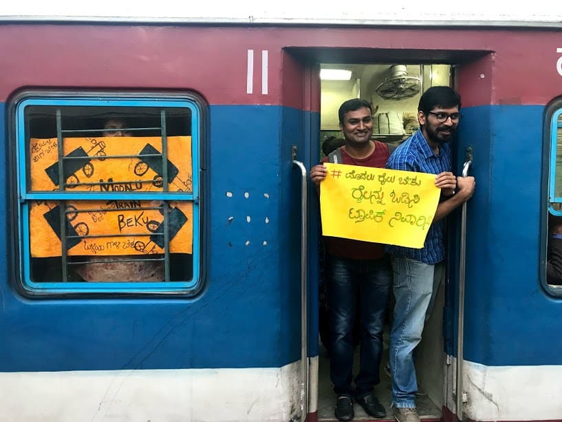
Pic: CitizensForBengaluru
Just a few days earlier, the Centre for Science and Environment had released a report on Urban Commute that analysed the topic for 14 cities. Bangalore had the fourth largest population among the cities that were looked at. The mode share in the city is almost equal between public transport (42%) and two-wheelers (38%). Cars account for less than 10%. Bangalore has the longest average trip lengths in a car after Chennai and Mumbai. Cars which constitute less than 10% of vehicles on the road, travel longer distances within the city. Which also means that those travelling by private transport spend some of the longest times inhaling toxic fumes.
Another report by MoveIn Sync, which looks at time taken by Bangaloreans, shows that in comparison to last year, Bangaloreans have added six minutes to their travel time every day. That adds up to 2.5 hours a month, with the worst-hit stretch being Outer Ring Road.
All those figures made a lot of sense suddenly. Had I managed to catch the train, I wouldn’t be inhaling toxic fumes with particle emissions, nitrogen oxide and carbon dioxide and would have reached my destination in less than 40 minutes. It took me about an hour and half in an auto and cost me Rs 350 to get home finally, after an aborted journey!
The author is not the only one with these kind of experiences. I have had horrendous experiences on the flyovers all along ORR.
I wonder who designed these pieces of poor design and flawed urban planning. For those wanting to learn about how transport planning should not be done, these flyovers are Lollapaloozas. They shall learn from these flyovers and tell the world not to design anything like this.
https://www.livemint.com/Politics/8lubXTlKUNt7HU4n50E2oJ/Bengaluru-flyovers-poorly-designed-Brazilian-expert-Paulo.html
Great lesson learnt!