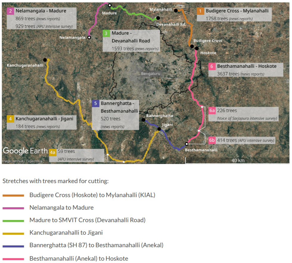
The Karnataka Road Development Corporation Limited (KRDCL) proposes to start widening and construction of roads surrounding Bengaluru. Newspaper reports estimate that 8,561 trees will be cut over 152.03 km of road length, but official numbers have not been released. The project’s public-available feasibility reports fail to provide information on its environmental or ecological impacts.
In this context, we at Azim Premji University, conducted an independent rapid EIA (environmental impact assessment) of this road-widening project based on rapid field visits between February 29 and March 6.
The impacts of the road-widening project will include:
- Health issues from increased air pollution
- Increased urban heat island effects
- Threat to lakes
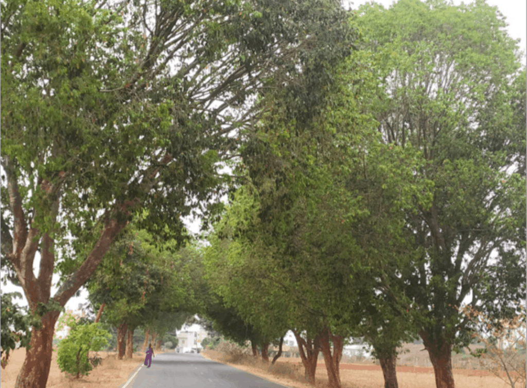
- Loss of trees, especially many heritage trees
- Loss of urban biodiversity
- Threat to forest ecosystems
- Loss of spiritually-important ashwathkattes
- Reduction in carbon sequestration
Key highlights of the rapid EIA
- Several old and large trees have already been cut or lopped even before the project has begun. For example, we noted 51 trees cut in the stretch between Kanchugaranahalli and Jigani.
- The actual numbers of trees that will be cut seem much higher than reported. In the stretch from the Kanchugaranahalli to Jigani, newspaper reports state that 184 trees will be cut. But in our field survey, we counted around 1,000 trees marked for cutting.
- Many heritage trees will be lost, and this loss can’t be replaced by planting saplings. In just one 15-km stretch between Madure and Nelamangala, we counted 206 banyan trees, including massive specimens with girths of 17.7 m and 14.9 m, that will be cut.
- 15 sacred ashwathkattes (platforms with massive peepal and neem trees, many with nagarkallus) have been marked for removal. These are essential sacred, cultural and community spaces for local residents.
- The project will have adverse impacts on endangered wildlife in important biodiversity habitats, especially Anekal Reserve Forest which connects Bannerghatta National Park, and Junnasundra Mini Forest.
- The road will disturb fauna including the endangered slender loris (Loris tardigradus), which is a Schedule 1 protected species under the Indian Wildlife Protection Act 1972, palm civet (Paradoxurus hemaphroditus), and Indian jackal (Canis aureus aureus).
- It will have environmental impacts on as many as 14 lakes, including large lakes like Varthur and Madure kere.
Trees provide a number of tangible and intangible services to a city and its residents. Street trees are the lungs of Bengaluru, cleaning air of harmful pollutants such as NOx, sulphur dioxide, and Suspended Particulate Matter that causes breathing disorders and reduces life expectancy. Street trees help to reduce the temperature of road surfaces by 20°C and air temperature by 3-5 °C, and sequester carbon.
When heritage trees are lost, the historical and social links between the city and its residents is erased. Habitats that support endangered biodiversity are destroyed forever, and linear roads that cut through protected areas disturb and endanger wildlife, also increasing human-animal conflict.
Bengaluru is expanding into peripheral areas. Such expansion must be planned with care. Rather than planning urban expansion to ensure that there is enough greenery for people’s health and well-being, projects like the proposed road expansion will destroy important, essential patches of greenery, which cannot be compensated for by planting saplings or transplanting trees.
The full EIA can be read here.
[This article is based on a press release from Azim Premji University, and has been published with minimal edits.]
It is ofcourse sad to hear that trees will be chopped and this needs to be considered and avoided as much as possible. However, narrow roads and extreme traffic is a reality. It would have been better if the author had provided both perspectives instead of simply bashing the project.
It’s sad…but Then first govt should be asked to plant new trees, almost double the amount they cut…also check if they have technology to relocate these trees…
As a concerned citizen, is there a representative of the government we can contact about this report?