In a little over a year, the BBMP has conducted yet another ward delimitation exercise. In June 2022, the civic body announced that Bengaluru would have 243 wards. On August 18th this year, close to midnight, the civic body announced a fresh delimitation exercise that has yielded 225 wards for the city.
What are the major changes in the city’s ward boundaries and how can you, the citizen, engage with these changes?
Timeline of events
Delimitation is an exercise conducted to redraw ward boundaries and account for the change in ward population over time. This is done to ensure proportional representation of wards based on its population. For instance, a ward with a very high population can be split into two and that population will be represented by two councillors instead of one.
Read more: Here’s how to check your new ward as per BBMP’s draft delimitation
The BBMP had delimited the current 198 wards into 243 wards in July 2022. The municipal body received thousands of objections to the new ward boundaries.
The delimitation was challenged twice in the Karnataka High Court. In its latest order, on June 19th, a High Court division bench ordered the BBMP to carry out a fresh exercise within 12 weeks. The state government reconstituted the committee for ward delimitation on June 23rd.
The committee headed by BBMP Commissioner Tushar Girinath came up with a fresh delimitation, which was released to the public on August 18th.
After a fresh delimitation exercise, the civic body has come up with 225 wards instead of the 243 wards last year. The delimitation exercise was done according to Section 7 of the BBMP Act, 2020. The public has two weeks, i.e., until September 1st to register any objections to the new ward boundaries.
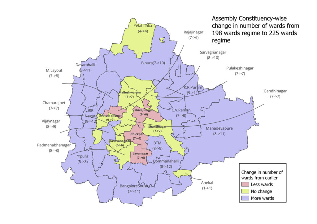
What has changed with the ward delimitation?
As with the 2022 exercise, ward delimitation has been done based on the 2011 Census data, according to the BBMP’s latest circular. The delimitation committee has proposed to increase the number of wards from 198 to 225. The delimitation exercise has primarily reduced wards from Assembly Constituencies, where ward numbers had increased after the 2022 exercise. You can view a complete map here.
Constituencies like Yelahanka, Chamarajpet and Padmanabhanagar have reverted to the same number of wards pre-2022 delimitation exercise. Constituencies like Malleshwaram, Hebbal, Pulakeshinagar, Shanti Nagar and Gandhi Nagar have retained the same number of wards in both the 2022 and 2023 delimitation exercises.

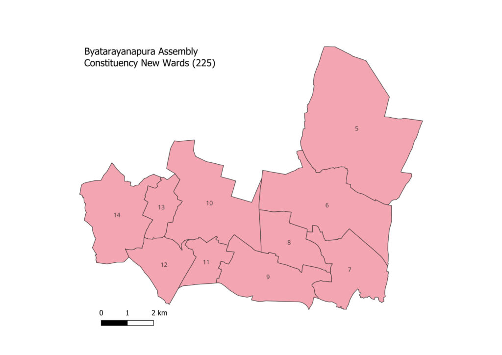
Byatarayanapura, Yeshwanthpur, and Vijayanagar have seen an increase in wards; the ward delimitation for these constituencies are similar to the 2022 delimitation exercise.

The constituency has gone from one to four wards after the latest delimitation exercise. Shivajinagar, Rajajinagar and Chickpet have one ward less, compared to the existing and 2022 delimitation exercise. The complete change in ward levels can be seen in the table below.
Assembly constituency wise ward change
| Constituency | Existing wards | 2022 delimitation | 2023 delimitation |
| Yelahanka (150) | 4 | 5 | 4 |
| KR Pura (151) | 9 | 13 | 11 |
| Byatarayanapura (152) | 7 | 10 | 10 |
| Yeshwanthpur (153) | 5 | 8 | 8 |
| Rajarajeshwari Nagar (154) | 9 | 14 | 12 |
| Dasarahalli (155) | 8 | 12 | 11 |
| Mahalakshmi Layout (156) | 7 | 9 | 8 |
| Malleshwaram (157) | 7 | 7 | 7 |
| Hebbal (158) | 8 | 8 | 8 |
| Pulakeshinagar (159) | 7 | 7 | 7 |
| Sarvagnanagar (160) | 8 | 10 | 10 |
| CV Raman Nagar (161) | 7 | 9 | 8 |
| Shivajinagar (162) | 7 | 6 | 6 |
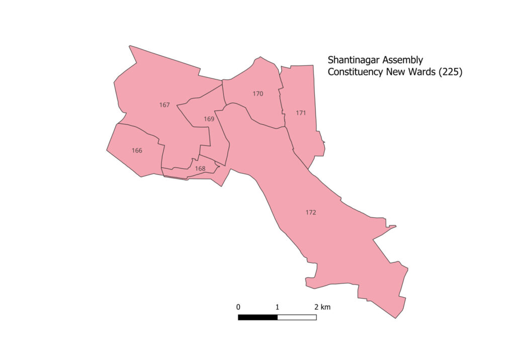
| Shanti Nagar (163) | 7 | 7 | 7 |
| Gandhi Nagar (164) | 7 | 7 | 7 |
| Rajaji Nagar (165) | 7 | 7 | 6 |
| Govindraj Nagar (166) | 9 | 10 | 9 |
| Vijayanagar (167) | 8 | 9 | 9 |
| Chamarajpet (168) | 7 | 6 | 7 |
| Chickpet (169) | 7 | 7 | 6 |
| Basavanagudi (170) | 6 | 7 | 6 |
| Padmanabha Nagar (171) | 8 | 10 | 8 |
| BTM Layout (172) | 8 | 9 | 9 |
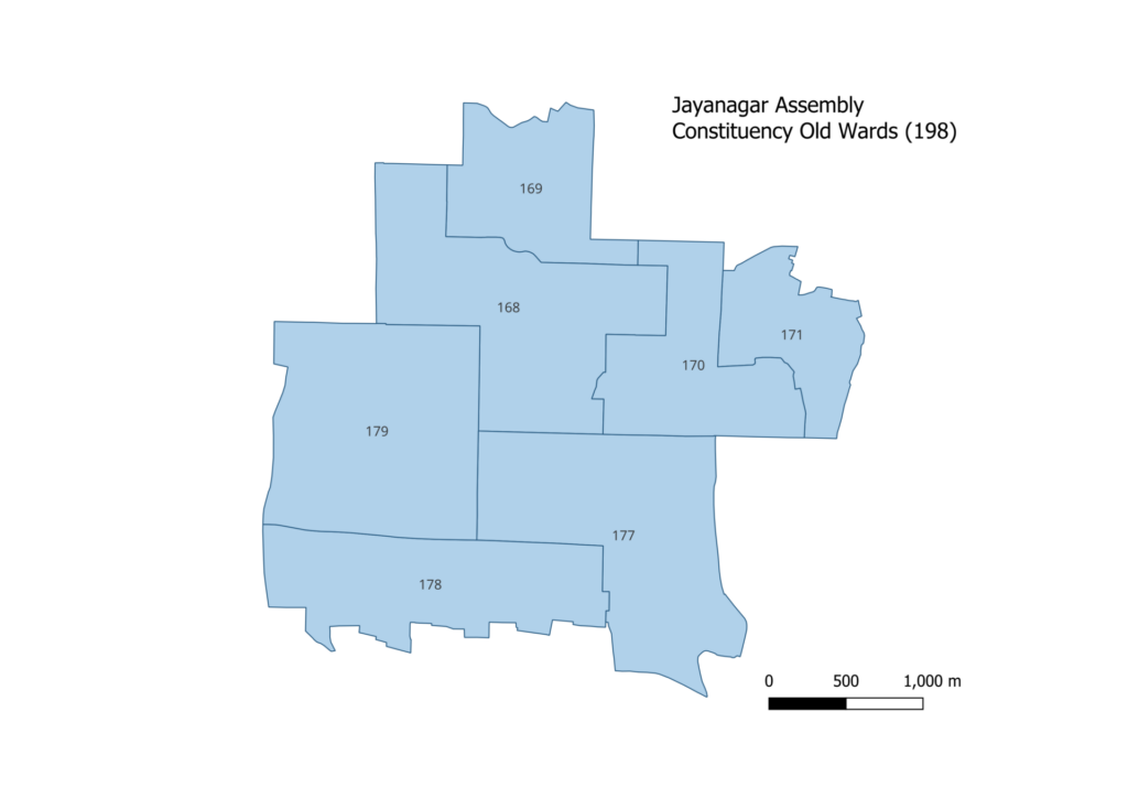
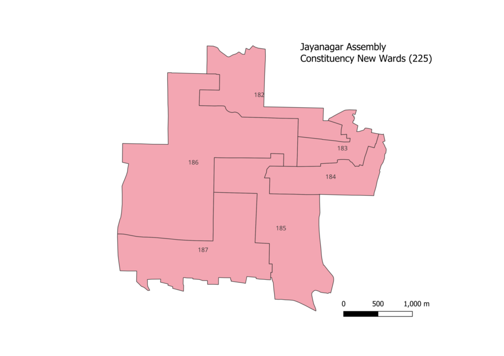
| Jayanagar (173) | 7 | 6 | 6 |
| Mahadevapura (174) | 8 | 13 | 11 |
| Bommanahalli (175) | 8 | 14 | 12 |
| Bangalore South (176) | 7 | 12 | 11 |
| Anekal (177) | 1 | 1 | 1 |
| Total | 198 | 243 | 225 |
The table shows a comparison among the current existing wards, the wards designated in the 2022 delimitation, and the number of wards under the 2023 delimitation.
You can check the details of your ward on the gazette notification here. The list of important localities and the boundaries of the wards are specified.
The detailed maps of the wards are available at http://bbmpdelimitation2023.com/. These show the previous and proposed boundaries of each ward and the change in their area and population. You can also view this visualisation.
Objections can be raised by filling a form on the website, by September 1, 2023.
It is expected that the BBMP elections, which have been stalled since 2020, will take place once the ward delimitation exercise is complete. The state transport minister Ramalinga Reddy said that BBMP elections would be held by the end of the year.