VES Studies in Urban Areas (Yemalur Watershed)

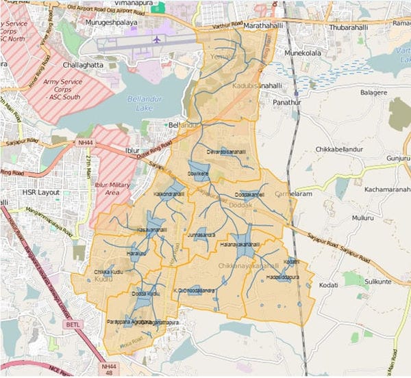
A map of the area under study. Pic: Biome

As part of the participatory aquifer management studies in the Yemalur watershed, we conducted a Vertical Electrical Sounding (VES) survey to get a clear geological profile of the ground below. A description of the activities is given below.

Objective

The VES or Resistivity Survey is a non-destructive in-situ test which is conducted  by measuring variations in the electrical resistivity of the ground in order to to locate and estimate the characteristics of the aquifer below.

Methodology

The survey is done by applying small electric currents across arrays of ground electrodes (depth of penetration of the electrodes is about 4-6 inches) while measuring variations in the electrical resistivity of the ground. The data is processed to produce a depth profile of the thickness and resistivity of subsurface electrical layers.The method is used to identify groundwater yielding zones, their structure, direction of groundwater movement and any variation in quality within them.

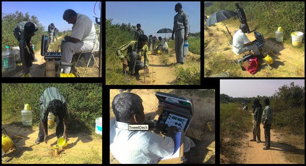
VES testing in progress. Pic: Biome

There are challenges in identifying suitable locations (which are called arrays) to perform these tests. An array is set of observation ponits that have to be in a straight line about 700m long, far from any electrical lines, with unhindered access (no trafiic !!) to the team performing the tests – for a duration of about 2 hours. The challenges in identifying such locations were many as the only near straight stretches that we got were either along lake bunds or along roads.

Read through this presentation to understand the details of what was attempted. The results of these tests are still to be interpreted.

https://www.documentcloud.org/documents/2764694-Yemalur-Watershed-VES-Studies-Feb-2016.html

Yemalur-Watershed-VES-Studies-Feb-2016 (PDF)

Yemalur-Watershed-VES-Studies-Feb-2016 (Text)

Leave a Reply

Your email address will not be published. Required fields are marked *

This site uses Akismet to reduce spam. Learn how your comment data is processed.

Similar Story

The trials of being an urban farmer in Delhi’s Yamuna floodplains

Agriculture around the Yamuna is strictly prohibited due to river pollution concerns, but where does that leave the farmers?

The river Yamuna enters Delhi from a village called Palla and travels for about 48 km. There is a part of the river, approximately 22 km long, between Wazirabad and Okhla, which is severely polluted, but for the remaining 26 km of its course, the river is still fairly clean. The surroundings serve as a habitat for a large number of trees, flowers, farms, birds, and people who have been living here for as long as they can remember. They are the urban farmers of Delhi-NCR, and they provide grains and vegetables for people living in the city. Although farming…

Similar Story

Save Pulicat Bird Sanctuary: Civil society groups appeal to TN government agencies

Voluntary organisations have urged the government to settle the claims of local communities, without reducing Pulicat Sanctuary's borders.

A collective of 34 civil society organisations and more than 200 individuals from Tamil Nadu and across the country have written to the Thiruvallur District Collector, Additional Chief Secretary of Environment, Climate Change and Forests, Chief Wildlife Warden, and the Tamil Nadu Chief Minister Cell to protect the Pulicat Bird Sanctuary for ecological and social reasons and settle the rights of people without reducing the sanctuary's boundary. The voluntary groups have urged the government to initiate the settlement of claims of local communities residing in the 13 revenue villages within the Pulicat Birds Sanctuary boundary limits. Excerpts from the letter:…