- The article aims to study a one square kilometer area of Jayanagar in different aspects. It is intended to be a comprehensive essay of the area for planners, designers, sociologists, and residents. It is an analysis of the current scenario of Jayanagar through four different aspects that include setting up historical and spatial context with the city, evolution, street network and land and built use.
- It provides analyses and inferences to comprehend the growing demand and redevelopment of Jayanagar and how it would further evolve in the coming years. The article draws information from primary surveys, documentation and secondary data collection from relevant journals, reports and government websites.
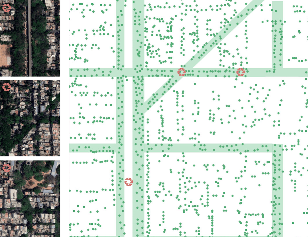
The first part pertains to Jayanagar’s spatial context in Bengaluru. In addition to that, the satellite image of the study area was observed to analyse the structure and pattern of Jayanagar. The strong influence of the city’s evolutions on the study area subsequently led to the next chapter on the transition of Jayanagar over the period of 20 years.
The gridiron street network was an insight to the third chapter that contains a detailed quantitative analysis of the street network in terms of connectivity, accessibility and walkability. Road elements and conditions were carefully documented to support the analyses. Finally, the transformation of Jayanagar was studied by understanding the changes in building typologies and land use that play a key role in the market.
Read more: How public spaces can be redesigned to make ‘unlocking’ safe in Bengaluru
Contextual setting and interpretation of aerial Imagery
Jayanagar is a popularly known neighbourhood in the fifth largest megalopolis of the country, Bengaluru. Figure 1.1 locates Bengaluru as a perfect example of rapid urban agglomeration in India. Until the 1980s, Bengaluru was a comfortable middle class town with secure union jobs in the large public sector research and manufacturing firms.
The city’s urban scape was shaped by the housing colonies for these large plants with English medium schools, parks, dense tree cover and community centres. Jayanagar was one of the early planned neighbourhoods in the city, right after independence. The IT explosion led to massive migration to Bengaluru, which has changed the landscape of the neighbourhood of Jayanagar over the past decade.
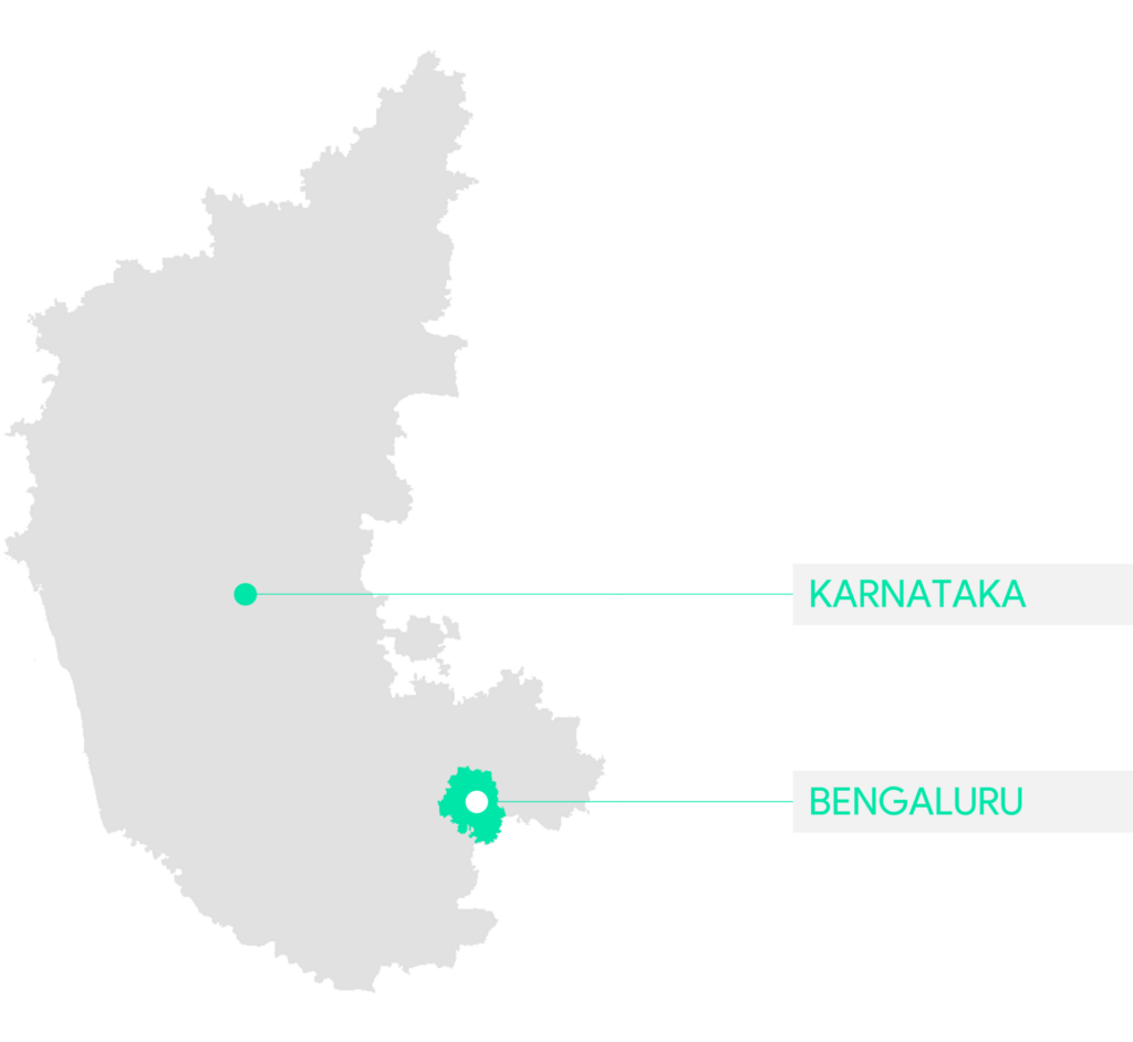
Jayanagar, an affluent residential and commercial neighbourhood in the southern part of Bengaluru, starts from the southern peripherals of Lalbagh and “South End Circle”. The Ashoka Pillar marks the beginning of Jayanagar territory and progresses towards the south.
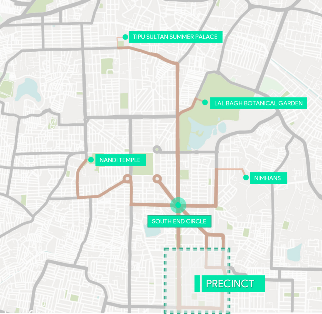
The entire locality is subdivided into nine areas referred to as blocks. Figure 1.2 demarcates the 1 km sq chosen for the study with respect to its surroundings. It lies mostly within the 4th block and partly contains the 7th block of Jayanagar. It falls under the Pattabhi Ram Nagar Ward, numbered 168.
Spatial interpretation
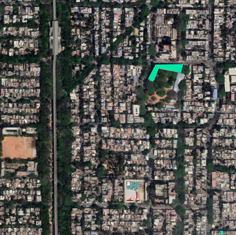
Figure 1.3 is largely dominated by a gridiron road network. A concrete line is visible running through a densely forested area along the west edge. A huge building footprint on the north indicates a large shopping complex, and the road running along the east edge speckled with a number of cars in Figure 1.3 indicates a busy commercial spine.
The pattern of the plots looks like a homogeneous grain throughout. However, the presence of few large pockets reflect public spaces. Another important observation is the fabric, which is dominated largely by a grid iron pattern. Figure 1.3 also shows the largest footprint that is a bus terminal of 2,830 sqm and the smallest footprint in the bottom right corner of 20 sqm.
Road network
Jayanagar shopping complex and the commercial spine, the 11th Main road, are the most active zones. These areas receive a high foot fall and form the nodes of this region.
These commercial spaces are the commercial magnet to the 9 blocks of Jayanagar and the surrounding neighbourhoods like Banashankari, BTM layout and JP Nagar. Figure 1.4 shows various important nodes of Jayanagar.
Green cover
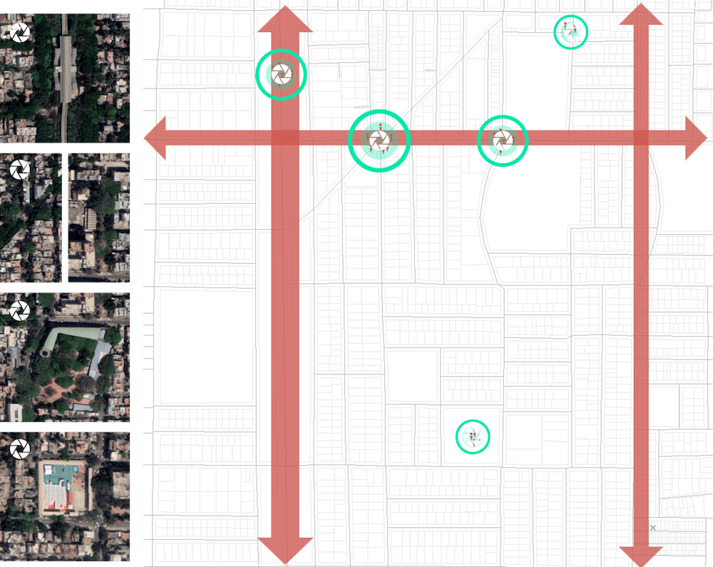
The satellite imagery is also dominated by vegetation with full grown trees along the roads in the study area. Figure 1.5 shows how the trees form boulevards and shaded streets in Jayanagar.
Observations from site visit
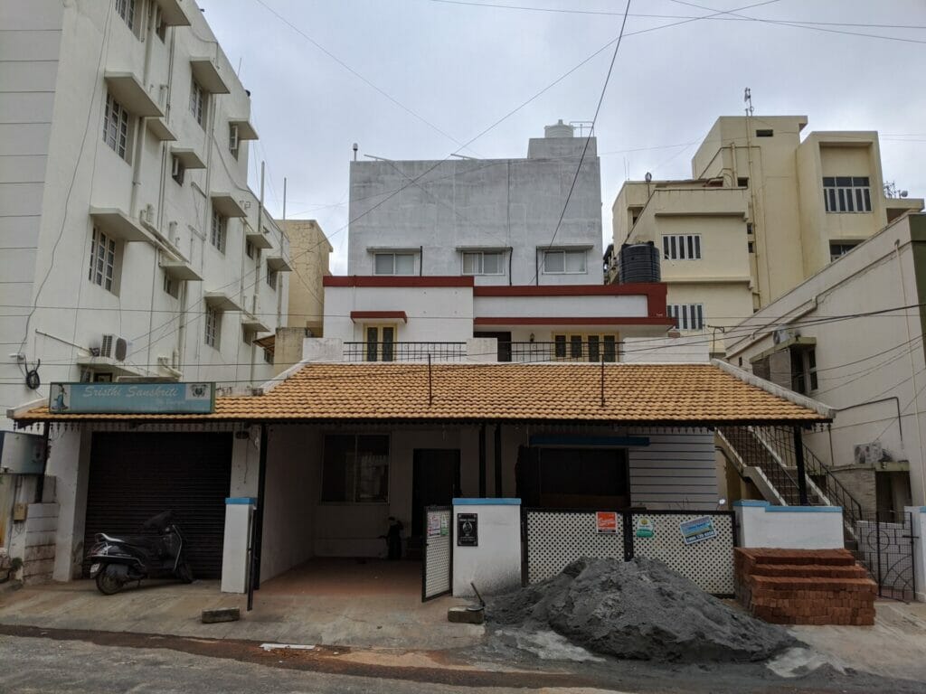
The precinct is experiencing a transformation with respect to building typologies and its usage due to the change in land dynamics in the neighbourhood. The land parcels that were once meant for residential single-family buildings, are largely being dominated by the commercial spaces soaring up to 4–5 floors. Figure 1.6 is an example of the commercial transformation around the single-family buildings, which was once much more predominant in the neighbourhood.
The scale, grain, open spaces, and road network reflect that the area was planned, with lush green vegetation cover along the streets. The area of study contains some important nodes that receive footfall from not only the immediate localities but also from surrounding neighbourhoods. Further, attention to the aspect of the commercial takes over in the region seems to have scope.
(Part 1 of this article is republished from the author’s Medium account with permission and with minimal edits)