With Unlock 1.0, Bengaluru has reopened its shops and businesses, and even traffic jams seem to be back. Is this good for us? The short answer is: not all of it. On the one hand, it is great that the economy can recover and the joblessness crisis may start to resolve.
But on the other hand, people returning to their daily lives as if nothing happened is a dangerous approach. More people risk falling sick and infecting others, as indicated by the recent spike in COVID-positive cases. Hospitals that have worked so hard these past few months to contain the virus, could get flooded with new cases, beyond what they can handle.
Of course Bengaluru cannot remain locked-down forever, but how do we cope and ensure our safety? By now, we are all too aware of precautionary measures like face masks, sanitisers, handwashing, testing, contact-tracing apps, and social distancing. The other important thing is to plan a safe physical path to allow businesses and other services to reopen. And several aspects must be taken into consideration, including how space is used and by who.
Urban redesign needed in pedestrian-heavy commercial areas
Establishments where people congregate – religious places, markets, shopping areas, etc. – must, of course, comply with the standard operating procedures (SOPs) provided by the government. These SOPs mandate thermal scanning, sanitiser use, ensuring social distancing etc., in establishments.
Additionally, the surrounding public spaces – footpaths, roads, parks, markets, etc. – must be controlled. For this, a redesign of our streets and public spaces is critical. Across the globe, several cities from New York to Bogota have transformed theirs to ensure safe mobility and economic recovery, while complying with public health guidelines. Namma Bengaluru also needs to innovate and adapt.
Many commercial areas in Bengaluru are pedestrian-heavy spaces, such as Brigade Road, KR market or Commercial Street. In these areas, safe distance must be provided for people to walk and cycle.
In Bengaluru, the lack of footpaths and cycle lanes makes this difficult, but not impossible. Partially or even completely closing down roads to cars, so as to allow people to walk and cycle, is definitely possible with careful planning, designing, education and enforcement.
A case study of Brigade Road
Consider the case of the Brigade Road section between MG Road and Residency Road, where pedestrian activity is high.
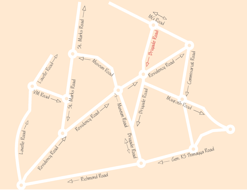
Here priority must be given to providing enough space for people to maintain safe distance while walking and waiting. Currently, the street has two lanes that includes parking space, as well as two narrow sidewalks.
Following are three possible scenarios for redesigning Brigade Road.
Option 1: Follow only government SOP
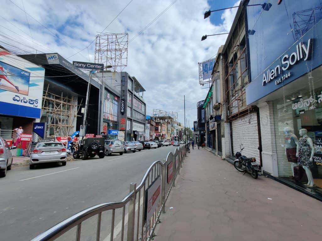
The first option is to maintain the status quo – that is, commercial establishments have to take precautions based on government-issued SOPs. But this may not be enough. Here is a video of what Brigade Road looked like on June 10, just two days after unlocking. Footfall has increased since then, with more shops reopening and people walking around.
The following image shows the usual pedestrian and vehicular activity on Brigade Road, and the inherent challenge in maintaining a safe distance.
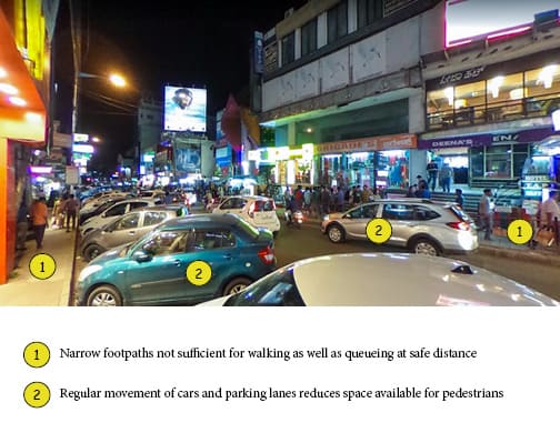
Maintaining safe distance only inside the stores would not be effective if people are crowding up on the narrow footpaths outside. This would beat the purpose of all safety precautions.
Option 2: Follow government SOP + Close street to all vehicles
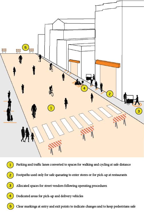
Considering Brigade Road’s narrow footpaths, this approach would give pedestrians the maximum space for walking or waiting. The street can be closed to cars and two wheelers at all times of the day or only during specific hours, with regulated access provided to vehicles of residents, shop owners, and delivery services. Car parking locations can be assigned on MG Road and Residency Road.
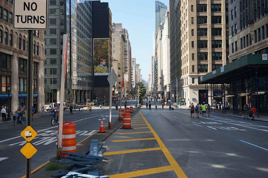
But this option would require careful planning, from identifying re-routing options for traffic, to stationing officials to monitor barricades and take care of daily operations.
Option 3: Follow government SOP + Keep only one lane open to traffic
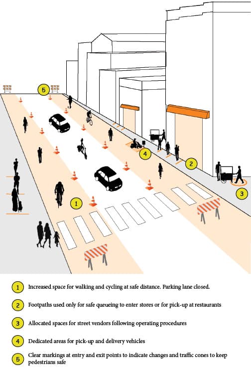
This is likely the “win-win” solution that would give Brigade Road users the space to move about while reducing the burden on officials to plan elaborately. This option allows through traffic – that is, cars can drive down in a single lane but not stop or park. Those coming to Brigade Road can park their cars in parking spots along MG Road or Residency Road.
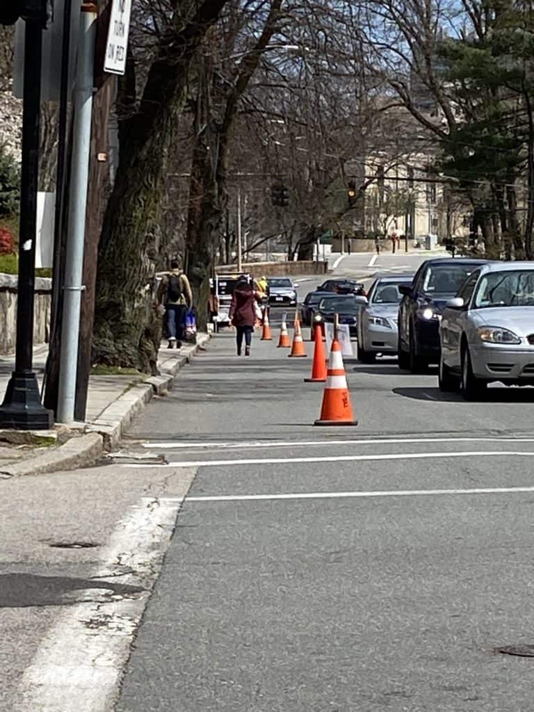
(@BlineTransport)
The advantage of this option is that the existing traffic flow can be retained, and doesn’t have to be re-routed. Since this area is full of one-ways, re-routing of traffic could lead to a gridlock on adjacent streets.
However, this option requires careful planning to ensure the safety of pedestrians who share the road with vehicles. Visible markings, traffic cones, and temporary road fences must be installed.
Essentially, people should get encouraged to shop local and avoid just strolling down Brigade Road like before, while businesses should increase digitisation through shopping websites, and prioritise home delivery and/or pick-up options. Given the proximity of the buildings, with each having multiple stores, queues will otherwise run long with the risk of overcrowding footpaths and cause difficulty in management.
Redesign can help avoid more lockdowns
The above example highlights ways in which Bengaluru can reinvent its public space to mitigate the crisis while reviving the economy. It is not exhaustive though, and the options given are only to encourage innovative thinking.
An urgent opportunity to recalibrate space exists in KR Market, which has been locked down again. Swift action will help avoid extension and repetition of lockdowns. In any case, thorough planning and evaluation of the area, organisation, stakeholder engagement, and communication of changes are needed before changes can be implemented.
The National Association of City Transportation Officials (NACTO), an organization of North American cities and transit agencies, has compiled further guidelines and best practices from around the world. Similarly, the Institute for Transportation and Development Policy (ITDP), an international association of transportation experts, has created an India-specific document to assist cities in designing and implementing changes during the pandemic.
While these documents are excellent guides, the solutions they suggest cannot be applied to different places the exact same way: the local context needs to be assessed and the implementation strategy customised. For example, closing the street entirely for cars may not be feasible in areas where traffic circulation may get adversely affected.
Without adapting and reimagining how spaces function, the only two possible outcomes for Bengaluru are a rise in cases and deaths, or keeping people indoors and businesses closed, tantamount to economic slowdown. Redesigning our streets is the best tool we have at our disposal to keep people safe as well as keep the economy moving. It will also improve our cities in the long term.
We only have so much time to make the right decisions, and the time for action is now.
Planning is good, but it has to be considered for entire CBD area including metro stations, parking areas, banning vehicular movement, introducing cycle and electric vehicles with charging points.planning cannot be for one road, as this create chokes.
It would be good to consider –
(i) How would the community and the commercial establishments seek to use this space assuming, say, you could use the space for two days a week/evenings of other days for other purposes? Could this be used for staging street plays on the weekend, promoting local musical talent for example, or holding a tech fair to promote engineering talent at schools?
(ii) What kinds of commute patterns and utility services would allow for safety, build trust, and allow flexible usage of space?
(iii) How could various communities in Bengaluru with expertise be tapped to contribute on a continuing basis towards the above?