The Pallikaranai Marshland, one of Chennai’s last remaining natural wetlands, has long been a site of ecological tension. Its designation as a Ramsar site brought national and international recognition, along with renewed expectations for strong conservation measures. Yet the marshland continues to face intense pressure from urban development, infrastructure projects and real estate expansion.
Recently, Arappor Iyakkam, an anti-corruption organisation, alleged that state agencies illegally cleared environmental and construction approvals for a large high-value housing project within the Ramsar boundary. As the matter unfolds, it reveals how regulatory gaps and political inaction make the marsh vulnerable. Meanwhile, residents of Tansi Nagar, Velachery, are campaigning against encroachments blocking a key culvert, warning that neglect increases flood risk and links the marsh’s health to the city’s safety.
Against this backdrop, Citizen Matters spoke to naturalist and environmental educator Deepak Venkatachalam of NGO Suzhal Arivom, who has spent a decade studying Pallikaranai’s ecology, hydrology and biodiversity. He explains what has changed since the Ramsar tag, why engineering-heavy solutions may do more harm than good and what Chennai must do to preserve its last great marsh.
Read more: Flood threat in Tansi Nagar: Chennai community’s plea to save canal, stop ‘beautification’
Encroachments, a threat to Pallikaranai marshland
The Ramsar tag brought renewed attention to the ecological sensitivity of the Pallikaranai Marshland. What developments, both good and bad, have taken place since the designation?
Since the Ramsar announcement, the marshland has seen a few important improvements. The boundaries of the reserved forests coming within the Ramsar site have been properly demarcated, and compound walls have been constructed covering a few ranges. These walls have been designed with openings to allow water movement and to protect the ecological processes within the wetland. This has been a thoughtful and needed intervention to protect the reserved area in the long run.
Awareness campaigns have also increased. However, challenges remain as areas outside the protected boundary still face anthropogenic pressure. Encroachments and developmental activity in adjoining lands pose threats to the marsh’s ecology.
Dealing with encroachments
Encroachments are not new to Pallikaranai. What is the solution to this recurring issue?
South Chennai is largely built on marshland. Historically, the Pallikaranai marsh spanned over 6,000 hectares, but only 660 hectares remain protected today. Much of the area has been legally encroached, with examples including NIOT, NIWT, the Perungudi dumpyard, Sholinganallur ELCOT, and the Perumbakkam housing board. As we reconsider the placement of these massive structures, one proposed approach is to clearly demarcate flood-prone zones in South Chennai by assessing hydrological flow and historic waterlogging since the 2005 floods.
The government must install signboards marking ecologically sensitive floodplains and release an ecological map of South Chennai highlighting wetlands, lakes, streams, and waterways. This would raise awareness among residents and buyers, prevent further construction in these zones, and reinforce that hydrology transcends administrative boundaries. Consistent enforcement and political will are essential to stop legal encroachments.
What should people know before buying apartments near protected areas such as the Pallikaranai Marsh, and how can they verify the nature of the land?
Buyers can check the land category through the government revenue records. The Tamil Nadu Geographical Information System (TNGIS) provides information on whether a particular parcel of land is classified as reserve land or Patta land. This online verification is simple and reliable, and it helps buyers avoid legally or environmentally problematic properties. Apart from this, they should know the topography of the place, waterways passing through that area, historic flooding information of that place and assess accordingly.
Declining biodiversity in Pallikaranai marshland
Flora and fauna are key indicators of wetland health. What trends have you observed in the past decade?
After the 2015 floods, the city prioritised rapid drainage over water retention. These interventions altered the natural topography, reducing the marsh’s ability to hold water. With climate change bringing heavier rainfall in shorter periods, the marsh now alternates between excess water during monsoons and rapid drainage, destabilising its habitat and risking ecological collapse. Continuous disturbances, such as grey water intrusion, major projects like the Metro, road widening, and increased transportation, have further degraded biodiversity. Freshwater flora is in steep decline, while invasive species are rising sharply.
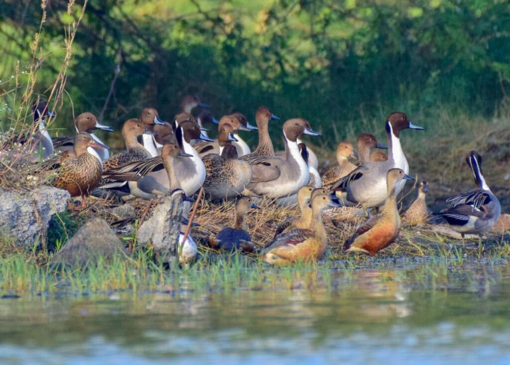
Historically, Pallikaranai supported a distinct sequence of bird populations corresponding to changes in water level and habitat availability. Now, bird populations are showing declining trends. For example, the number of Greater Flamingos (one of the marsh’s flagship species) visiting Pallikaranai marsh and their stay duration has sharply reduced in the last five years.
Read more: Ramsar Tag secured, what is the way ahead for the Pallikaranai marshland?
Proposed projects and their impacts
The state has proposed desilting and deepening the Pallikaranai Marsh to revive it. Why do you believe this approach is unsuitable?
Pallikaranai is a naturally evolved marshland. It is not a man-made water body that can be desilted like a reservoir, just prioritising water holding. Desilting or deepening interferes with the sensitive soil layers and disrupts the ecological processes that sustain biodiversity. Such interventions can also cause irreversible changes, including salination and desertification. Desilting, bringing the marsh to the actual level, creating sponge parks or new reservoirs, and deepening the marsh cannot be solutions for any of the ongoing issues at Pallikaranai.
The road widening project at Okkiyam Maduvu and the cut-and-cover drainage works are being promoted as flood mitigation measures. What ecological impacts do you foresee?
Okkiyam Maduvu, located near Karappakam under the Old Mahabalipuram Road, is the only outlet for the entire 6,000+ hectare watershed of the Pallikaranai Marshland in South Chennai. Water from Adambakkam, Madipakkam, Velachery, Keelakatalai and surrounding areas flows south into this point, while water from Selaiyur, Madambakkam, Siruseri, Thazhambur, Semmencheri, and Perumbakkam areas flows northwards towards Okkiyam Maduvu. This makes its mouth extremely sensitive. Changes to this fragile brackish water zone can cause severe ecological impacts, which may result in long-term adverse impacts to South Chennai.
It is neither practical nor scientifically advisable to channelise this flow through engineered cuts and drains. For instance, if more than 5,000 cusecs of water flows into Okkiyam Maduvu, cut-and-cover drains designed for far lower capacities will fail, potentially creating floods in new areas adjoining the drains.
Coastal surges and rising sea levels risk seawater intrusion into the marsh, causing irreversible ecological damage. Wetlands must be protected as natural floodplains, not treated as reservoirs.
Focus on restoration
The government has decided to dismantle a 2.1-kilometre stretch of the Thoraipakkam to Pallavaram Radial Road and replace it with a high-level bridge. How will this help restore the marsh, and what additional measures would you recommend for traffic management in such a sensitive area?
There are three major linear intrusions into the Pallikaranai Marshland, namely the Thoraipakkam (Jain college) to Pallavaram Radial Road, the Sholinganallur to Medavakkam route and the Kumaran Nagar to Semmencheri link. These roads fragment the wetland and obstruct its hydrology.
Replacing one of these with a high-level bridge will eventually help the wetland by allowing water to flow freely, but the benefits will take time. The Thoraipakkam–Pallavaram Radial Road upliftment needs to be assessed with regard to the season, ecology of the wetland and the flow of heavily contaminated water from the Perungudi dump yard.
Do you believe the Pallikaranai Marshland can be revived to its original form? What measures are needed for its recovery?
Conservation efforts must be informed by a complete understanding of the marshland’s topography, hydrology, ecology and, more importantly, restricting us from further depleting the non-protected areas of marshland with major projects like high-rise townships or state flagship projects such as sports centres.
With strong political will and public participation, the marshland can be rehabilitated into a vibrant ecological asset, guided by scientific principles rather than short-term solutions.
Really helpful insights. I found this article very informative and easy to understand.