
A view of Bellandur lake from Sobha Lakeview Club House. Pic: Akshatha M
Enough has been said and heard about infamous Bellandur lake. But what does the lake spread across 800 acres actually look like? How polluted it is?
A team of researchers from Indian Institute of Science led by Prof T V Ramachandra and army personnel from Madras Engineering Group (MEG) have been conducting bathymetric survey of Varthur and Bellandur lakes for the last 10 days.
Bathymetric survey aims to study the character of water across the various layers. This will help in scientifically deciding how to restore the water quality and rejuvenate the lake. This exhaustive survey has been initiated by community groups – Whitefield Rising and Bellandur Lake Group.
As I cruised across the lake in a military boat piloted by soldiers from Madras Engineering Group, in the company researchers from Indian Institute of Science, here is what I came across. High rise “Lake view” apartments on the one side, dense green cover on the other, the water covered with hyacinth, the dirty black water all around….Bellandur lake is much more than we know.
While I saw the ugly side of the lake, flocks of water birds sitting on hyacinth gave me some hope about the life that still exists in this dying lake. Indulge in the photo essay on the unseen side of one of the largest lakes in Bengaluru!

Green carpet on the lake? They are hyacinth, the troublesome aquatic weeds. Hyacinth reduce the oxygen level in water leading to suffocation of water organisms, like fish. Pic: Akshatha M

Highrise apartments surround one side of Bellandur Lake. These apartments command premium rates, for they offer ‘lake view’. Ironically, if you live close to Bellandur lake, all you experience is unbearable stench. Pic: Akshatha M

While one side of the lake is covered with high rise buildings, the other side has some green pastures. This is the Defence dairy farm land. Pic: Akshatha M

And those beautiful birds! Some relief at last. Flocks of water birds fly above the lake. Pic: Akshatha M

Madras Engineering Group (MEG) on the boat. Teams from MEG and IISc have been carrying out the Bathymetric survey braving the sun and extreme heat. Pic: Akshatha M
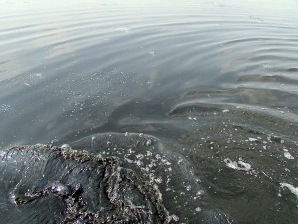
Pitch black water reflects the sad state of affair of Bellandur lake. Water quality seems worse in this part of the lake which is close to the sewage inlet. Anaerobic condition is created here in the absence of free oxygen. Pic: Akshatha M

Stinking water and bubble formation somewhere in the middle of Bellandur lake. Pic: Akshatha M

Bathymetric survey under progress at Bellandur lake. Researchers measure the sediment thickness and depth of the polluted lake. Pic: Akshatha M

Research team collects the sample of silt at Bellandur lake. Sample will be further tested to examine the chemicals and contamination in the silt. Pic: Akshatha M

Sample collected at one point during the study.

IISc and MEG team that conducted the study at Bellandur Lake. A team of 13 personnel from MEG and 12 researchers from IISc are part of the Varthur and Bellandur lakes survey.
All the pictures in the article are clicked by Akshatha M. Copying them in any form is prohibited. They cannot be shared without permission and credits.
Related Articles
False promise to save Bellandur lake exposed
How govt helps SEZ trump Bellandur lake
Environment authority to review clearance to Bellandur lakebund project