Tracing the truth behind the claims made by the previous government that “47 lakes had been developed under the Nava Nagarothana scheme at the cost of Rs 317.25 crore”, the author of this series, in a ground report, examines the state of Bengaluru’s lakes.
In the first part, he provides a detailed insight into the actual condition of three lakes, where rejuvenation was supposedly carried out. These were: Doddakallasandra lake, Kothanur Lake, Chunchaghatta lake, and Yelachenahalli lake.
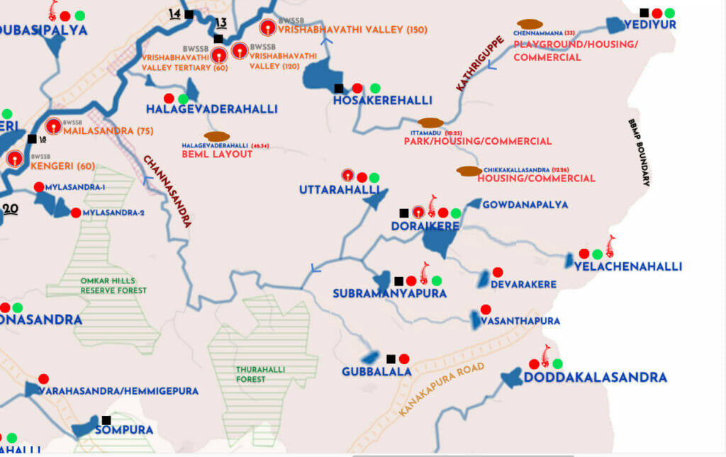
In the second part, the author–who is a birdwatcher, a naturalist, and a passionate conservationist–gives detailed reports on the status of two other lakes: Gowdanapalya lake and Subbaraya Kere.
Gowdanapalya Lake
Gowdanapalya Lake or Gowdanapalya Kere is a peculiar case, where rejuvenation started more than a year ago. BBMP constructed a diversion channel, after which the restoration work has been paused for unknown reasons.
One of the reasons, BBMP claims, is due to an ongoing case with regard to the lake. The basic structure of inlet and outlets have been done, but the stone pitching work for retaining of water is incomplete. The lake bed was cleaned up a while ago.
During the previous monsoon, too, there were issues due to uncleared silt, which was lying around, along with heaps of plastic and many other pollutants (including medical waste). When it started raining, this silt, along with the rest of the garbage, settled back across the lake bed and has been lying like that since then.
The gradient of Gowdanapalya lake is on a lower level and feeds into Dorekere. It receives water from Padmanabhanagar area and a secondary stream (SWD) feeds into the lake. A lot of rainwater and untreated water enters the lake. It was there for the last few months. The lake receives a lot of water, which dries up by March (summer). During the dry season, the water from the stormwater drain usually does not enter the lake, as the inlet is higher than the SWD. However, during the rainy season due to the quantum of water in the rajakaluve/secondary stream, which is mixed with sewage and garbage, it entered the lake.

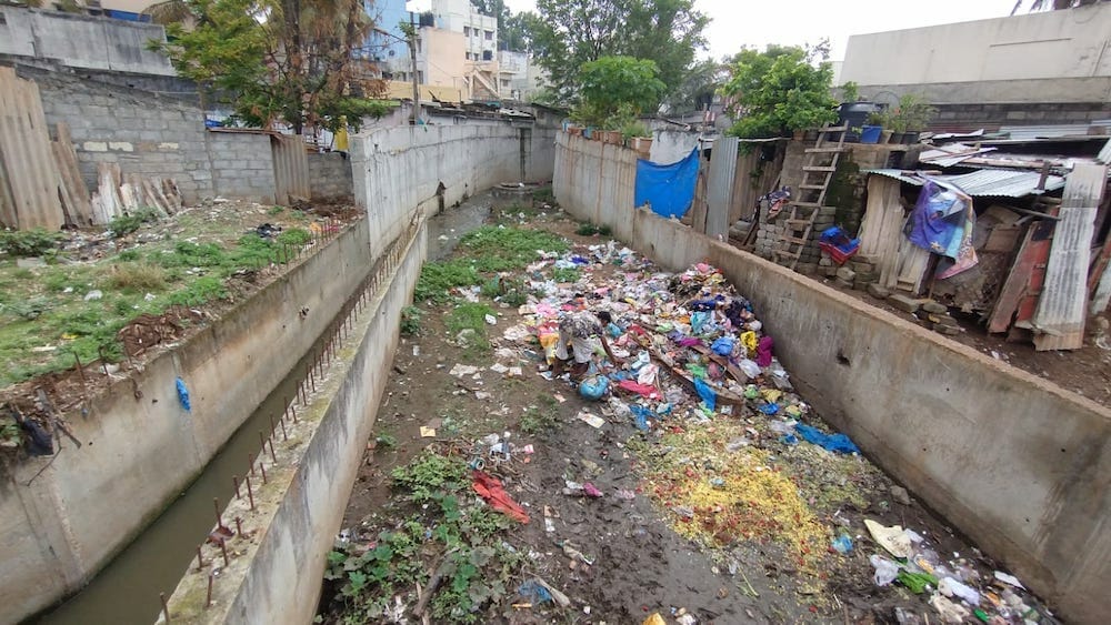
The video below clearly shows how the inlet is filled with solid waste and plastic. The diversion channel is also not in a healthy condition.
Accumulated silt, tree branches, and plastics, are in the lake. As it is, the lake is filled with so much plastic, bigger waste material, such as mattresses, some furniture, among other things, are strewn about on the lake bed.

The lake bed also has small islands of polluted water, already in an algal bloom stage. Rain showers bring in more plastic and other unwanted things into the lake bed. I visited BBMP, personally met the chief engineer and requested him to at least clear the lake bed so that less rainwater comes inside the lake.
But all my requests have gone in vain. For the last one month, I have been regularly monitoring the changes, but there is hardly any progress. BBMP should immediately clear the waste on the lake bed and prepare it for the monsoons so that the city can get good rainwater.
Otherwise we will miss one more season. It is a loss to the ecology, if we don’t do something about it. Despite so much money being spent, two seasons have already been wasted.
Read more: A historical lens on Bengaluru’s drains
Subbaraaya Kere
Subbaraaya Kere is a very small lake, which is under five acres. As it is located on a lower side of the gradient, the lake attracts a lot of rainwater. Unfortunately, it is not well planned. The DPR also doesn’t show how it is going to collect the rainwater and channelise it to the lake.
This year too, it rained in the wrong season. It is ideal to dewater around January/February so that by March, the lake bed would be dry for desilting. If this is delayed by a month or two, we face a monsoon which can upset the works and the lake may not be ready to collect rainwater.
Despite this knowledge, the rainwater channelling commenced during the last week of May, when it was about to rain. As expected, when it rained heavily, a portion of the bund collapsed and water started seeping from the bund region. This was highlighted, and later they corrected it with a small stone structure, which generalises a little bit of rainwater.
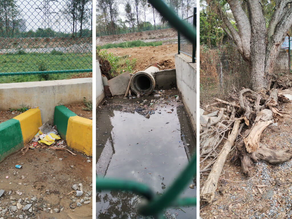
But the way it is collected, the drain system is not in place even now, despite the issue being brought to their notice. The DPR doesn’t mention this in the plan at all. The inlets are made in small structures and it is still seems like a temporary structure.
There are inlets that have a sewage diversion channel. There have been a few spells of rain. And it has already taken so much sewage and plastic to the lake bed that there is no mechanism to stop the solid waste entering into the lake.
And as a peculiar case, one side of the lake also gets a lot of rainwater from the road from the top of the Jambusavari Dinne. Arrangements have been made so that there is no water logging on the road.
A few inlets that are too small, measuring just four inches have been made. While this too brings a lot of rain to the lake, of course it comes with plastic and solid waste, which is supposed to be cleaned. So, despite being a new lake, the design has not been properly planned in advance.
How do we plan it well so that the issues with the lake are avoided in future?
Our approach to lake rejuvenation is very engineering centric without any thought to ecology. All lakes are approached with a cookie cutter method, where the lake is developed into a soup bowl, which is devoid of any vegetation. The lake vegetation is not only a source for biodiversity – fish, amphibians, birds, etc- but also serves as a livelihood for people who forage wild greens.
With monsoons around the corner, in the backdrop of the two unfortunate deaths, which occurred during the Summer rainfall, this calls for urgent action on the part of the authorities.
